16B Selwyn Ave Akaroa 7520 Canterbury Region New Zealand
1 council report since February 2026, 1 carrying a photograph.
The green nearby
- Hutchenson Reserve, 114 m to the edge · 1 ha
- Stanley Park, 170 m to the edge · 7 ha
- Bercusson Reserve, 269 m to the edge
- Walnut Place Reserve, 273 m to the edge
- Kowhai Grove Esplanade Reserve, 343 m to the edge
Parks within half a kilometre, measured to the boundary, the council’s open data. The whole roll is at /parks.
The civic shelf nearby
- Akaroa Library, 232 m away · Library
Libraries, halls and the rest within half a kilometre, the council’s open data.
On the doorstep
- Akaroa Cinema, 137 m away · Cinemas & theatres
- Akaroa Cinemas and Café, 193 m away · Cafés
- Cine Cafe Akaroa, 206 m away · Cinemas & theatres
- Tresori Motor Lodge & Apartments, 246 m away · Motels
Businesses within four hundred metres, measured at the pin, OpenStreetMap and the council directories.
The named ground
Named water within 500 m of this address, measured to the line or the edge; Named places within 1.5 km of this address; the council’s own structure register, bridges, boardwalks and steps standing nearby, the open map’s record.
What gets reported here
- Damaged Road, 1
Photographed here 1 on record
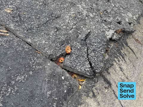
What’s on record
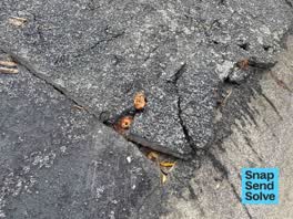 Damaged Road, 24 Feb 2026
This damage has just appeared. I’m not sure what the cause is, but it looks potentially like supporting ground underneath was washed out in
The civic layer
This ground votes in Banks Peninsula ward, the Banks Peninsula community board is its local layer. Ward lines don’t always follow suburb lines; this one is measured at the pin, not the suburb’s centre. The whole roll is at /wards.
Selwyn Ave Akaroa 7520 Canterbury Region New Zealand, the whole record → · Everything about Akaroa → · What stood on this ground → · On the map → · Street View → · From the air, RetroLens holds the Crown’s aerials back to 1936; search the address there →
Questions, answered briefly
1 council report on record since February 2026, most often damaged road (1).
Akaroa, Christchurch, on Selwyn Ave Akaroa 7520 Canterbury Region New Zealand.
Nothing on the heritage register at this exact spot, the record around this ground →
Hutchenson Reserve, 114 m to its edge, 1 ha.