3 Church Street
2 council reports since January 2018, 2 carrying a photograph. The most-reported address on Church Street.
The green nearby
- Britomart Reserve, 68 m to the edge
- Walnut Place Reserve, 140 m to the edge
- Stanley Park, 184 m to the edge · 7 ha
- Akaroa Beach, 196 m to the edge · 1 ha
- Garden Of Tane, 359 m to the edge · Botanic · 6 ha · playground, 7 pieces
Parks within half a kilometre, measured to the boundary, the council’s open data. The whole roll is at /parks.
The civic shelf nearby
- Akaroa Library, 93 m away · Library
Libraries, halls and the rest within half a kilometre, the council’s open data.
On the doorstep
- Aihe, 18 m away · Restaurants
- Aihe Restaurant And Bar, 20 m away · Restaurants
- L'Hotel Boutique Hotel, 26 m away · Hotels
- La Voyageur Apartments, 26 m away · Hotels
Businesses within four hundred metres, measured at the pin, OpenStreetMap and the council directories.
The named ground
Named water within 500 m of this address, measured to the line or the edge; Named places within 1.5 km of this address; the council’s own structure register, bridges, boardwalks and steps standing nearby, the open map’s record.
The remembered names nearby
- Lions Club of Akaroa and Bays, 94 m away ·
Lions Club of Akaroa and Bays
· 2008 - In Memory of Jim Shipman a Loyal Member and Friend, 94 m away ·
In Memory of Jim Shipman A Loyal Member and Friend
· 2008 - Commander Frank Arthur Worsley Dso and Bar, OBE, Rnr, 95 m away ·
COMMANDER FRANK ARTHUR WORSLEY DSO AND BAR, OBE, RNR. BORN AND RAISED IN AKAROA 1872. DIED
· 2008
Inscribed plaques within two hundred and fifty metres, the register’s pins, not surveyed spots. The whole roll is at /plaques.
What gets reported here
Photographed here 2 on record
What’s on record
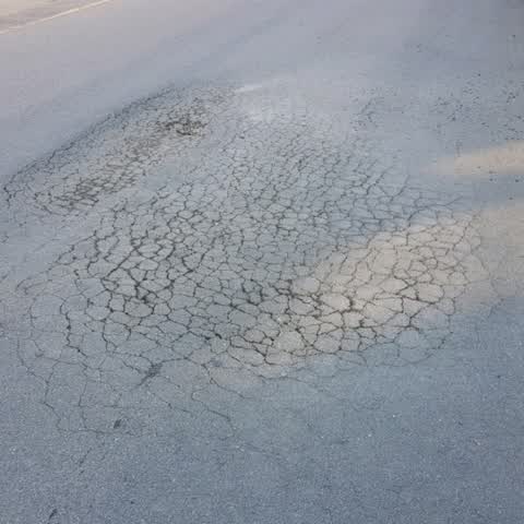
Roading/Streets, 8 Jan 2018
The road is sinking and has starting cracking. There is a small pothole that has formed.
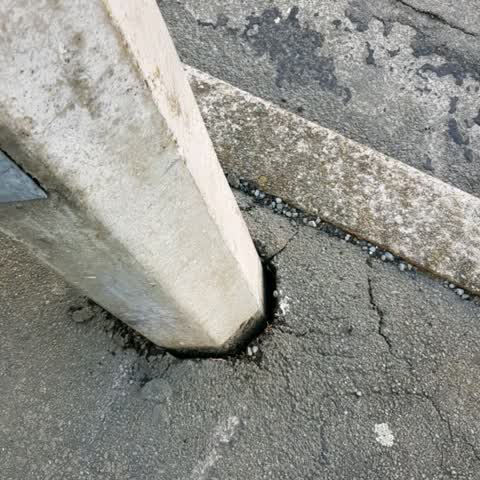
Roading/Streets, 8 Jan 2018
The light post has been hit and has cracked the pavement. It is leaning and looks like it could fall into the Old Shipping Office.
Elsewhere on Church Street
- 5 Church Street, 1 report
- 4 Church Street, 1 report
- 2 Church Street, 1 report
The civic layer
This ground votes in Banks Peninsula ward, the Banks Peninsula community board is its local layer. Ward lines don’t always follow suburb lines; this one is measured at the pin, not the suburb’s centre. The whole roll is at /wards.
Church Street, the whole record → · Everything about Akaroa → · What stood on this ground → · On the map → · From the air, RetroLens holds the Crown’s aerials back to 1936; search the address there →
Questions, answered briefly
2 council reports on record since January 2018, most often roading/streets (2).
Akaroa, Christchurch, on Church Street.
Nothing on the heritage register at this exact spot, the record around this ground →
Britomart Reserve, 68 m to its edge.