36 Penlington Place, Akaroa
12 reports on record since December 2023 · 12 with photographs. The most-reported address on Penlington Place. Indicative rating valuation and school zones, hazards, bin day and what stood here before.
What gets reported here
- Water Leak — 11
- Water General — 1
Photographed here 12 on record
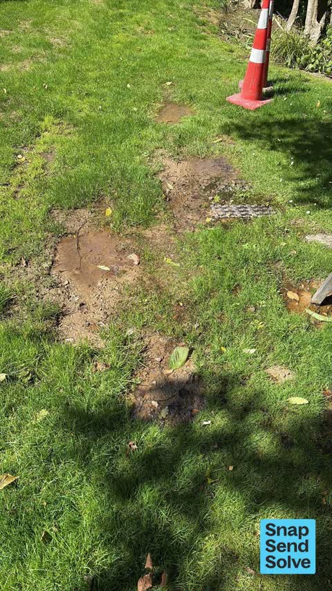


Reported here
 Water Leak —
 Leaking pipe where it has just been fixed 3 weeks ago
 Water Leak —
 Water leak outside 36 penlington place akaroa. It’s where city care water have previously fixed a leak
 Water Leak —
 We had 4 repairs outside 36 penlington and now it’s leaking into 38 penlington - caused by the external leak. Ian 027 4978804
 Water Leak —
 Another water leak just past one that has been fixed previously
 Water Leak —
 Leaking again just up from where fixed previously
 Water General —
 Large amount of water coming from roadway
 Water Leak —
 On penlington place. Exisiting council repair now leaking badly
 Water Leak —
 Water is coming up through the asphalt on the road - has been doing this for a week and is getting worst. Is damaging adjacent drives
 Water Leak —
 Recently fixed water leak is now leaking just up the road a few metres
 Water Leak —
 This water leak is expanding quickly
 Water Leak —
 New leak outside 36 penlington place akaroa and old leak fixed but no tar seal replacement
 Water Leak —
 End of street water leak and getting worse. Thanks
Also reported on Penlington Place
- 38 Penlington Place — 4 reports
- 37 Penlington Place — 3 reports
- 33 Penlington Place — 2 reports
- 35 Penlington Place — 1 report
- 27 Penlington Place — 1 report
- 18 Penlington Place — 1 report
- 16 Penlington Place — 1 report
- 1 Penlington Place — 1 report
The green nearby
- Stanley Park — 28 m to the edge · 7 ha
- Bercusson Reserve — 46 m to the edge
- Watson Reserve — 247 m to the edge
- Walnut Place Reserve — 313 m to the edge
- Hutchenson Reserve — 324 m to the edge · 1 ha
Parks within half a kilometre, measured to the boundary — the council’s open data.
The civic shelf nearby
- Akaroa Library — 358 m away · Library · 2 Selwyn Ave
Libraries, halls and the rest within half a kilometre — the council’s open data.
On the doorstep
- Fox II — 254 m away · Business
- Akaroa Cinema — 287 m away · Cinemas & theatres
- Akaroa Cinemas and Café — 327 m away · Cafés
- Cine Cafe Akaroa — 342 m away · Cinemas & theatres
Businesses within four hundred metres, measured at the pin — OpenStreetMap and the council directories.
The named ground
Named water within 500 m of this address, measured to the line or the edge; Named places within 1.5 km of this address; the council’s own structure register — bridges, boardwalks and steps standing nearby — the open map’s record.
The civic layer
This ground votes in Banks Peninsula ward — the Banks Peninsula community board. Ward lines don’t always follow suburb lines; this one is measured at the pin, not the suburb’s centre.
What stood on this ground → · On the map → · From the air — the Crown’s aerials back to 1936; search the address on RetroLens →
Questions, answered briefly
12 council reports on record since December 2023 — most often water leak (11), water general (1).
Akaroa, Christchurch — on Penlington Place.
Nothing on the heritage register at this exact spot — the record around this ground →
Stanley Park — 28 m to its edge, 7 ha.