5 Purple Peak Road
6 council reports since July 2021, 4 carrying a photograph. The street’s heaviest record is 4 Purple Peak Road, 8 reports on file.
On the doorstep
- Linton The Giants House Accommodation, 374 m away · B&Bs
Businesses within four hundred metres, measured at the pin, OpenStreetMap and the council directories.
The named ground
Named water within 500 m of this address, measured to the line or the edge; Named places within 1.5 km of this address, the open map’s record.
What gets reported here
Photographed here 4 on record


What’s on record
 Damaged Road, 22 Feb 2026
 road damaged by floods last week needs repair
 Street Gutters / Storm Water, 28 Jul 2024
 Good afternoon. The gutter has build-up of leaves ?? It's out number 10 purple peak road
- Roads - General, 30 Sept 2023
- Damaged Road, 27 Jul 2023
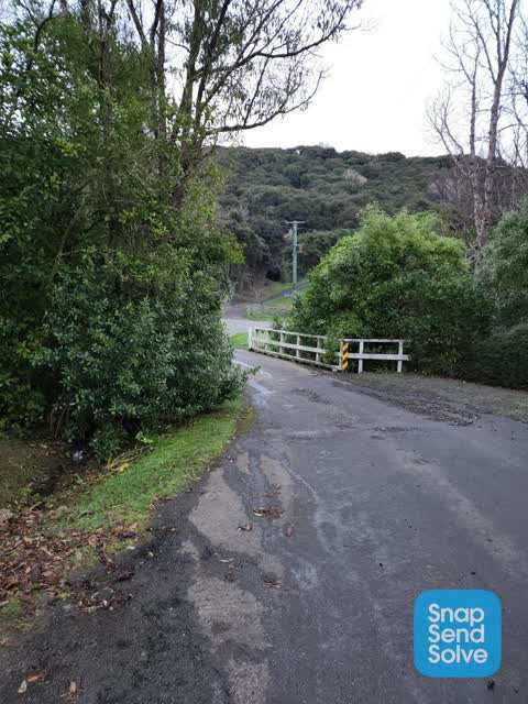
 Roading/Streets, 17 Jul 2022
 Bridge abatement is obscured by over grown trees, someone will hit the bridge soon as no way of identifying the left hand side when heading
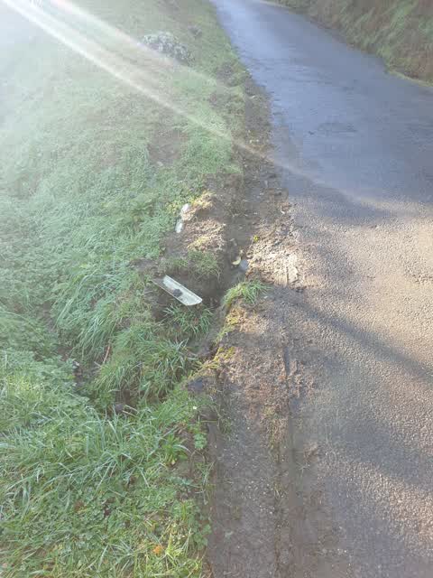
 Roading/Streets, 3 Jul 2021
 damage that has and is still being done from logging trucks accessing logging up purple peak rd. road is now unstable and has the potential
Elsewhere on Purple Peak Road
- 4 Purple Peak Road, 8 reports
- 10 Purple Peak Road, 3 reports
- 6 Purple Peak Road, 2 reports
- 22 Purple Peak Road, 2 reports
- 54 Purple Peak Road, 1 report
- 40 Purple Peak Road, 1 report
- 33 Purple Peak Road, 1 report
The street’s crash record
NZTA’s record names Purple Peak Road in 2 crashes that hurt somebody since 2006, 0 seriously hurt, nobody killed.
The civic layer
This ground votes in Banks Peninsula ward, the Banks Peninsula community board is its local layer. Ward lines don’t always follow suburb lines; this one is measured at the pin, not the suburb’s centre. The whole roll is at /wards.
Purple Peak Road, the whole record → · Everything about Akaroa → · What stood on this ground → · On the map → · From the air, RetroLens holds the Crown’s aerials back to 1936; search the address there →
Questions, answered briefly
6 council reports on record since July 2021, most often roading/streets (2), damaged road (2), street gutters / storm water (1).
Akaroa, Christchurch, on Purple Peak Road.
Nothing on the heritage register at this exact spot, the record around this ground →