85D 85D
1 council report since April 2021, 1 carrying a photograph.
The green nearby
- Britomart Reserve, 33 m to the edge
- Walnut Place Reserve, 213 m to the edge
- Stanley Park, 262 m to the edge · 7 ha
- Akaroa Beach, 276 m to the edge · 1 ha
- Garden Of Tane, 283 m to the edge · Botanic · 6 ha · playground, 7 pieces
Parks within half a kilometre, measured to the boundary, the council’s open data. The whole roll is at /parks.
The civic shelf nearby
- Akaroa Library, 130 m away · Library
- Akaroa Anglican And Dissenters Cemetery, 462 m away · Cemetery
Libraries, halls and the rest within half a kilometre, the council’s open data.
On the doorstep
- Bruce Waterfront Apartments, 3 m away · Hotels
- Akaroa Waterfront Accommodation, 13 m away · Motels
- The Akaroa Cooking School, 30 m away · Restaurants
- Akaroa Village Inn, 32 m away · Hotels
Businesses within four hundred metres, measured at the pin, OpenStreetMap and the council directories.
The named ground
Named water within 500 m of this address, measured to the line or the edge; Named places within 1.5 km of this address; the council’s own structure register, bridges, boardwalks and steps standing nearby, the open map’s record.
The remembered names nearby
- Commander Frank Arthur Worsley Dso and Bar, OBE, Rnr, 49 m away ·
COMMANDER FRANK ARTHUR WORSLEY DSO AND BAR, OBE, RNR. BORN AND RAISED IN AKAROA 1872. DIED
· 2008 - In Loving Memory of / Rod Steel / 1927 - 2004, 52 m away ·
In loving memory of / ROD STEEL / 1927 - 2004
- Charles Edward Cooke / Eddie 1947-2023, 57 m away ·
Charles Edward Cooke / Eddie 1947-2023 / Where sea meets the sky, he found his peace. Dail
· 2025
Inscribed plaques within two hundred and fifty metres, the register’s pins, not surveyed spots. The whole roll is at /plaques.
What gets reported here
Photographed here 1 on record
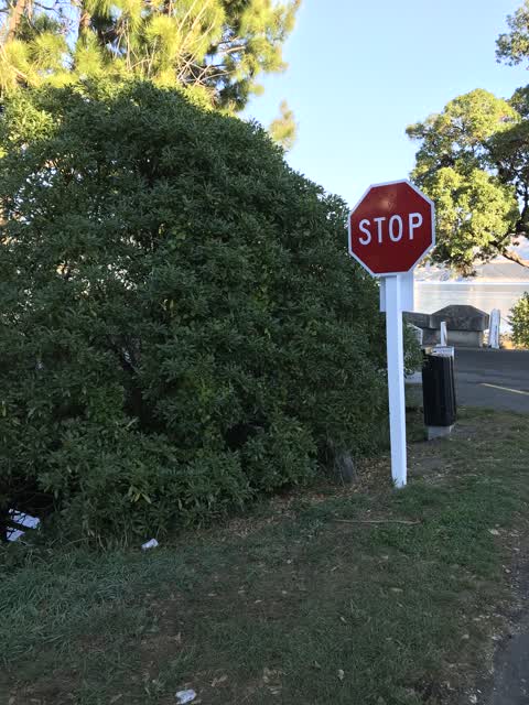
What’s on record
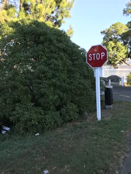 Roading/Streets, 9 Apr 2021
 Young Ngaio tree / bush blocking view of oncoming vehicles at intersection of Beach Rd & Bruce Terrace, serious hazard to traffic with many
The civic layer
This ground votes in Banks Peninsula ward, the Banks Peninsula community board is its local layer. Ward lines don’t always follow suburb lines; this one is measured at the pin, not the suburb’s centre. The whole roll is at /wards.
Everything about Akaroa → · What stood on this ground → · On the map → · From the air, RetroLens holds the Crown’s aerials back to 1936; search the address there →
Questions, answered briefly
1 council report on record since April 2021, most often roading/streets (1).
Akaroa, Christchurch, on D.
Nothing on the heritage register at this exact spot, the record around this ground →
Britomart Reserve, 33 m to its edge.