14 Brookby Crescent
8 council reports since December 2020, 8 carrying a photograph. The street’s heaviest record is 18 Brookby Crescent, 33 reports on file.
From the air, then
Sourced from Canterbury Maps and partners. LINZ, CC BY 3.0 NZ. Each frame is cut from Environment Canterbury’s historic imagery MapServer for that decade, only where the Footprints layer names a CC BY survey (NZAM-covered spots stay out). RetroLens holds more Crown aerials →
The green nearby
- Greendale Reserve, 146 m to the edge · playground, 4 pieces
- Cricklewood Reserve, 288 m to the edge
- Westgrove Park, 438 m to the edge · playground, 12 pieces
Parks within half a kilometre, measured to the boundary, the council’s open data. The whole roll is at /parks.
On the doorstep
- Countdown Avonhead, 18 m away · Supermarkets
- Woolworths, 31 m away · Supermarkets
- Westpac, 42 m away · ATMs
- ANZ, 44 m away · Banks
Businesses within four hundred metres, measured at the pin, OpenStreetMap and the council directories.
The bus nearby
The closest Metro stops, within four hundred and fifty metres.
Renting nearby
new bonds in Avonhead ran about $596 a week, $46 above the city median of $550, the suburb page keeps the rent record →.
What gets reported here
Photographed here 8 on record


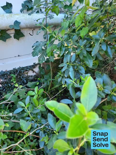


What’s on record
 Hazard, vehicle, 11 Sept 2026
 hi, this car is continuously parking in the three minute car parking for the whole day. This has been going on for months can someone please
 Dumped Rubbish, 27 Oct 2025
 Large tracter tyre and mattress dumped outside the Avonhead Mall. As it's near a primary school exit it is very dangerous as tyre could roll
 Dumped Rubbish, 26 Oct 2025
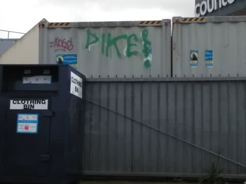
 Rubbish near the clothe bin thingys, they definitely won’t take the shotty bed frame and tires. So will probably be left here for ages pleas
 Water General, 17 Mar 2025
 Leaking water pipe from Woolworths Avonhead flooding walkway through to Merrin School
 Hazard, vehicle, 14 Aug 2024
 Car parked on yellow lines.
 Hazard, vehicle, 7 Aug 2024
 This is a 3 minute parking spot that is continually abused by parents of the school, causing unnecessary chaos and putting kids at risk. It
 Damaged Street Sign, 4 Aug 2024
 Speed hump sign facing wrong way, this is the 4th time reporting the same sign, last time ccc said they did a more permanent solution but it
 Graffiti, 30 Dec 2020
 graffiti is also on side of clothing bin
Elsewhere on Brookby Crescent
- 18 Brookby Crescent, 33 reports
- 19 Brookby Crescent, 9 reports
- 4 Brookby Crescent, 3 reports
- 15 Brookby Crescent, 3 reports
- 6 Brookby Crescent, 2 reports
- 17 Brookby Crescent, 2 reports
- 8 Brookby Crescent, 1 report
- 5 Brookby Crescent, 1 report
The street’s crash record
NZTA’s record names Brookby Crescent in 2 crashes that hurt somebody since 2006, 1 seriously hurt, nobody killed.
The civic layer
This ground votes in Waimairi ward, the Fendalton-Waimairi-Harewood community board is its local layer. Ward lines don’t always follow suburb lines; this one is measured at the pin, not the suburb’s centre. The whole roll is at /wards.
Brookby Crescent, the whole record → · Everything about Avonhead → · What stood on this ground → · On the map → · From the air, RetroLens holds the Crown’s aerials back to 1936; search the address there →
Questions, answered briefly
8 council reports on record since December 2020, most often hazard, vehicle (3), dumped rubbish (2), water general (1).
Avonhead, Christchurch, on Brookby Crescent.
Nothing on the heritage register at this exact spot, the record around this ground →
Greendale Reserve, 146 m to its edge.