Avonhead, Christchurch
5,278 council reports since June 2015, the 24th busiest suburb in the city. 4,047 photographs on record. 10,650 people at the 2023 Census, 2,065 to the square kilometre across 5.2 km².
The record also holds about $596 a week to rent· 2023 Census snapshot· 4,047 photographs· 3 old photographs· 3 schools· 20 parks· 1 civic facility· 4 places of worship· 2 tracks· 6 names on the map· 0.2% of the outline mapped liquefied· graded mostly TC1 in 2011· noise overlays over the whole outline· setback strips over 1% of the outline· 3% of the outline inside the plan’s density overlays· 1,514 SCIRT photographs filed on this ground· 10.9 km of cycleway crosses the outline· 10 remembered names on this ground· 6 drawn rules bind this ground· 1 parcels on the dangerous-work register· 135 parcels of made ground· 1 parcels with a cleanup on file· the 2019 model grades this ground mostly low· 8 council structures on the register· 38 recreation register records· 4,777 trees on the register· the plan’s word on this ground· 10% of the outline reserved· the plan’s exceptions touch 3% of the outline· 1 place on the heritage schedule· 205 injury crashes· 1,215 recorded victimisations· 42 bus stops· 49 businesses· the council’s fix times· 1 heritage place· 40 documents· 5 mentions on the wire
Live source links
Link-outs to the source’s own live pages, chch.live does not copy their live values or source text.
Living here rent · the ground · the day-to-day
New bonds here ran at about $596 a week in the April–June 2026 quarter, the middle half of them between $560 and $698, across 54 bonds lodged, down 3% on a year ago. That’s about $46 a week above the city’s own quarter median of $550. Tenancy Services counts these under the Avonhead North, Avonhead West, Avonhead East, Avonhead South and Hawthornden areas combined, approximately this suburb.
By dwelling type and bedrooms, April–June 2026 quarter
- 1-bedroom house, $638 a week · 12 new bonds
- 3-bedroom house, $648 a week · 12 new bonds
- 2-bedroom house, $505 a week · 6 new bonds
Median and quartiles of weekly rents on new private bonds, by quarter; suburb figures are a bond-weighted blend of the areas. New bonds are fresh lodgements, not the whole rental stock; under five bonds the rent is withheld, and counts are randomly rounded. Source: Tenancy Services rental bond data: provisional while the bond system migrates.
The ground: the February 2011 survey drew liquefaction over 0% of it; the 2011 grading filed it mostly TC1, the rest of the watch is drawn further down.
Day to day it holds 3 schools, 20 parks, 1 civic facility, 4 places of worship, 2 tracks and 42 bus stops, each is counted further down.
Lately the record’s mostly trees & parks, 866 reports in the year to 12 October 2026, the newest 11 October 2026.
One for the quiz, Its busiest day on record was 22 December 2023, 19 reports in a single day.
2023 Census snapshot SA1 areas grouped here
About 12,264 people and 4,422 occupied private households in the “Avonhead North”, “Avonhead West”, “Russley”, “Avonhead East” and “Avonhead South” areas, grouped from 75 SA1 areas. Several statistical areas are combined here, so this is a grouped proxy rather than a count for one suburb boundary.
More of the 2023 Census
- Born overseas36% of stated birthplace
- European ethnicity66% of ethnicity responses
- Māori ethnicity7% of ethnicity responses
- Pacific Peoples ethnicity4% of ethnicity responses
- Asian ethnicity29% of ethnicity responses
- Households with internet90% of stated households
- Households with two or more vehicles59% of stated households
Ethnicity is a multiple-response measure, so those percentages are not meant to add to 100%.
Stats NZ’s 2023 Census uses fixed random rounding to base 3. Unavailable or confidential cells are left out, not treated as zero. individuals · households · geography · CC BY 4.0.
About the suburb
Avonhead is a suburb of the New Zealand city of Christchurch. It has two primary schools, a shopping centre and several parks.
As reported 4,047 on record
The suburb, back then 3 in the archive
Placed by the record’s locality join or the name in its own title, a lead, not a claim each frame stood here.
The shape of it outline © OpenStreetMap · recent reports, pinned
The record on Avonhead
- Avonhead enters the written record on 16 July 1853, “ELECTORAL ROLL FOR THE DISTRICT OF CHRISTCHURCH, July 5th, 1853. (Lyttelton Times, 16 July 1853)”, Papers Past.
- “Avonhead” appears somewhere in 178 of the archive’s records, title, description or body.
- A Papers Past search for the name surfaced 30 records, leads by provenance, not by phrase.
- The first report the feed ever carried here: roading/streets, 7 June 2015, at 172.
- Its busiest day on record was 22 December 2023, 19 reports in a single day.
- The street that keeps coming up is Avonhead Road, reported on 478 separate days.
- For elections the suburb’s centre falls inside Waimairi ward, the Fendalton-Waimairi-Harewood community board is its local layer. The whole roll is at /wards.
Lately the newest reports

property owner: Continuous water ponding and stagnant water occur at my driveway entrance and roadside channel whenever it rains. Water remains even during…


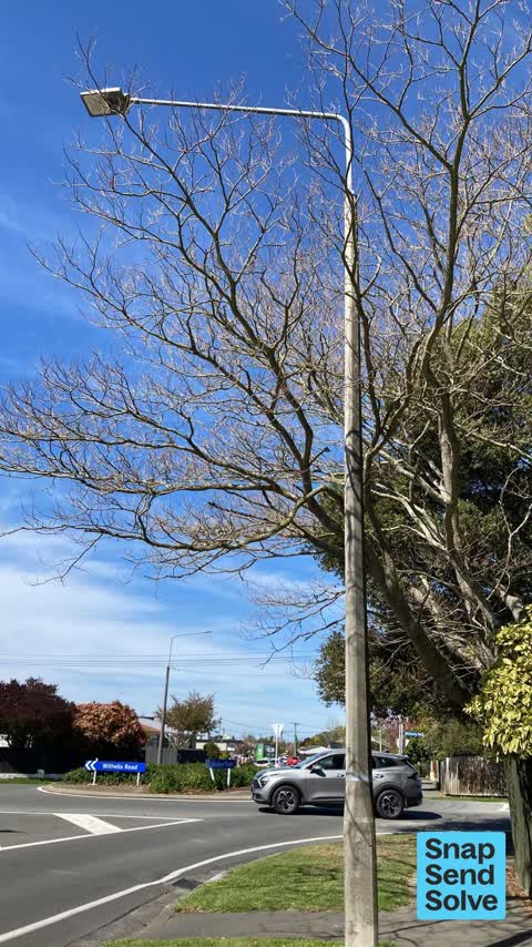
Tagged street light (fence, building or structure)

my green bin lid has been broken by truck for a few weeks now. can I get it replaced please


Reports per year up 3% 2024→2025
What gets reported
Exactly what people say
How fast the council fixes things here 9,856 finished jobs on record
The median council work order pinned in Avonhead took 6 days to resolve, the city-wide median is 3 days, so this ground runs slower than the city as a whole. The slowest tenth waited 3 months or longer. 258 tickets are open here now, the oldest was filed 24 December 2018.
Work orders, not the resident reports above, the council’s MyCouncilTicket stream, and one job can appear in both. A median counts only finished jobs; open ones are named as open, never averaged in. The ticket roll · the whole city’s fix times.
Alcohol rules on this ground
2 sensitive sites stand here, Avonhead School - Rakipaoa, Merrin School Ngā Whetū Kohara, and the Local Alcohol Policy restricts new off-licences within 200 m of them.
The council’s bylaw zones and the Local Alcohol Policy’s buffer list, read from the Regulatory open-data service. A ban rules drinking in public places; it says nothing about whether a premises may sell, that is the licence register’s job.
The suburb today
Schools here 3
- Avonhead School - RakipaoaFull Primary · decile 7 · EQI 406
- Merrin School Ngā Whetū KoharaFull Primary · decile 8 · EQI 398
- Te Parito Kōwhai Russley SchoolFull Primary · decile 7 · EQI 420
Zoned for Christchurch Adventist School · Middleton Grange School · Our Lady of Victories · Riccarton High School · St Thomas of Canterbury College · Te Puna Wai o Waipapa - Hagley College · and 11 more zones, the drawn zone is indicative; the Ministry’s written scheme is the legal boundary.
Decile and EQI describe the community a school draws from, not how well it teaches.
The green here 20
- Avonhead ParkSports ground · 23 ha
- Crosbie ParkSports ground · 7 ha · playground, 76 pieces
- Ferrier ParkSports ground · 3 ha · playground, 28 pieces
- Staveley Reserve1 ha · playground, 4 pieces
- Westgrove Parkplayground, 12 pieces
- Hyde Parkplayground, 21 pieces
- Stewarts Bushplayground, 37 pieces
- Brigadoon Reserve
The first eight of 20, Parks and reserves in the council’s open data, a park lands in the suburb its centre falls inside. The whole roll is at /parks.
The civic shelf 1
- Avonhead CemeteryCemetery
Libraries, halls, cemeteries and the rest in the council’s open data, a facility lands in the suburb its point or centre falls inside. The whole shelf is at /facilities.
Where the suburb worships 4
- Avonhead Baptist Churcha Baptist church · 102 Avonhead Road
- Hansarang Churcha Presbyterian church · 100 Avonhead Road
- Saint Christopher'san Anglican church · 244 Avonhead Road
- St Marks Presbyterian Churcha Presbyterian church · 150 Withells Road
Places of worship in the open map’s record, one lands in the suburb its building stands in. The whole roll is at /worship.
The tracks through here 2
- Walk and bike track through Avonhead1.3 km · Christchurch · walk · bike
- Walk and bike track through Avonhead928 m · Christchurch · walk · bike
Tracks in the council’s open data, a line belongs to every suburb it passes through. The whole network is at /tracks.
The names on this ground 6
The February 2011 survey drew mapped ground failure over 0.2% of this outline. A patch is a footprint, not a finding about an address; the count for the whole city is at /liquefaction.
The 2011 grading filed 249.6% of this outline, about 1,287 hectares, mostly TC1. A graded area files under the suburb its middle sits in, and a category is a verdict for a patch of ground, not a finding about an address; the grades are drawn at /technical-categories.
1 parcel inside this outline sits on the hazardous-activities register, mostly chemical manufacture, application and bulk storage. A listing records the work, not a soil test; the whole register is drawn at /hazards.
The files record 135 parcels of made or characterised ground inside this outline, about 16 hectares, mostly silt, topsoil, engineered fill, 1 carry fill the file can’t vouch for. A record is the file’s word on what was laid, not a fresh survey; the whole layer is drawn at /fill.
1 parcel inside this outline carries a cleanup on the file. A cleanup on the file is the register’s word, not a clearance; the whole register is drawn at /remediated.
The 2019 liquefaction study put 91% of this outline in the low class. A class is the model’s verdict on a patch of ground, not a finding about an address; the whole study is drawn at /vulnerability.
The council’s structure register stands 8 assets on this ground, 3 bridges, 3 sets of steps, 1 ramp, 1 boardwalk, sited at Avonhead Park, Crosbie Park, Ferrier Park, Westgrove Park. The register’s site names are its own labels for the ground an asset stands in; the layer is drawn at the map.
The recreation register keeps 38 records inside this outline, bookable surfaces for 16 football, 5 touch rugby, 4 softball, 3 rugby league. Seasons and surfaces are the register’s record, not this week’s draw; the layer is drawn at the map.
The register counts 4,777 living trees inside this outline, 16 veterans among them, 51 carrying a protection, mostly Yoshino Cherry, Silver Birch, Flowering Cherry. The file remembers 2,805 trees felled here. A tree record is the register’s word on what stands or stood; the whole canopy is drawn at /trees.
The plan files 44% of this outline under Residential Suburban, 47% residential, the rest mostly Rural Urban Fringe 22%, Transport 13%. A zone is a permission, not a description, the mix is read from a sampled join of the plan’s polygons; the whole district is drawn at /zones.
The plan reserves about 52 hectares of this outline, 10%, under 7 designations, mostly movement, learning. A designation is a claim on the ground, not a build date, the mix is read from a sampled join; the whole register is drawn at /designations.
The plan’s exceptions touch 3% of this outline, 5 qualifying matters, mostly utilities. A matter narrows how the density rule applies, it does not forbid; the mix is read from a sampled join, and the cultural-significance areas are the plan’s own unnamed ones. The whole register is drawn at /matters.
The plan’s heritage schedule protects 1 place by name in this suburb, Former Stables and Setting. A setting is the ground the item stands in, each files under the suburb holding its centroid; the whole schedule is at /heritage.
No high-hazard flood area covers this outline. The broader flood-management watch covers 1% of it, Avon River. Shares read from a sampled join; a model’s map, not a promise. The waiting water is drawn at /flood-hazard.
The plan’s noise overlays cover all of this outline, about 516 hectares across 6 mapped overlays, 43% of it inside the airport’s air-noise contours, where the 55 dB line bites, and inside the airport’s bird-strike buffer. Shares read from a sampled join; a planning line, not a meter’s reading. The quiet lines are drawn at /noise.
The plan’s water-margin layers cross this outline, 52 classified reaches, the plan calling Ilam Stream and Avon River by name, 1% of it inside the setback strips, the widest holding 7 m off the bank. The margin is the plan’s drawing, not a survey of the bank; the reaches, strips and held edges are mapped at /water-margin.
The plan’s allowed shape holds this outline, 3% of it inside the residential overlays, the densest standing Suburban. The shape is the plan’s permission, not a survey of what stands; the allowed shape is drawn at /density.
The rebuild’s cameras filed 1,514 photographs on this ground, 2011–2016, wastewater work mostly. Each frame is a receipt the dig left behind, a work log, not a survey of what stands now; the whole record is drawn at /rebuild.
The pedal network threads this ground, 10.9 km of cycleway crosses the outline. A segment counts under every suburb its path enters; the whole network is drawn at /cycleways.
The remembered names stand on this ground, 10 inscribed plaques, Avonhead Cemetery, Base Line Survey Monument among the grounds. The plaque is the register’s pin, not a surveyed spot; the whole roll is kept at /plaques.
The rulebook binds this ground, 6 drawn instruments, 2 alcohol bans, 4 bottle-store buffers; the outline sits inside the takiwā of Te Ngai Tuahuriri Runanga. The bylaw is the instrument, this the map of it, the whole rulebook is drawn at /rules.
- Avonhead Memorial Cemeterycemetery
- 2011 Earthquake Interment Sitemonument
- Avon Streamwaterway · 0.4 km
- Avon Stream / Ōrakipaoawaterway · 1.1 km
- Ilam Streamwaterway · 2.9 km
- Waimairi Streamwaterway · 5.1 km
The named waterways, bays, headlands, monuments, summits and old sites OpenStreetMap puts inside this outline, a pin is the mapper’s own; a waterway belongs to every suburb it crosses. Every roll, counted: /geography.
The crash record 205 injury crashes
205 crashes that hurt somebody on record inside Avonhead's outline, 2 people killed, 50 seriously hurt.
The corner that keeps appearing: Merrin Street at Withells Road, 12 injury crashes.
The crime record 1,215 recorded victimisations
1,215 victimisations on the Police record inside Avonhead’s outline, September 2022–August 2026, mostly theft, about 25 a year per 1,000 residents. Up 13% on the year before. Reported is not all, how much never reaches the record depends on the offence.
The buses through it 42 stops
42 Metro stops inside Avonhead's outline, in ECan’s stop record, served by route 130, route 3, route 125, route 140, route 86.
- Avonhead Mall near Merrin St
- Avonhead Mall near Merrin St
- Avonhead Mall near Withells Rd
- Avonhead Mall near Withells Rd
- Hawthornden Rd near Bellingham Pl
- Hawthornden Rd near Henridge Pl
- Kedleston Dr near Apsley Dr
- Kedleston Dr near Audley Gate near Kedleston Dr
- Kedleston Dr near Audley Gate near Kedleston Dr
- Kedleston Dr near Brockhall Ln
- Kedleston Dr near Greystoke Ln
- Kedleston Dr near Hatfield Pl
- Maidstone Rd near Colina St near Maidstone Rd
- Maidstone Rd near Colina St near Maidstone Rd
- Maidstone Rd near Derenzy Pl near Maidstone Rd
- Maidstone Rd near Derenzy Pl near Maidstone Rd
Businesses here 49 in the directory
49 premises in Avonhead across 29 kinds, from OpenStreetMap, the council’s licensed-premises register and its 2024 Find Christchurch directory. Each kind below opens at this suburb’s shelf.
- Bottle stores4
- Bars & pubs3
- Cafés3
- Fast food3
- Hairdressers3
- Supermarkets3
- Clubs2
- Fashion Accessories2
- Malls2
- Restaurants2
- ATMs1
- B&Bs1
- Bakeries1
- Banks1
- Bookshops1
- Dairies & convenience1
- Doctors & clinics1
- Florists1
- Hotels1
- Mini golf1
- Museums1
- Ngo1
- Petrol stations1
- Pharmacies1
- Real estate1
- Religion1
- Storage1
- Vets1
- Wholesale1
Among them, the ones the record says most about:
Before any of that
On the register here
Documents 40
What the archive’s sources say about Avonhead, titled for it, turned up by a search for one of its places, or carrying its name in the text. These are leads and citations: the originals live at the provider, linked from each row.
…2 with house thereon freeholder as before described surveyor labourer bray william bayley avonhead civil engineer brittan william guise oxford terrace westchristchurch gentleman brittan joseph linwood…Lyttelton Times · Papers Past · National Library of New Zealand · · text held
…tchurch london street lyttelton milford wellington and lyttelton tuam street christchurch avonhead oxford terrace westchristchurcl lin wood near christchurch papanui durham street gloucester street ch…Lyttelton Times · Papers Past · National Library of New Zealand · · text held
…t beyond the estimated cost of the railway i am sir your obedient servant signed w b bkat avonhead may 19 1854…Lyttelton Times · Papers Past · National Library of New Zealand · · text held
…yttelton lyttelton milford wellington and lyttelton tuam street christchurch christchurch avonhead oxford terrace westchristchurch brewer ginger-beer maker labourer shoemaker blacksmith tailor butcher…Lyttelton Times · Papers Past · National Library of New Zealand · · text held
…hristchurch lyttelton papanui road land-owner surveyor clerk labourer bray william bayley avonhead civil engineer brittan william guise oxford terrace westchristchurch gentleman brittan joseph linwood…Lyttelton Times · Papers Past · National Library of New Zealand · · text held
…white tartarian seed oats free from docks or darnel 12s per bushel enquire of mr bray at avonhead wanted a storeman one used to soft goods j would be preferred p noble campbell co oxford street lytte…Lyttelton Times · Papers Past · National Library of New Zealand · · text held
…white tartarian seed oats free from docks or darnel 12s per bushel enquire of mr bray at avonhead the draught stallion lofty will stand at the royal hotel stables christchurch every saturday during t…Lyttelton Times · Papers Past · National Library of New Zealand · · text held
…white tartarian seed oats free from docks or darnel 12s per bushel enquire of mr bray at avonhead the draught stallion lofty will stand at the royal hotel stables christchurch every saturday during t…Lyttelton Times · Papers Past · National Library of New Zealand · · text held
…whitk tartarian seed oats free from docks or darnel 12s per bushel enquire of mr bray at avonhead the draught stallion lofty will stand at the royal hotel stables christchurch every saturday during t…Lyttelton Times · Papers Past · National Library of New Zealand · · text held
…white tartarian seed oats free from docks or darnel 12s per bushel enquire of mr bray at avonhead the draught stallion lofty will stand at the royal hotel stables christchurch every saturday during t…Lyttelton Times · Papers Past · National Library of New Zealand · · text held
The rest are a search away, the whole shelf, for the name →
The wire on Avonhead 5 lately
15 more documents came up in searches for Avonhead's places and have not been read yet, a lead is a search result, not a fact, until somebody reads it.
Next door
Compare Avonhead with Russley · Ilam · Burnside · Broomfield · Sockburn · Upper Riccarton, same record, side by side.
Questions, answered briefly
Avonhead is a suburb of the New Zealand city of Christchurch. The public record holds 5,278 council reports for it, the first filed in June 2015.
10,650 people at the 2023 Census, 2,065 per square kilometre across 5.2 km².
About 12,264 people and 4,422 occupied private households (combined SA2s): grouped from Stats NZ SA1 areas through this site’s suburb join. Indicative, not a LIM.
5,278 reports on record, most often trees & parks (1,361), roads & footpaths (1,102), water & drains (1,051). 866 of them in the year to 12 October 2026.
205 injury crashes on the police record inside the suburb’s outline, 2 people killed, 50 seriously hurt. The suburb’s crashes, mapped →
The 2011 technical categories filed 249.6% of the suburb’s outline, about 1,287 hectares, mostly TC1. TC1 meant standard foundations sufficed, TC2 enhanced, TC3 site-specific engineering, a verdict for the patch of ground, not a finding about any one address. The grades, drawn →
Every suburb in Christchurch → · Its decade, charted → · the whole A–Z →