676 Avonside Drive, Avonside
11 reports on record since January 2016 · 8 with photographs. The street’s heaviest record is 244/240 Avonside Drive — 56 reports on file. Indicative rating valuation and school zones, hazards, bin day and what stood here before.
What gets reported here
Photographed here 8 on record


Reported here
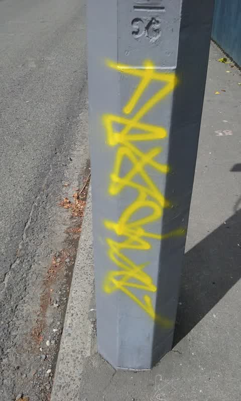
 Graffiti on a fence, building or structure —
 Ftp on white railing around river
 Overgrown Vegetation —
 Kia ora team, Re. Very large cabbage tree Ngarimu/Avonside Dr junction, SW cnr. Please would it be possible to get this tree cut down & trea
 Overgrown Vegetation —
 Grass on the Avon River side of the Avonside Rd road-edge barrier is getting very long (some head height) and dry as it seeds. Location: Dal
 Graffiti —
  Trees - General —
 This house has a cabbage tree and they block up the drain causing flooding in rainy weather. I believe they are placing the fallen leaves
 Street Gutters / Storm Water —
 Completely blocked storm drain at cnr Ngarimu & Avonside Dr, southwest side of intersection. Has been accumulating for a couple of months bu
- Graffiti —
- Damaged Road —
- Facility - General Request —
 Parks —
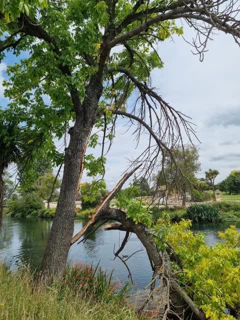
 Tree has snapped a branch, still hanging, big branch in river, causing issues with build up of debris.
Graffiti —
Power role
Also reported on Avonside Drive
- 244/240 Avonside Drive — 56 reports
- 800 Avonside Drive — 43 reports
- 746 Avonside Drive — 34 reports
- 774 Avonside Drive — 31 reports
- 658 Avonside Drive — 27 reports
- 740 Avonside Drive — 23 reports
- 836 Avonside Drive — 21 reports
- 240 Avonside Drive — 20 reports
The street’s crash record
NZTA’s record names Avonside Drive in 17 crashes that hurt somebody since 2006 — 1 seriously hurt, nobody killed.
The green nearby
- Avon Riverbank True Right — 111 m to the edge · 11 ha
- Woodham Park — 222 m to the edge · Botanic · 2 ha
- Avon Park — 332 m to the edge · Sports ground · 6 ha
Parks within half a kilometre, measured to the boundary — the council’s open data.
On the doorstep
- City Express Discounter — 365 m away · Dairies & convenience
- Woodham Road Liquor Store — 393 m away · Bottle stores
- Manila Barbershop — 394 m away · Hairdressers
- The Great India — 397 m away · Restaurants
Businesses within four hundred metres, measured at the pin — OpenStreetMap and the council directories.
The bus nearby
- Woodham Rd near Ngarimu St — 381 m away · the Orbiter (clockwise)
- Woodham Rd near Ngarimu St — 402 m away · the Orbiter (anticlockwise)
The closest Metro stops, within four hundred and fifty metres.
The tracks through here
- Walk and bike track through Avonside — 4 m to the line · walk · bike
- Walk and bike track through Avonside — 57 m to the line · walk · bike
- Walk and bike track through Avonside — 393 m to the line · walk · bike
Tracks whose line passes within half a kilometre, measured to the line itself — the council’s open data.
The named ground
Named water within 500 m of this address, measured to the line or the edge; the council’s own structure register — bridges, boardwalks and steps standing nearby — the open map’s record.
The remembered names nearby
- This Landing / Was Opened in March 2022 / Funded — 80 m away ·
This landing / was opened in March 2022 / Funded by the / Christchurch Earthquake Appeal T
· 2021
Inscribed plaques within two hundred and fifty metres — the register’s pins, not surveyed spots. The whole roll is at /plaques.
Renting nearby
new bonds in Avonside ran about $293 a week — $257 below the city median of $550 — the suburb page keeps the rent record →.
The civic layer
This ground votes in Linwood ward — the Coastal-Burwood-Linwood community board. Ward lines don’t always follow suburb lines; this one is measured at the pin, not the suburb’s centre.
What stood on this ground → · On the map → · From the air — the Crown’s aerials back to 1936; search the address on RetroLens →
Questions, answered briefly
11 council reports on record since January 2016 — most often graffiti (3), overgrown vegetation (2), trees - general (1).
Avonside, Christchurch — on Avonside Drive.
Nothing on the heritage register at this exact spot — the record around this ground →
Avon Riverbank True Right — 111 m to its edge, 11 ha.