162 Coutts Island Road, Belfast
14 reports on record since May 2021 · 9 with photographs. The most-reported address on Coutts Island Road. Indicative rating valuation and school zones, hazards, bin day and what stood here before.
What gets reported here
Photographed here 9 on record


Reported here
 Facility - General Request —
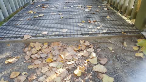
 The bridge has been vandalised yet again. This time the temporary fix has been removed. Presumably the culprits are bridge jumpers. As with
 Pavement - Damaged —
 Pedestrian bridge has a section of its side cut out. A very dangerous hazard as someone could fall in.
 Graffiti on a road, footpath or bridge —
 On Sunday someone cut a section of the bridge out that goes over the Otukaikino stream near the outlet to the Waimakariri river. They did it
- Public Toilet —
Toliet paper needs refilling
 Park - General Request —
 This sign proved misleading for us. Our group often uses the track along the stream and also the track over the footbridge up to Coutts Isla
 Park - General Request —
 Great to see this work under way. However there is no directional sign at stopbank top. Are those present only during gate opening hours?
 Park - General Request —
 Footbridge across Otukakino stream at junction with waimak river has large gap in railings
 Graffiti somewhere else —
 Carpark toilets graffiti inside, rubbish on door and toilet paper inaccessible
 Park - General Request —
 The east side gate on the stopbank on the road at the end of coutts island road that goes to the carpark by the Waimak bridge has a gate hin
- Litter —
- Graffiti —
- Park - General Request —
- Public Toilet —
 Roading/Streets —
 Bridge entrances needs levwling for bikes please and blackberry needs pruning
Also reported on Coutts Island Road
- 179 Coutts Island Road — 4 reports
- 164 Coutts Island Road — 4 reports
- 59 Coutts Island Road — 1 report
- 49 Coutts Island Road — 1 report
The civic shelf nearby
- Public Toilet, Belfast — 18 m away · Public toilet
- Monument — 290 m away · Monument
Libraries, halls and the rest within half a kilometre — the council’s open data.
On the doorstep
- Jet Thrills — 269 m away · Attractions
Businesses within four hundred metres, measured at the pin — OpenStreetMap and the council directories.
The tracks through here
- Combined Mtb And Walk — 308 m to the line · walk · bike
- Combined Mtb And Walk — 384 m to the line · walk · bike
- Combined Mtb And Walk — 397 m to the line · walk · bike
Tracks whose line passes within half a kilometre, measured to the line itself — the council’s open data.
The named ground
Named water within 500 m of this address, measured to the line or the edge — the open map’s record.
Renting nearby
new bonds in Belfast ran about $610 a week — $60 above the city median of $550 — the suburb page keeps the rent record →.
The civic layer
This ground votes in Harewood ward — the Fendalton-Waimairi-Harewood community board. Ward lines don’t always follow suburb lines; this one is measured at the pin, not the suburb’s centre.
What stood on this ground → · On the map → · From the air — the Crown’s aerials back to 1936; search the address on RetroLens →
Questions, answered briefly
14 council reports on record since May 2021 — most often park - general request (5), public toilet (2), roading/streets (1).
Belfast, Christchurch — on Coutts Island Road.
Nothing on the heritage register at this exact spot — the record around this ground →