9R Fords Road, Belfast
21 reports on record since November 2024 · 20 with photographs. The most-reported address on Fords Road. Indicative rating valuation and school zones, hazards, bin day and what stood here before.
What gets reported here
Photographed here 20 on record



Reported here
 Pavement - Damaged —
 This sunken approach to the ridge has a raised wooden edging which is extremely slippery and hazardous especially when wet.Please have it le
 Pavement - General —
 fence barrier
 Pavement - General —
 fence panels and safety handrails have been removed (roughly) again from alongside the Northern Corridor Shared Path. somebody is obviously
- Pavement - General —
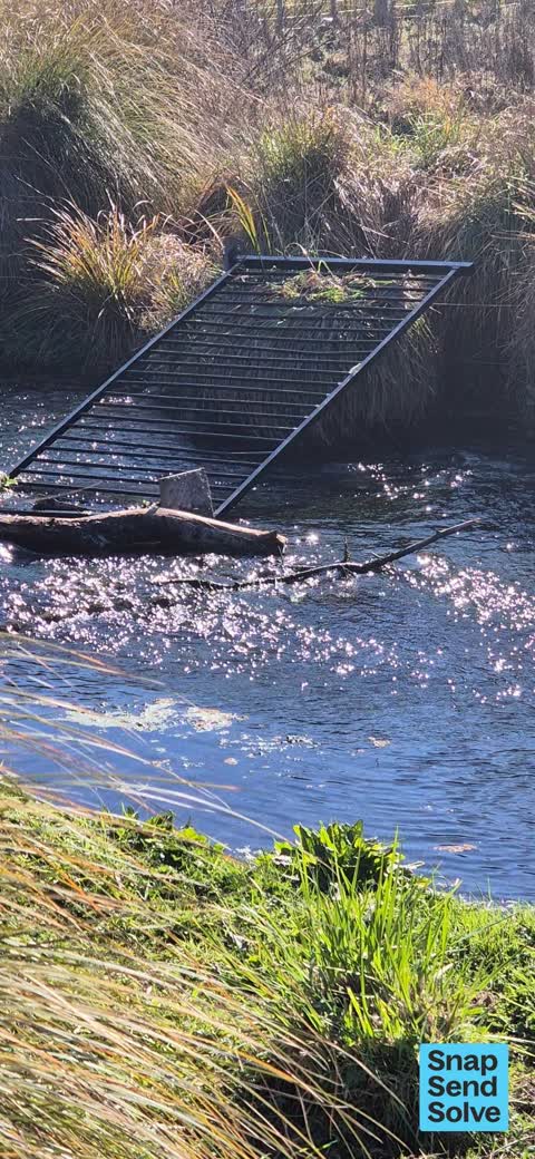
safety fencing alongside the Northern Corridor Shared path has been removed (stolen?). It seems someone has been periodically removing the f
 General Request —
 More safety fence panels have been removed at the CNC Shared Path underpass. This location is active for vandalism and theft, although it oc
 Pavement - General —
 Safety fence has been removed.
 Road Blockage —
 Traffic cone in river.
 Roads - General —
 At end of Factory Rd left onto cycleway towards Kaiapoi first underpass bridge. Fence missing.
 Pavement - General —
 missing/stolen fence
 Graffiti on a fence, building or structure —
 graffiti
 Pavement - General —
 public safety guard fence has been stolen down by the river which is a safety hazard as this route is used by many cyclists
 Pavement - General —
 A significant escalation of the ongoing theft and vandalism of the security fences along the Chch Northern Corridor shared path. Elsewhere
 Pavement - General —
 fence along stream on cycle trail under motorway stolen. dangerous for youngsters. needs immediare attention.
 Poles and Signage - General —
 invisible signage, might as well not be there.
 Graffiti on a fence, building or structure —
 Offensive graffitti
 Graffiti on a road, footpath or bridge —
  Graffiti on a fence, building or structure —
 Under motorway on cycle/footpath
 Pavement - Damaged —
 There are a minimum of three of these exposed brackets on the cycling path and are highly dangerous and pose a serious risk of severe injury
 Pavement - General —
 The bollard is missing and bracket that remains is a health and safety threat if someone happens to ride over it.
 Pavement - General —
 The seal transition along the cycle way from tar seal to the wood on the bridge heading north as you turn left from the underpass under the
 Graffiti on a fence, building or structure —
Also reported on Fords Road
- 4 Fords Road — 4 reports
- 10 Fords Road — 3 reports
- 155 Fords Road — 1 report
The green nearby
- Ouruhia Reserve — 356 m to the edge · Sports ground · 9 ha
Parks within half a kilometre, measured to the boundary — the council’s open data.
The tracks through here
- Walk and bike track through Belfast — 409 m to the line · walk · bike
Tracks whose line passes within half a kilometre, measured to the line itself — the council’s open data.
The named ground
Named water within 500 m of this address, measured to the line or the edge — the open map’s record.
Renting nearby
new bonds in Belfast ran about $610 a week — $60 above the city median of $550 — the suburb page keeps the rent record →.
The civic layer
This ground votes in Harewood ward — the Fendalton-Waimairi-Harewood community board. Ward lines don’t always follow suburb lines; this one is measured at the pin, not the suburb’s centre.
What stood on this ground → · On the map → · From the air — the Crown’s aerials back to 1936; search the address on RetroLens →
Questions, answered briefly
21 council reports on record since November 2024 — most often pavement - general (10), graffiti on a fence, building or structure (4), pavement - damaged (2).
Belfast, Christchurch — on Fords Road.
Nothing on the heritage register at this exact spot — the record around this ground →
Ouruhia Reserve — 356 m to its edge, 9 ha.