500 Dyers Road, Bromley
18 reports on record since December 2021 · 15 with photographs. The most-reported address on Dyers Road. Indicative rating valuation and school zones, hazards, bin day and what stood here before.
What gets reported here
Photographed here 15 on record


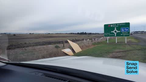


Reported here
 Graffiti on a sign, mural or public art —
  Graffiti on a sign, mural or public art —
  Dumped Rubbish —
 Dumped rubbish entrance to sewer outfall to estuary
 Hazard — vehicle —
 Parked trailer for advertisement , $80 ticket
 Dumped Rubbish —
 Dumped rubbish by Bridge st/Myers roundabout
 Animal - Domestic —
 Small light tan curly haired dog running around inside first gate to effluent ponds. Black collar and was able to get close but ran off quic
 Dumped Rubbish —
 21 black bags dumped on corner breezes & dyers road please remove merry christmas team
 Dumped Rubbish —
 Large amount of rubbish dumped on side of Dyers road next to roundabout with Breezes Road, Bromley
 Dumped Rubbish —
 A load of rubbish on the side of the road
 Dumped Rubbish —
 Fly tipping:-(
- Roads - General —
Rock in middle of road
 Graffiti on a road, footpath or bridge —
  Dumped Rubbish —
 Through gate next to estuary
 Dumped Rubbish —
  Dumped Rubbish —
 Dumped rubbish
- Street Light Outage —
- Roads - General —
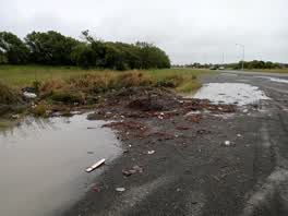 Parks —
Also reported on Dyers Road
- 300 Dyers Road — 15 reports
- 244 Dyers Road — 11 reports
- 194 Dyers Road — 11 reports
- 194F Dyers Road — 10 reports
- 254 Dyers Road — 9 reports
- 322–392 Dyers Road — 7 reports
- 247 Dyers Road — 7 reports
- 230 Dyers Road — 7 reports
The street’s crash record
NZTA’s record names Dyers Road in 18 crashes that hurt somebody since 2006 — 6 seriously hurt, nobody killed.
The green nearby
- Rat Island Reserve — 167 m to the edge · 2 ha
- Bexley Wetland — 480 m to the edge · Regional · 15 ha
Parks within half a kilometre, measured to the boundary — the council’s open data.
The tracks through here
- Walk and bike track through Bromley — 212 m to the line · walk · bike
- Walk and bike track through Bromley — 212 m to the line · walk · bike
Tracks whose line passes within half a kilometre, measured to the line itself — the council’s open data.
The named ground
Named water within 500 m of this address, measured to the line or the edge; Named places within 1.5 km of this address — the open map’s record.
Renting nearby
new bonds in Bromley ran about $560 a week — $10 above the city median of $550 — the suburb page keeps the rent record →.
The civic layer
This ground votes in Linwood ward — the Coastal-Burwood-Linwood community board. Ward lines don’t always follow suburb lines; this one is measured at the pin, not the suburb’s centre.
What stood on this ground → · On the map → · From the air — the Crown’s aerials back to 1936; search the address on RetroLens →
Questions, answered briefly
18 council reports on record since December 2021 — most often dumped rubbish (9), roads - general (2), graffiti on a sign, mural or public art (2).
Bromley, Christchurch — on Dyers Road.
Nothing on the heritage register at this exact spot — the record around this ground →
Rat Island Reserve — 167 m to its edge, 2 ha.