18 Carradale Avenue
5 council reports since September 2021, 4 carrying a photograph. The most-reported address on Carradale Avenue.
From the air, then
Sourced from Canterbury Maps and partners. LINZ, CC BY 3.0 NZ. Each frame is cut from Environment Canterbury’s historic imagery MapServer for that decade, only where the Footprints layer names a CC BY survey (NZAM-covered spots stay out). RetroLens holds more Crown aerials →
The green nearby
- Rannoch Drainage Reserve, you are in it
- Glen Kerran Drainage Reserve, 61 m to the edge
- Carradale Drainage Reserve, 130 m to the edge
- Broomfield Common, 146 m to the edge · Sports ground · 9 ha · playground, 64 pieces
- Kilbrannan Reserve, 223 m to the edge
Parks within half a kilometre, measured to the boundary, the council’s open data. The whole roll is at /parks.
The tracks through here
- Walk and bike track through Broomfield, 488 m to the line · walk · bike
Tracks whose line passes within half a kilometre, the council’s open data.
The named ground
the council’s own structure register, bridges, boardwalks and steps standing nearby, the open map’s record.
The remembered names nearby
- In Remembrance of / Matthew McEachen, 236 m away ·
In Remembrance Of/ MATTHEW McEACHEN/ Died as a rseult of the Christchurch/ Earthquake - 22
· 2014
Inscribed plaques within two hundred and fifty metres, the register’s pins, not surveyed spots. The whole roll is at /plaques.
Renting nearby
new bonds in Broomfield ran about $600 a week, $50 above the city median of $550, the suburb page keeps the rent record →.
What gets reported here
Photographed here 4 on record


What’s on record
 Pavement - Damaged, 17 Sept 2025
 Tree roots are causing damage to the footpath outside 16 and 18 Carradale Ave to the point of creating danger for pedestrians. I'm also conc
 Park - General Request, 3 Apr 2025
 Bollard snapped
 Trees - General, 23 Dec 2024
 Area adjacent to my fence line has usually been regularly sprayed for weeds but has not been done for I think at least 3 months and is becom
- Trees - General, 3 Apr 2024
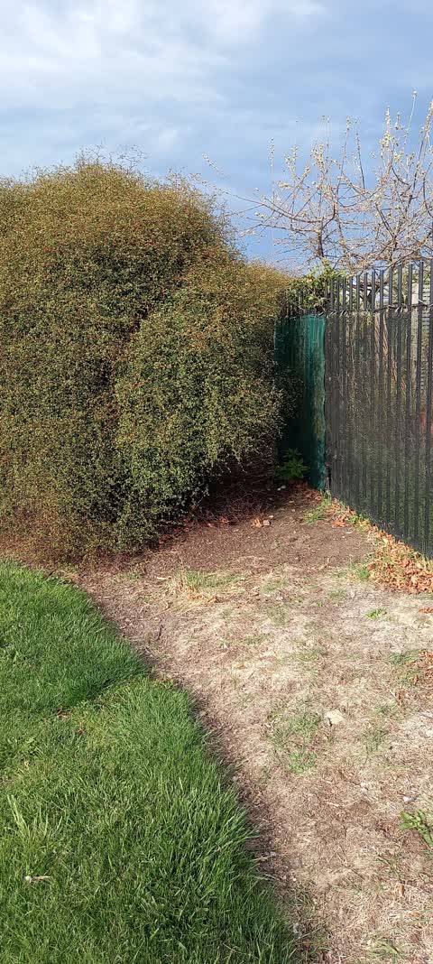
A small stand of Muehlenbeckia was removed from this area a couple of years ago. This bit has started to grow again. I would like to see it
 Parks, 19 Sept 2021
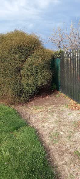
 Muehlenbekia needs to be cut back from fenced-in and reduced to fence high level
Elsewhere on Carradale Avenue
- 41 Carradale Avenue, 3 reports
- 4 Carradale Avenue, 2 reports
- 3E Carradale Avenue, 2 reports
- 12 Carradale Avenue, 2 reports
- 3 Carradale Avenue, 1 report
- 25 Carradale Avenue, 1 report
- 15 Carradale avenue, 1 report
- 15 Carradale Avenue, 1 report
The street’s crash record
NZTA’s record names Carradale Avenue in 2 crashes that hurt somebody since 2006, 0 seriously hurt, nobody killed.
The civic layer
This ground votes in Hornby ward, the Halswell-Hornby-Riccarton community board is its local layer. Ward lines don’t always follow suburb lines; this one is measured at the pin, not the suburb’s centre. The whole roll is at /wards.
Carradale Avenue, the whole record → · Everything about Broomfield → · What stood on this ground → · On the map → · From the air, RetroLens holds the Crown’s aerials back to 1936; search the address there →
Questions, answered briefly
5 council reports on record since September 2021, most often trees - general (2), pavement - damaged (1), parks (1).
Broomfield, Christchurch, on Carradale Avenue.
Nothing on the heritage register at this exact spot, the record around this ground →
Rannoch Drainage Reserve, the address is inside it.