
Broomfield, Christchurch
1,402 council reports since November 2015, the 71st busiest suburb in the city. 1,125 photographs on record. 306 people at the most recent Census, 147 to the square kilometre across 2.1 km².
The record also holds about $600 a week to rent· 2023 Census snapshot· 1,125 photographs· 1 old photograph· 14 parks· 3 tracks· noise overlays over the whole outline· setback strips over 2% of the outline· 1% of the outline inside the plan’s density overlays· 365 SCIRT photographs filed on this ground· 7.9 km of cycleway crosses the outline· 1 remembered name on this ground· 3 drawn rules bind this ground· 1 parcels on the dangerous-work register· 47 parcels of made ground· 2 parcels with a cleanup on file· the 2019 model grades this ground mostly low· 7 council structures on the register· 1 recreation register record· 1,122 trees on the register· the plan’s word on this ground· 4% of the outline reserved· 1 place on the heritage schedule· 2 epicentres inside the outline· 21 injury crashes· 475 recorded victimisations· 4 bus stops· 10 businesses· the council’s fix times· alcohol ban over most of the outline· 1 heritage place· 40 documents· 1 mention on the wire
Live source links
Link-outs to the source’s own live pages, chch.live does not copy their live values or source text.
Living here rent · the ground · the day-to-day
$600/week
middle half $581–$600
New bonds here ran at about $600 a week in the April–June 2026 quarter, the middle half of them between $581 and $600, across 6 bonds lodged, down 7% on a year ago. That’s about $50 a week above the city’s own quarter median of $550. Tenancy Services counts these under the “Broomfield” statistical area, close to this suburb’s outline, not exactly it.
Median and quartiles of weekly rents on new private bonds, by quarter. New bonds are fresh lodgements, not the whole rental stock; under five bonds the rent is withheld, and counts are randomly rounded. Source: Tenancy Services rental bond data: provisional while the bond system migrates.
Day to day it holds 14 parks, 3 tracks and 4 bus stops, each is counted further down.
Lately the record’s mostly rubbish & dumping, 259 reports in the year to 12 October 2026, the newest 9 October 2026.
One for the quiz, Its busiest day on record was 4 September 2017, 10 reports in a single day.
2023 Census snapshot SA1 areas grouped here
About 2,784 people and 1,065 occupied private households in the “Broomfield” statistical area, grouped from 18 SA1 areas. This exact statistical-area match is close to this suburb’s outline, not exactly it.
More of the 2023 Census
- Born overseas30% of stated birthplace
- European ethnicity62% of ethnicity responses
- Māori ethnicity14% of ethnicity responses
- Pacific Peoples ethnicity9% of ethnicity responses
- Asian ethnicity26% of ethnicity responses
- Households with internet84% of stated households
- Households with two or more vehicles54% of stated households
Ethnicity is a multiple-response measure, so those percentages are not meant to add to 100%.
Stats NZ’s 2023 Census uses fixed random rounding to base 3. Unavailable or confidential cells are left out, not treated as zero. individuals · households · geography · CC BY 4.0.
About the suburb
Broomfield is a rural community in the Hurunui District, in the northern part of Canterbury in New Zealand's South Island. It is approximately 10 minutes drive West of Amberley.
As reported 1,125 on record
The suburb, back then 1 in the archive
Placed by the record’s locality join or the name in its own title, a lead, not a claim each frame stood here.
The shape of it outline © OpenStreetMap · recent reports, pinned
The record on Broomfield
- Broomfield enters the written record on 21 April 1860, “Page 9 Advertisements Column 1 (Lyttelton Times, 21 April 1860)”, Papers Past.
- “Broomfield” appears somewhere in 79 of the archive’s records, title, description or body.
- A Papers Past search for the name surfaced 30 records, leads by provenance, not by phrase.
- The first report the feed ever carried here: parks, 9 November 2015, at Broomfield.
- Its busiest day on record was 4 September 2017, 10 reports in a single day.
- The street that keeps coming up is Vanguard Drive, reported on 141 separate days.
- For elections the suburb’s centre falls inside Hornby ward, the Halswell-Hornby-Riccarton community board is its local layer. The whole roll is at /wards.
Lately the newest reports
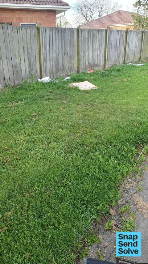

Damaged Street Sign34 Miromiro Street
The Road sign that marks out Miro Miro, Koral Lane and Musket Lane had become turned around and needs to be adjusted as well as possibly reseated to ensure it…


Water Leak21 Kintyre Dr
The water main at the house next door has been leaking for some time and appears to be getting worse address is 23 Kintyre drive

Poles and Signage - General18 Torbeg Lane
Park missing sign to prevent motorbikes constantly riding in park. Theres never been signs but there needs to be. Theres always damage somewhere in the park…


General Request54–72 Vanguard Dr
Gate wire rope has been cut at Broomfield common opposite Malabar Cres

Poles and Signage - General14 Strone Cl
The Glenbarr Lane street sign is falling over and the signs have blown around in the wind. The name of the Lane and the Private lane signs are no longer…
Reports per year up 28% 2024→2025
15
2
16
44
17
80
18
56
19
52
20
53
21
79
22
153
23
196
24
218
25
280
What gets reported
Exactly what people say
How fast the council fixes things here 2,377 finished jobs on record
The median council work order pinned in Broomfield took 4 days to resolve, the city-wide median is 3 days, so this ground runs slower than the city as a whole. The slowest tenth waited 3 months or longer. 52 tickets are open here now, the oldest was filed 9 September 2019.
Work orders, not the resident reports above, the council’s MyCouncilTicket stream, and one job can appear in both. A median counts only finished jobs; open ones are named as open, never averaged in. The ticket roll · the whole city’s fix times.
Alcohol rules on this ground one ban zone reaches in
Riccarton Racecourse. A public drinking ban, applies from 7am to 12 midnight, Saturday of Cup Week (New Zealand Cup Day), covers most of Broomfield.
The council’s bylaw zones and the Local Alcohol Policy’s buffer list, read from the Regulatory open-data service. A ban rules drinking in public places; it says nothing about whether a premises may sell, that is the licence register’s job.
The suburb today
Schools here
Zoned for Christchurch Adventist School · Gilberthorpe School · Hornby High School · Middleton Grange School · St Bernadette's School (Hornby) · St Thomas of Canterbury College · and 5 more zones, the drawn zone is indicative; the Ministry’s written scheme is the legal boundary.
The green here 14
- Broomfield CommonSports ground · 9 ha · playground, 64 pieces
- Neathwest Reserve2 ha
- Arcon Stream Reserve1 ha · playground, 47 pieces
- Rosella Reserve1 ha · playground, 5 pieces
- Glen Kerran Drainage Reserve
- Rannoch Drainage Reserve
- Carradale Drainage Reserve
- Kilbrannan Reserve
The first eight of 14, Parks and reserves in the council’s open data, a park lands in the suburb its centre falls inside. The whole roll is at /parks.
The tracks through here 3
- Walk and bike track through Broomfield1.5 km · Christchurch · walk · bike
- Walk and bike track through Broomfield400 m · Christchurch · walk · bike
- Walk and bike track through Broomfield141 m · Christchurch · walk · bike
Tracks in the council’s open data, a line belongs to every suburb it passes through. The whole network is at /tracks.
The quiet lines
1 parcel inside this outline sits on the hazardous-activities register, mostly chemical manufacture, application and bulk storage. A listing records the work, not a soil test; the whole register is drawn at /hazards.
The files record 47 parcels of made or characterised ground inside this outline, about 116 hectares, mostly silt, sand, engineered fill. A record is the file’s word on what was laid, not a fresh survey; the whole layer is drawn at /fill.
2 parcels inside this outline carry a cleanup on the file, 1 marked verified. A cleanup on the file is the register’s word, not a clearance; the whole register is drawn at /remediated.
The 2019 liquefaction study put 100% of this outline in the low class. A class is the model’s verdict on a patch of ground, not a finding about an address; the whole study is drawn at /vulnerability.
The council’s structure register stands 7 assets on this ground, 7 bridges, sited at Neathwest Reserve, Laramie Reserve, Broomfield Common, Arcon Stream Reserve. The register’s site names are its own labels for the ground an asset stands in; the layer is drawn at the map.
The recreation register keeps 1 record inside this outline, bookable surfaces for 1 basketball. Seasons and surfaces are the register’s record, not this week’s draw; the layer is drawn at the map.
The register counts 1,122 living trees inside this outline, mostly Kowhai, Tulip tree, Ribbonwood. The file remembers 513 trees felled here. A tree record is the register’s word on what stands or stood; the whole canopy is drawn at /trees.
The plan files 38% of this outline under Open Space Metropolitan Facilities, 43% residential, the rest mostly Residential Suburban 22%, Residential New Neighbourhood 20%. A zone is a permission, not a description, the mix is read from a sampled join of the plan’s polygons; the whole district is drawn at /zones.
The plan reserves about 8 hectares of this outline, 4%, under 1 designation, mostly movement. A designation is a claim on the ground, not a build date, the mix is read from a sampled join; the whole register is drawn at /designations.
The plan’s heritage schedule protects 1 place by name in this suburb, 1 graded highly significant, Riccarton Racecourse Tea House and Setting. A setting is the ground the item stands in, each files under the suburb holding its centroid; the whole schedule is at /heritage.
The plan’s noise overlays cover all of this outline, about 208 hectares across 2 mapped overlays, and inside the airport’s bird-strike buffer. Shares read from a sampled join; a planning line, not a meter’s reading. The quiet lines are drawn at /noise.
The plan’s water-margin layers cross this outline, 16 classified reaches, the plan calling Paparua Stream and Paparua South Branch by name, 2% of it inside the setback strips, the widest holding 7 m off the bank. The margin is the plan’s drawing, not a survey of the bank; the reaches, strips and held edges are mapped at /water-margin.
The plan’s allowed shape holds this outline, 1% of it inside the residential overlays, the densest standing Medium Density. The shape is the plan’s permission, not a survey of what stands; the allowed shape is drawn at /density.
The rebuild’s cameras filed 365 photographs on this ground, 2012–2014, wastewater work mostly. Each frame is a receipt the dig left behind, a work log, not a survey of what stands now; the whole record is drawn at /rebuild.
The pedal network threads this ground, 7.9 km of cycleway crosses the outline, South Express. A segment counts under every suburb its path enters; the whole network is drawn at /cycleways.
The remembered names stand on this ground, 1 inscribed plaque, Glen Kerran Drainage Reserve among the grounds. The plaque is the register’s pin, not a surveyed spot; the whole roll is kept at /plaques.
The rulebook binds this ground, 3 drawn instruments, 1 alcohol ban, 2 bottle-store buffers; the outline sits inside the takiwā of Te Ngai Tuahuriri Runanga. The bylaw is the instrument, this the map of it, the whole rulebook is drawn at /rules.
GeoNet’s catalogue puts 2 magnitude-3+ epicentres inside this outline since the sequence opened, the biggest a M3.7 in 2016. An epicentre is where the instruments placed the break, not a measure of the shaking here; the whole catalogue is counted at /sequence, the live record is /quakes, and the story in plain language is the earthquakes explainer.
The crash record 21 injury crashes
21 crashes that hurt somebody on record inside Broomfield's outline, 7 seriously hurt, nobody killed.
The corner that keeps appearing: Masham Road at Kintyre Drive, 3 injury crashes.
The crime record 475 recorded victimisations
475 victimisations on the Police record inside Broomfield’s outline, September 2022–August 2026, mostly theft, about 43 a year per 1,000 residents. Up 17% on the year before. Reported is not all, how much never reaches the record depends on the offence.
The buses through it 4 stops
4 Metro stops inside Broomfield's outline, in ECan’s stop record, served by route 125, route 140.
- Carmen Rd
- Carmen Rd near Steadman Rd
- Masham Rd near Kintyre Dr
- Masham Rd near Rosella St
Businesses here 10 in the directory
10 premises in Broomfield across 7 kinds, from OpenStreetMap, the council’s licensed-premises register and its 2024 Find Christchurch directory. Each kind below opens at this suburb’s shelf.
Among them, the ones the record says most about:
Before any of that
On the register here
Documents 40
What the archive’s sources say about Broomfield, titled for it, turned up by a search for one of its places, or carrying its name in the text. These are leads and citations: the originals live at the provider, linked from each row.
71860s
41870s
51880s
261890s
181900s
221910s
31930s
61940s
62000s
182010s
2020s
Page 9 Advertisements Column 1 (Lyttelton Times, 21 April 1860)
…hereford street cast household part of section no 60 east hereford street douglas george broomfield station r kowai freehold madras st christchurch part town reserves 108 miles grosvenor christchurch…Lyttelton Times · Papers Past · National Library of New Zealand · · text held
Page 2 Advertisements Column 1 (Lyttelton Times, 25 April 1860)
…hereford street east household part of section no 50 east hereford street douglas george broomfield station rkowai madrasst clmstchurcb part town reserves 108 miles grosvenor christchurch household t…Lyttelton Times · Papers Past · National Library of New Zealand · · text held
BIRTHS. (Lyttelton Times, 05 October 1861)
…tringer of twins seagerjuiy 16 at lyttelton mrs h fowle seager of a son garlandjuiy 16 at broomfield farm heathcote river the wife of mr edward garland of a daughter callaghanjuiy 19 at christchurch t…Lyttelton Times · Papers Past · National Library of New Zealand · · text held
Page 3 Advertisements Column 1 (Star, 17 December 1869)
…st tenders wanted tenders for tying and setting up 250 acres more or less of corn crop on broomfield farm sealed tenders marked on the outside harvest tender to be sent to mr john thomson racecourse o…Star · Papers Past · National Library of New Zealand · · text held
Page 1 Advertisements Column 1 (Star, 21 December 1869)
…st tenders wanted tenders for tying and setting up 250 acres more or less of corn crop on broomfield farm sealed tenders marked on the outside harvest tender to be sent to mr john thomson racecourse o…Star · Papers Past · National Library of New Zealand · · text held
Page 1 Advertisements Column 1 (Star, 24 December 1869)
…st tenders wanted tenders for tying and setting up 250 acres more or lebs of corn crop on broomfield farm sealed tenders marked on the outside harvest tender to be sent to mr john thomson haceeourae o…Star · Papers Past · National Library of New Zealand · · text held
Page 1 Advertisements Column 1 (Star, 27 December 1870)
…rk papanni eoad 2519 wanted a good ploughman apply to mr john thomson near the racecourse broomfield dec 23 1870 artesian well wanted tenders for sinking an arte sian well 2-inch pipe 2447 e w trent w…Star · Papers Past · National Library of New Zealand · · text held
Page 1 Advertisements Column 1 (Star, 23 December 1871)
…rvest wanted tenders for binding 250 acres of grain more or less the crops may bo seen on broomfield farm near the racecourse contractors to keep up with two 2 reaping machines sealed tenders to be se…Star · Papers Past · National Library of New Zealand · · text held
Page 1 Advertisements Column 2 (Star, 27 December 1871)
…rvest wanted tenders for binding 250 acres of grain more or less the crops may bo seen on broomfield farm near the racecourse contractors to keep up with two 2 reaping machines sealed tenders to be se…Star · Papers Past · National Library of New Zealand · · text held
The rest are a search away, the whole shelf, for the name →
The wire on Broomfield 1 lately
Little Owl seen — Broomfield, Christchurch 8042, New ZealandiNaturalist · robhendynz ·
39 more documents came up in searches for Broomfield's places and have not been read yet, a lead is a search result, not a fact, until somebody reads it.
Next door
Compare Broomfield with Hei Hei · Russley · Yaldhurst · Avonhead · Hornby · Sockburn, same record, side by side.
Questions, answered briefly
What is Broomfield?
Broomfield is a rural community in the Hurunui District, in the northern part of Canterbury in New Zealand's South Island. The public record holds 1,402 council reports for it, the first filed in November 2015.
How many people live in Broomfield?
306 people at the the most recent count Census, 147 per square kilometre across 2.1 km².
How many people does the 2023 Census count for Broomfield?
About 2,784 people and 1,065 occupied private households: grouped from Stats NZ SA1 areas through this site’s suburb join. Indicative, not a LIM.
What gets reported in Broomfield?
1,402 reports on record, most often rubbish & dumping (419), trees & parks (335), graffiti & vandalism (220). 259 of them in the year to 12 October 2026.
How many crashes has Broomfield had?
21 injury crashes on the police record inside the suburb’s outline, 7 seriously hurt, nobody killed. The suburb’s crashes, mapped →
Did earthquakes strike under Broomfield?
GeoNet’s catalogue puts 2 magnitude-3+ epicentres inside the suburb’s mapped outline since the September 2010 mainshock, the biggest a M3.7 in 2016. An epicentre is where the instruments placed the break, not a measure of the shaking felt here. The whole sequence, counted → · The story, in plain language →
Every suburb in Christchurch → · Its decade, charted → · the whole A–Z →