195 Grahams Road, Burnside
19 reports on record since June 2021 · 15 with photographs. The most-reported address on Grahams Road. Indicative rating valuation and school zones, hazards, bin day and what stood here before.
What gets reported here
- Parks — 4
- Water Leak — 3
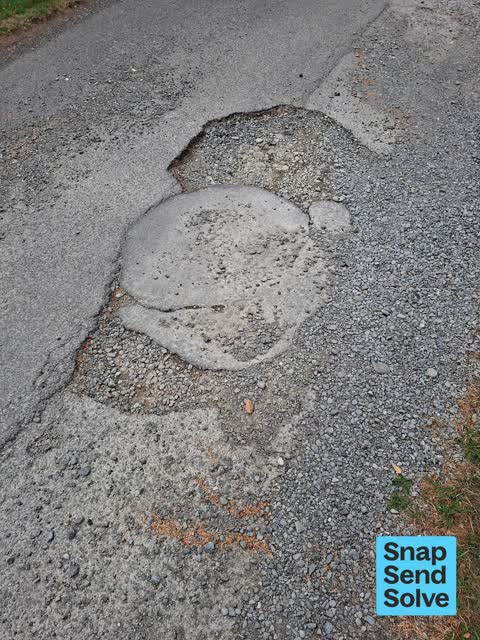
- Pothole — 3
- Dumped Rubbish — 3
- Water General — 1
- Trees - General — 1
Photographed here 15 on record




Reported here
 Water General —
 Water in Cemetery not working. This includes toilet block. Cannot flush toilets or wash hands
 Dumped Rubbish —
 A pile of old (presumably stolen) bikes dumped outside our church building.
 Fallen Tree —
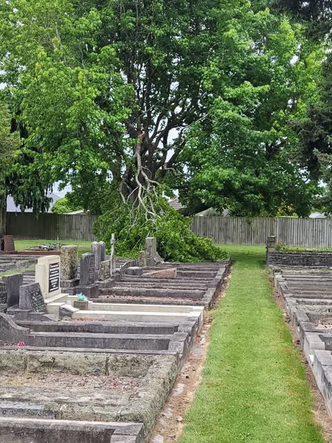
 fallen tree on top of Graves withing Waimari Cemetery.
 Pothole —
 Small pothole opening up on driveway in Waimairi Cemetery
 Pothole —
 Large pothole on driveway in Waimairi Cemetery
 Pothole —
 Large pothole on driveway in Waimairi Cemetery
 Dumped Rubbish —
 Old bed dumped outside Waimairi Cemetery.
 Overgrown Vegetation —
 Can we carry-out a heavy branch reduction on two large limbs overhanging gravestones, the removal of a hanger and canopy lift to 3m or so. L
 Water Leak —
 Waimairi cemetery, underground water leak
 Dumped Rubbish —
 Rubbish dumped in the cemetery.
- Trees - General —
- Graffiti —
- Water Leak —
- Water Leak —
 Parks —
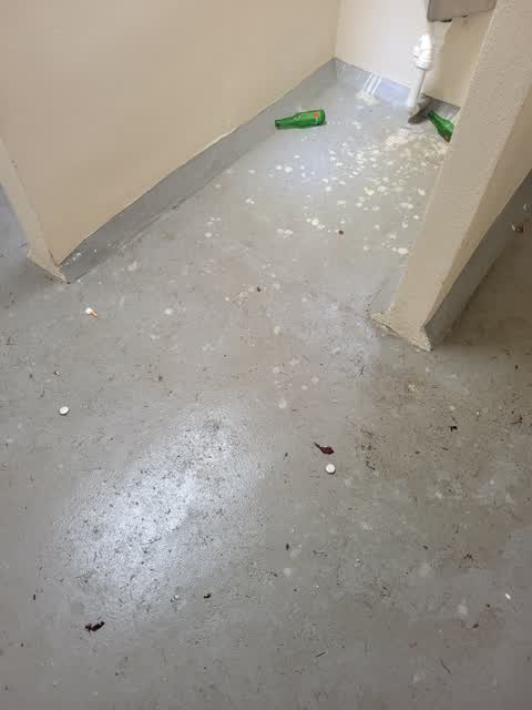
 WImari cemetery men's toilets has had something ,probably beer poured all over the floor and is very sticky, needs washing out
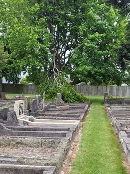 Parks —
 Large branch broken and hanging over tombstones Waimari cemetery Send to Tree tech
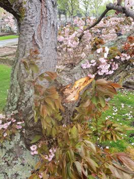 Parks —
 Cherry blossom tree branch broken by wind.
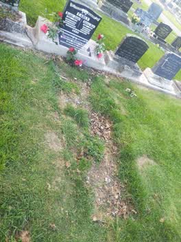 Parks —
 Our Gran has been here for a year now can this please be fixed
Rubbish/Recycling —
Inside of big belly dropped unable to get bin out.
Also reported on Grahams Road
- 195A Grahams Road — 19 reports
- 92 Grahams Road — 14 reports
- 110 Grahams Road — 14 reports
- 129 Grahams Road — 8 reports
- 93 Grahams Road — 7 reports
- 73 Grahams Road — 5 reports
- 58 Grahams Road — 5 reports
- 160 Grahams Road — 5 reports
The street’s crash record
NZTA’s record names Grahams Road in 89 crashes that hurt somebody since 2006 — 1 person killed, 23 seriously hurt.
The green nearby
- Kendal Reserve — 175 m to the edge
- Derwent Reserve — 412 m to the edge
- Halifax Reserve — 491 m to the edge
Parks within half a kilometre, measured to the boundary — the council’s open data.
The civic shelf nearby
- Waimairi Cemetery — you are in it · Cemetery
Libraries, halls and the rest within half a kilometre — the council’s open data.
On the doorstep
- Sevantis Restaurant & Cafe — 363 m away · Restaurants
- Burnside Medical Centre — 380 m away · Doctors & clinics
- Dream Garden Contemporary Vegetarian Cafe and Restaurant — 390 m away · Cafés
- Nice Cook — 391 m away · Restaurants
Businesses within four hundred metres, measured at the pin — OpenStreetMap and the council directories.
The bus nearby
- Cranbrook Ave near Grahams Rd — 185 m away · route 120
- Cranbrook Ave near Glencoe St — 191 m away · route 120
The closest Metro stops, within four hundred and fifty metres.
The tracks through here
- Walk and bike track through Burnside — 326 m to the line · walk · bike
Tracks whose line passes within half a kilometre, measured to the line itself — the council’s open data.
The named ground
Named water within 500 m of this address, measured to the line or the edge — the open map’s record.
The remembered names nearby
- Rest‑a‑while / This Seat Was Donated by Rita — 37 m away ·
Rest‑A‑While / This seat was donated by Rita (illegible) / in loving memory of her Mother
· 2013 - Kendal School / 1961 – 2013 — 202 m away ·
Kendal School / 1961 – 2013 / Learn from yesterday, live for today, hope for tomorrow / Th
· 2014
Inscribed plaques within two hundred and fifty metres — the register’s pins, not surveyed spots. The whole roll is at /plaques.
Renting nearby
new bonds in Burnside ran about $641 a week — $91 above the city median of $550 — the suburb page keeps the rent record →.
The civic layer
This ground votes in Waimairi ward — the Fendalton-Waimairi-Harewood community board. Ward lines don’t always follow suburb lines; this one is measured at the pin, not the suburb’s centre.
What stood on this ground → · On the map → · From the air — the Crown’s aerials back to 1936; search the address on RetroLens →
Questions, answered briefly
19 council reports on record since June 2021 — most often parks (4), water leak (3), pothole (3).
Burnside, Christchurch — on Grahams Road.
Nothing on the heritage register at this exact spot — the record around this ground →
Kendal Reserve — 175 m to its edge.