33A Truman Road, Burnside
14 reports on record since April 2021 · 12 with photographs. The street’s heaviest record is 19A Truman Road — 16 reports on file. Indicative rating valuation and school zones, hazards, bin day and what stood here before.
What gets reported here
Photographed here 12 on record


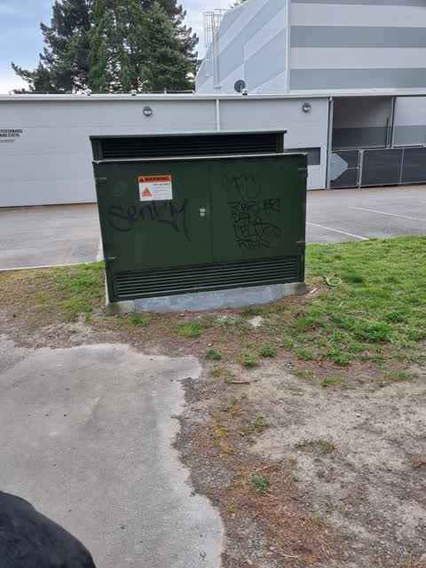
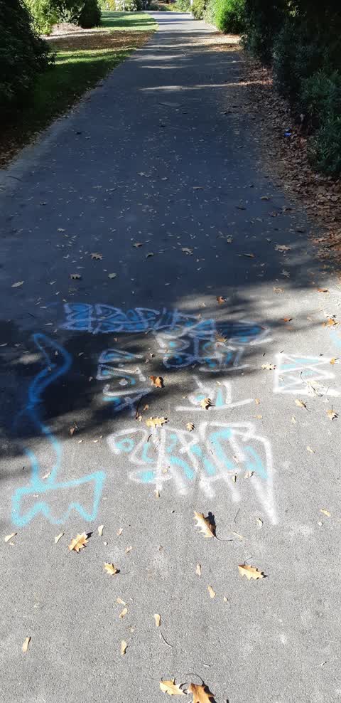
Reported here
 Graffiti on a fence, building or structure —
  Park - General Request —
 Lights aren't working on the path through jellie park.
 Graffiti on a playground or in a park —
 Repeat near last post of MANDO disc golf sign - bench by lake and nearby lampost also tagged
 Graffiti on a playground or in a park —
 Graffiti on disc golf MANDO sign near lake, opposite side to pool
 Trees - General —
 Covering footpath branch has snapped off and broken the branches underneath it been like this for 2 weeks still a hazard as branchs can snap
 Park - General Request —
 Large branches fallen and partially blocking path
 Park - General Request —
 Fallen tree blocking path and yet to fully fully detach. Could hurt someone if walking by
 Fallen Tree —
 In Jellie Park. Fallen over path.
- Animal - General —
- Pavement - General —
 Graffiti —
 Tree tagged - blue paint, Jellie Park, by stream
 Graffiti —
 Large blue tag on footpath, adjacent to stream near lake in Jellie Park
 Graffiti —
  Graffiti —
 left path has the tag
Also reported on Truman Road
- 19A Truman Road — 16 reports
- 49 Truman Road — 10 reports
- 19 Truman Road — 7 reports
- 25 Truman Road — 6 reports
- 27 Truman Road — 4 reports
- 55 Truman Road — 3 reports
- 39 Truman Road — 3 reports
- 23A Truman Road — 2 reports
The green nearby
- Jellie Park — you are in it · Sports ground · 13 ha
- Morley Reserve — 315 m to the edge
Parks within half a kilometre, measured to the boundary — the council’s open data.
On the doorstep
- Jellie Park Recreation and Sport Centre — 221 m away · Sports centres
- Lower Courts — 261 m away · Sports centres
- Laura Fergusson Brain Injury Trust — 324 m away · Hospital
Businesses within four hundred metres, measured at the pin — OpenStreetMap and the council directories.
The bus nearby
- Burnside High School — 240 m away · the Orbiter (anticlockwise)
- Burnside High School — 240 m away · the Orbiter (clockwise)
The closest Metro stops, within four hundred and fifty metres.
The tracks through here
- Walk and bike track through Burnside — 6 m to the line · walk · bike
- Walk and bike track through Burnside — 118 m to the line · walk · bike
- Walk and bike track through Burnside — 173 m to the line · walk · bike
- Walk and bike track through Burnside — 212 m to the line · walk · bike
- Walk and bike track through Burnside — 227 m to the line · walk · bike
Tracks whose line passes within half a kilometre, measured to the line itself — the council’s open data.
The named ground
Named water within 500 m of this address, measured to the line or the edge; the council’s own structure register — bridges, boardwalks and steps standing nearby — the open map’s record.
The remembered names nearby
- Jellie Park plaque — 34 m away
Inscribed plaques within two hundred and fifty metres — the register’s pins, not surveyed spots. The whole roll is at /plaques.
Renting nearby
new bonds in Burnside ran about $641 a week — $91 above the city median of $550 — the suburb page keeps the rent record →.
The civic layer
This ground votes in Fendalton ward — the Fendalton-Waimairi-Harewood community board. Ward lines don’t always follow suburb lines; this one is measured at the pin, not the suburb’s centre.
What stood on this ground → · On the map → · From the air — the Crown’s aerials back to 1936; search the address on RetroLens →
Questions, answered briefly
14 council reports on record since April 2021 — most often graffiti (4), park - general request (3), graffiti on a playground or in a park (2).
Burnside, Christchurch — on Truman Road.
Nothing on the heritage register at this exact spot — the record around this ground →
Jellie Park — the address is inside it, 13 ha.