The Church Pub
The Church Pub is a bar or pub in Christchurch Central City.
Checked 23 Oct 2026
Central-city pub inside the former Trinity Congregational Church, a Highly Significant heritage listing, open daily from 11 am, with veranda seating: read from the public record
Sits inside Former Trinity Congregational Church and Setting, highly significant in the District Plan · Has a Wikipedia entry
One of 96 bars & pubs in Christchurch Central City, 37% of the city’s count
Opening hours
| Monday – Sunday | 11 am to midnight |
|---|
Hours change, especially over holidays: confirm with the business before a special trip. About 91 hours a week, by the map’s count.
From its website and public pages
Read from the site itself 2 Oct 2026, Its own website.
Reviews
Getting there
The map loads only when you ask for it.
Straight-line distances from the pin, not walking routes.
Nearby
More nearby places 5
Environment Canterbury’s Canterbury Maps Parks layer, refreshed 2026-10-10. Distances are straight-line from the business pin, not walking routes.
The nearest other bars & pubs
More nearby bars & pubs 5
All 96 bars & pubs in Christchurch Central City → · Every one in the city →
Also in Christchurch Central City
More businesses in Christchurch Central City 7
What the record holds 9 sourced facts
What the record holds
| Fact | What the source says | Source |
|---|---|---|
| Kind | Bars & pubs | OpenStreetMap |
| Phone | +64 3 595 1533 | OpenStreetMap |
| Website | churchpub.co.nz | OpenStreetMap · its own site agrees |
| info@churchpub.co.nz | Its own website | |
| Menu | churchpub.co.nz | OpenStreetMap · its own site agrees |
| Social | OpenStreetMap | |
| Wheelchair | Not wheelchair accessible | OpenStreetMap |
| Payment | Credit cards, Debit cards | OpenStreetMap |
| Encyclopaedia | Trinity Congregational Church, Christchurch, Wikipedia | Wikidata |
Is this your business? Send hours, menu or photos, free and this page updates.
The ground it stands on
| Fact | What the source says | Source |
|---|---|---|
| District Plan zone | City centre zone | District Plan |
| Heritage item | Former Trinity Congregational Church and Setting (Heritage NZ category 1), highly significant in the District Plan | District Plan |
| Consent CRC172154 | Hazardous Storage, held by Crown Infrastructure Delivery Limited, to 31 Dec 2027, 20 m from the pin | ECan consents |
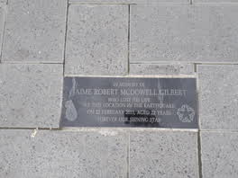 In Memory of / Jaime Robert McDowell Gilbert
 Godley Statue Reserve plaque
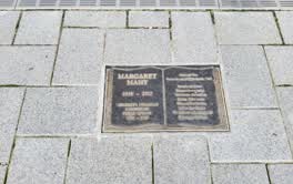 Godley Statue Reserve plaque
The reports nearby
6,448 council reports pinned within 250 m of the premises, most often Graffiti & vandalism and Roads & footpaths, 5,359 with a photograph. A pin is where a reporter stood, not a claim about the place itself.
The 6,448 reports on file
 Facility - General Request
 Graffiti on a fence, building or structure
 Graffiti on a fence, building or structure
 Trees - General
 Park - General Request
 Graffiti on a bus stop or public toilet
 Graffiti on a fence, building or structure
 Graffiti on a fence, building or structure
 Graffiti on a fence, building or structure
 Graffiti on a fence, building or structure
 Graffiti on a fence, building or structure
 Graffiti on a fence, building or structure
Questions, answered briefly
Read answers 8
A bar or pub in Christchurch Central City, Christchurch.
Somewhere in Christchurch Central City, the record holds no street address. On the map →
On OpenStreetMap.
phone 03 595 1533, its website, email info@churchpub.co.nz (its own website).
Monday – Sunday: 11 am to midnight, as mapped on OpenStreetMap.
The Church Pub And Paddy McNaughton's (5 m), Paddy McNaughton's (15 m), Knight Wine Bar (78 m), every one in the city.
6 other premises within a short walk, nearest The Church Pub And Paddy McNaughton's (5 m); the Manchester St Super Stop bus stop is 22 m away: routes 1, 5, 7, 8, 27, 29, 44, 86, 91, 92, 95; a shared path passes the door; nearest park: Cathedral Square (168 m).
The record behind this
This page is the union of what these public sources say, each fact above names the one it came from. A listing is a lead, not a promise the business still trades:
Sources: OpenStreetMap · Christchurch District Plan layers · Christchurch City Council off-street parking layer (CC BY 4.0) · Environment Canterbury’s active resource consents · Wikidata · Environment Canterbury’s Metro stop record · Christchurch City Council’s cycleway layer · The business’s own website
Read source notes 8
- OpenStreetMap, named premises drawn and kept current by its contributors (ODbL)
- Christchurch District Plan layers, zones, commercial centres and scheduled heritage items, from the council’s open data (CC BY 4.0)
- Christchurch City Council off-street parking layer (CC BY 4.0),
- Environment Canterbury’s active resource consents, recorded where the consented activity happens (CC BY 4.0)
- Wikidata, the item an OpenStreetMap mapper linked the premises to (CC0)
- Environment Canterbury’s Metro stop record, distances measured here from the pin
- Christchurch City Council’s cycleway layer, lanes, separated paths and the named Major Cycle Routes (CC BY 4.0)
- The business’s own website, read politely by chch.live for contact details the open record is missing, re-checked monthly
Map data © OpenStreetMap contributors (ODbL); council and ECan data under CC BY 4.0; Wikidata CC0. Something wrong? Fix it on OpenStreetMap or tell us. The whole directory lives at /businesses. This page as markdown: /business/the-church-pub-christchurch-central-city.md.