
Christchurch Central City, Christchurch
73,250 council reports since May 2015, the 1st busiest suburb in the city. 60,813 photographs on record. 9,180 people at the 2023 Census, 1,434 to the square kilometre across 6.4 km².
The record also holds about $508 a week to rent· 2023 Census snapshot· 60,813 photographs· 189 old photographs· 4 schools· 35 parks· 10 civic facilities· 18 places of worship· 1 marae· 30 tracks· 58 names on the map· 47.3% of the outline mapped liquefied· 0.6% of the outline in the red zone· graded mostly TC3 in 2011· the record drew water over 23% of the outline· the Ngāi Tahu schedule covers 7% of the outline· ecological sites over 3% of the outline· landscape schedules over 4% of the outline· noise overlays over 97% of the outline· setback strips over 11% of the outline· 15% of the outline inside the plan’s density overlays· 9,501 SCIRT photographs filed on this ground· 62.3 km of cycleway crosses the outline· 431 remembered names on this ground· 31 drawn rules bind this ground· 82 parcels on the dangerous-work register· 118 parcels of made ground· 28 parcels with a cleanup on file· the 2019 model grades this ground mostly medium· 173 council structures on the register· 160 recreation register records· 12,454 trees on the register· the plan’s word on this ground· 8% of the outline reserved· the plan’s exceptions touch 9% of the outline· 188 places on the heritage schedule· 13 epicentres inside the outline· 1,743 injury crashes· 14,599 recorded victimisations· 76 bus stops· 1,537 businesses· the council’s fix times· alcohol bans over most of the outline· 3 written pieces· 185 heritage places· 40 documents· 5 mentions on the wire
Live source links
Link-outs to the source’s own live pages, chch.live does not copy their live values or source text.
Living here rent · the ground · the day-to-day
$508/week
middle half $438–$558
New bonds here ran at about $508 a week in the April–June 2026 quarter, the middle half of them between $438 and $558, across 348 bonds lodged, up 1% on a year ago. That’s about $42 a week below the city’s own quarter median of $550. Tenancy Services counts these under the Christchurch Central-West, Christchurch Central-North, Christchurch Central, Christchurch Central-East and Christchurch Central-South areas combined, approximately this suburb.
By dwelling type and bedrooms, April–June 2026 quarter
- 1-bedroom house, $502 a week · 195 new bonds
- 2-bedroom apartment, $523 a week · 39 new bonds
- 2-bedroom house, $523 a week · 18 new bonds
- 1-bedroom apartment, $401 a week · 15 new bonds
- 1-bedroom flat/unit, $225 a week · 15 new bonds
- 3-bedroom house, $605 a week · 6 new bonds
Median and quartiles of weekly rents on new private bonds, by quarter; suburb figures are a bond-weighted blend of the areas. New bonds are fresh lodgements, not the whole rental stock; under five bonds the rent is withheld, and counts are randomly rounded. Source: Tenancy Services rental bond data: provisional while the bond system migrates.
The ground: 1% of the outline went into the residential red zone; the February 2011 survey drew liquefaction over 47% of it, the rest of the watch is drawn further down.
Day to day it holds 4 schools, 35 parks, 10 civic facilities, 18 places of worship, 1 marae, 30 tracks and 76 bus stops, each is counted further down.
Lately the record’s mostly graffiti & vandalism, 9,190 reports in the year to 12 October 2026, the newest 11 October 2026.
One for the quiz, Its busiest day on record was 28 May 2021, 234 reports in a single day.
2023 Census snapshot SA1 areas grouped here
About 8,148 people and 3,861 occupied private households in the “Christchurch Central-South”, “Hagley Park”, “Christchurch Central”, “Christchurch Central-East”, “Christchurch Central-West” and “Christchurch Central-North” areas, grouped from 54 SA1 areas. Several statistical areas are combined here, so this is a grouped proxy rather than a count for one suburb boundary.
Stats NZ’s 2023 Census uses fixed random rounding to base 3. Unavailable or confidential cells are left out, not treated as zero. individuals · households · geography · CC BY 4.0.
About the suburb
Christchurch Central City or Christchurch City Centre is the geographical centre and the heart of Christchurch, New Zealand. It is defined as the area within the Four Avenues and thus includes the densely built up central city, some less dense surrounding areas of residential, educational and industrial usage, and green space including Hagley Park, the Christchurch Botanic Gardens and the Barbadoes Street Cemetery.
As reported 60,813 on record
The suburb, back then 189 in the archive
Placed by the record’s locality join or the name in its own title, a lead, not a claim each frame stood here.
The shape of it outline © OpenStreetMap · recent reports, pinned
The record on Christchurch Central City
- Christchurch Central City enters the written record on 1 January 1850, “Barbadoes St Cemetery: index to cemetery registers”, Canterbury Stories.
- “Christchurch Central City” appears somewhere in 299 of the archive’s records, title, description or body.
- A Papers Past search for the name surfaced 30 records, leads by provenance, not by phrase.
- The first report the feed ever carried here: other, 11 May 2015, at 60 Worcester Blvd.
- Its busiest day on record was 28 May 2021, 234 reports in a single day.
- The street that keeps coming up is Oxford Terrace, reported on 1,608 separate days.
- For elections the suburb’s centre falls inside Central ward, the Papanui-Innes-Central community board is its local layer. The whole roll is at /wards.
- On foot: The square and its ring and The boulevard and The river bend and The school’s own register and The city’s stones and Belfries and chapels and The old high street and The old university, a heritage walks over this ground.
Lately the newest reports

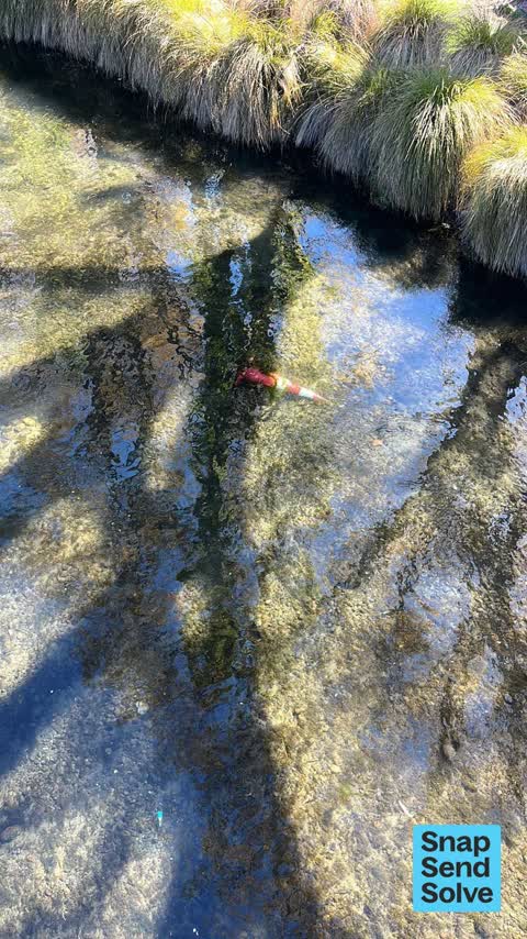
Dumped RubbishMadras St
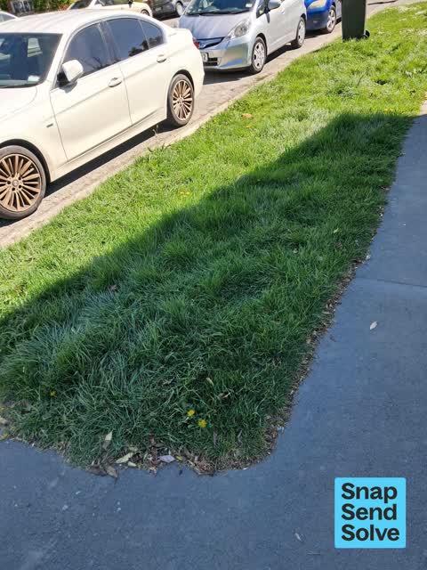

Pavement - General591 Colombo St
This has been brought to your attention with nothing done!!! How long do we have to have an adjacent bar store their bins on the footpath outside of our…


Reports per year down 26% 2024→2025
15
552
16
2.2K
17
2.2K
18
3.5K
19
4.6K
20
5.5K
21
6.8K
22
7.3K
23
10.1K
24
13.6K
25
10.1K
What gets reported
Streets that keep coming up each a street page
Every street the archive knows in Christchurch Central City →
Exactly what people say
How fast the council fixes things here 66,486 finished jobs on record
The median council work order pinned in Christchurch Central City took 47 hours to resolve, the city-wide median is 3 days, so this ground runs faster than the city as a whole. The slowest tenth waited 3 months or longer. 1,828 tickets are open here now, the oldest was filed 10 January 2019.
Work orders, not the resident reports above, the council’s MyCouncilTicket stream, and one job can appear in both. A median counts only finished jobs; open ones are named as open, never averaged in. The ticket roll · the whole city’s fix times.
Alcohol rules on this ground 2 ban zones reach in
Central City. A public drinking ban, at all times, 24 hours a day, seven days a week, covers most of Christchurch Central City.
Hagley Park and Environs. A public drinking ban, seven days a week from 10pm to 7am, covers about 34% of Christchurch Central City.
10 sensitive sites stand here, Ao Tawhiti Unlimited Discovery, Catholic Cathedral College, Christ's College, Christchurch Bus Interchange, Christchurch City Mission, Christchurch East School and more, and the Local Alcohol Policy restricts new off-licences within 50 m of them.
The council’s bylaw zones and the Local Alcohol Policy’s buffer list, read from the Regulatory open-data service. A ban rules drinking in public places; it says nothing about whether a premises may sell, that is the licence register’s job.
The suburb today
Schools here 4
- Christ's CollegeSecondary (Year 9-15) · private, not rated
 Christchurch East SchoolFull Primary · decile 3 · EQI 454
- St Michael's Church SchoolFull Primary · private, not rated
- Te Puna Wai o Waipapa - Hagley CollegeSecondary (Year 9-15) · decile 6 · EQI 468
Zoned for Christchurch Adventist School · Hillview Christian School · Marian College · Te Puna Wai o Waipapa - Hagley College · Addington Te Kura Taumatua (part) · Burnside High School (part) · and 12 more zones, the drawn zone is indicative; the Ministry’s written scheme is the legal boundary.
Decile and EQI describe the community a school draws from, not how well it teaches.
The green here 35
- Hagley Park NorthSports ground · 91 ha
- Hagley Park SouthSports ground · 71 ha
- Botanic GardensBotanic · 21 ha · playground, 53 pieces
- Little Hagley ParkBotanic · 7 ha
- Avon Riverbank Central City6 ha
- Barbadoes CemeteryBotanic · 3 ha
- Cranmer SquareBotanic · 2 ha
- Latimer SquareBotanic · 2 ha
The first eight of 35, Parks and reserves in the council’s open data, a park lands in the suburb its centre falls inside. The whole roll is at /parks.
The civic shelf 10
- AldersgateCar park · Car Park
- Armagh StreetCar park · Car Park
- Christchurch Hospital GroundsCar park · Car Park
- Re:start - Lichfield StreetCar park · Car Park
- Rolleston AvenueCar park · Car Park
- ScalesCar park · Car Park
- St AsaphCar park · Car Park
- TriangleCar park · Car Park
The first eight of 10, Libraries, halls, cemeteries and the rest in the council’s open data, a facility lands in the suburb its point or centre falls inside. The whole shelf is at /facilities.
Where the suburb worships 18
- Aldersgate / Puari Huingaa church
- Canterbury Hebrew Congregationa synagogue · 406 Durham Street North
- Christchurch Nurses Memorial Chapela church
- City Church Christchurcha Pentecostal church · 346 Manchester Street
- Durham Street Gospel Halla Brethren church · 375 Durham Street North
- Elim Church Christchurch Citya Pentecostal church · 285 Cashel Street
- Faith Family Outreach Centrea church · 9 Bangor Street
- Knox Churcha Presbyterian church · 28 Bealey Avenue
The first eight of 18, Places of worship in the open map’s record, one lands in the suburb its building stands in. The whole roll is at /worship.
The marae standing here 1
- Te Puna Wānakainstitutional whare · wharenui Te Mātauranga Māori · Coventry Street
Marae in the region’s roll, a marae stands where it stands; the join names the suburb the roll files it under. The whole roll is at /maraes.
The tracks through here 30
- Walk and bike track through Christchurch Central City6.6 km · Christchurch · walk · bike
- Walk and bike track through Christchurch Central City2.6 km · Christchurch · walk · bike
- Walk and bike track through Christchurch Central City2.2 km · Christchurch · walk · bike
- Walk and bike track through Christchurch Central City2.1 km · Christchurch · walk · bike
- Walk and bike track through Christchurch Central City2.0 km · Christchurch · walk · bike
- Walk and bike track through Christchurch Central City1.9 km · Christchurch · walk · bike
- Walk and bike track through Christchurch Central City1.9 km · Christchurch · walk · bike
- Walk and bike track through Christchurch Central City1.3 km · Christchurch · walk · bike
The first eight of 30, Tracks in the council’s open data, a line belongs to every suburb it passes through. The whole network is at /tracks.
The names on this ground 58
The February 2011 survey drew mapped ground failure over 47.3% of this outline, about 303 hectares. A patch is a footprint, not a finding about an address; the count for the whole city is at /liquefaction.
The Crown’s 2011 classification drew 0.6% of this outline inside the residential red zone. A mapped area files under the suburb its middle sits in, and a classification is the record of a decision, not a finding about an address; the whole line is drawn at /redzone.
The 2011 grading filed 7.6% of this outline, about 49 hectares, mostly TC3, with TC3 39 ha · TC2 9 ha. A graded area files under the suburb its middle sits in, and a category is a verdict for a patch of ground, not a finding about an address; the grades are drawn at /technical-categories.
The flood record drew water over 23.2% of this outline, about 149 hectares, across 1 named event. A patch is one event’s observation, not a live hazard finding; the whole record is drawn at /floods.
82 parcels inside this outline sit on the hazardous-activities register, mostly chemical manufacture, application and bulk storage, vehicle refuelling, service and repair, cemeteries and waste recycling, treatment and disposal, 34 still doing the work. A listing records the work, not a soil test; the whole register is drawn at /hazards.
The files record 118 parcels of made or characterised ground inside this outline, about 19 hectares, mostly mixed fill with rubbish, peat, sand, 20 carry fill the file can’t vouch for. A record is the file’s word on what was laid, not a fresh survey; the whole layer is drawn at /fill.
28 parcels inside this outline carry a cleanup on the file, 8 marked verified. A cleanup on the file is the register’s word, not a clearance; the whole register is drawn at /remediated.
The 2019 liquefaction study put 67% of this outline in the medium class, and 9 assessed areas here carry the free-face flag for possible lateral spreading. A class is the model’s verdict on a patch of ground, not a finding about an address; the whole study is drawn at /vulnerability.
The council’s structure register stands 173 assets on this ground, 74 sets of steps, 26 boardwalks, 24 bridges, 20 shelters, sited at Botanic Gardens, Avon Riverbank Central City, Rauora Park, Hagley Park North. The register’s site names are its own labels for the ground an asset stands in; the layer is drawn at the map.
The recreation register keeps 160 records inside this outline, bookable surfaces for 35 netball, 22 cricket, 22 softball, 19 football. Seasons and surfaces are the register’s record, not this week’s draw; the layer is drawn at the map.
The register counts 12,454 living trees inside this outline, 584 veterans among them, 596 carrying a protection, mostly English Oak, Common Lime, Kowhai. The file remembers 3,889 trees felled here. A tree record is the register’s word on what stands or stood; the whole canopy is drawn at /trees.
The plan files 31% of this outline under Open Space Community Parks, 16% residential, the rest mostly Central City Mixed Use Zone 15%, Transport 14%. A zone is a permission, not a description, the mix is read from a sampled join of the plan’s polygons; the whole district is drawn at /zones.
The plan reserves about 52 hectares of this outline, 8%, under 15 designations, mostly other, learning, movement. A designation is a claim on the ground, not a build date, the mix is read from a sampled join; the whole register is drawn at /designations.
The plan’s exceptions touch 9% of this outline, 32 qualifying matters, mostly heritage, section 6. A matter narrows how the density rule applies, it does not forbid; the mix is read from a sampled join, and the cultural-significance areas are the plan’s own unnamed ones. The whole register is drawn at /matters.
The plan’s heritage schedule protects 188 places by name in this suburb, 105 graded highly significant, Antigua Boatsheds and Setting, Armagh Street Bridge and Setting, Armagh Street Kerbstones and Setting among them. And the street itself is listed, the Chester Street East / Dawson Street, Inner City West heritage areas lie here, protected as a street rather than house by house. A setting is the ground the item stands in, each files under the suburb holding its centroid; the whole schedule is at /heritage.
The plan’s schedule of sites significant to Ngāi Tahu covers 7% of this outline, about 47 hectares, ngā tūranga tūpuna, ngā wai. Shares read from a sampled join; a recognition overlay, not a catalogue. The whole schedule is drawn at /cultural.
The plan’s ecological schedules cover 3% of this outline, about 18 hectares across 2 scheduled sites, all protected under Schedule A. Shares read from a sampled join; a recognition overlay, not a survey. The whole ledger is drawn at /ecology.
The plan’s landscape schedules cover 4% of this outline, about 27 hectares across 2 scheduled areas. Shares read from a sampled join; a protection overlay, not a ranking of views. The kept view is drawn at /landscape.
No high-hazard flood area covers this outline. The broader flood-management watch covers 36% of it, Bells Creek, Avon River. Shares read from a sampled join; a model’s map, not a promise. The waiting water is drawn at /flood-hazard.
The plan’s noise overlays cover 97% of this outline, about 620 hectares across 10 mapped overlays, 4% inside a loud entertainment precinct, 11% inside a noise-insulation zone, and inside the airport’s bird-strike buffer. Shares read from a sampled join; a planning line, not a meter’s reading. The quiet lines are drawn at /noise.
The plan’s water-margin layers cross this outline, 33 classified reaches, the plan calling Avon River and Manchester Street Drain by name, 11% of it inside the setback strips, the widest holding 30 m off the bank, and an esplanade line holds a public edge here. The margin is the plan’s drawing, not a survey of the bank; the reaches, strips and held edges are mapped at /water-margin.
The plan’s allowed shape holds this outline, 15% of it inside the residential overlays, the densest standing Central City, the centre’s ceiling here is 39 m, inside the central city’s walking catchment. The shape is the plan’s permission, not a survey of what stands; the allowed shape is drawn at /density.
The rebuild’s cameras filed 9,501 photographs on this ground, 2007–2017, stormwater work mostly. Each frame is a receipt the dig left behind, a work log, not a survey of what stands now; the whole record is drawn at /rebuild.
The pedal network threads this ground, 62.3 km of cycleway crosses the outline, 8.5 km of it separated from the traffic, City to Sea Pathway, Heathcote Expressway, Little River Link, Papanui Parallel, Quarryman's Trail, Rapanui Shag Rock, South Express, Te Ara Ōtākaro Avon River Trail, Uni-Cycle. A segment counts under every suburb its path enters; the whole network is drawn at /cycleways.
The remembered names stand on this ground, 431 inscribed plaques, Botanic Gardens, Hagley Park North, Victoria Square among the grounds. The plaque is the register’s pin, not a surveyed spot; the whole roll is kept at /plaques.
The rulebook binds this ground, 31 drawn instruments, 9 of them dog rules, 6 alcohol bans, 1 camping zone, a certified self-contained van can stay the night at Christchurch Urban Restricted Area, 15 bottle-store buffers; the outline sits inside the takiwā of Te Ngai Tuahuriri Runanga. The bylaw is the instrument, this the map of it, the whole rulebook is drawn at /rules.
GeoNet’s catalogue puts 13 magnitude-3+ epicentres inside this outline since the sequence opened, the biggest a M4.6 in 2010. An epicentre is where the instruments placed the break, not a measure of the shaking here; the whole catalogue is counted at /sequence, the live record is /quakes, and the story in plain language is the earthquakes explainer.
- Bathing Figureartwork
- Chaliceartwork · Neil Dawson
- Chapman's Homerartwork · Michael Parekowhai
- Corgis on Highartwork
- Dahliasartwork · Andrew Veitch
- Diminish and Ascendartwork · David McCracken
- Falling in loveartwork · Mackenzi Thorpe
- Flour Powerartwork · Regan Gentry
- Free Flightartwork · Paul Dibble
- Inner Struggleartwork · Richard Taylor & Weta Workshop
- James Edward Fitzgeraldartwork
- John Robert Godleyartwork
- Mary, Blessed Motherartwork
- No Place Like Homeartwork · Flox
- Nucleusartwork · Phil Price
The named waterways, bays, headlands, monuments, summits and old sites OpenStreetMap puts inside this outline, a pin is the mapper’s own; a waterway belongs to every suburb it crosses. Every roll, counted: /geography.
The crash record 1,743 injury crashes
1,743 crashes that hurt somebody on record inside Christchurch Central City's outline, 14 people killed, 280 seriously hurt.
The corner that keeps appearing: Bealey Avenue at Barbadoes Street, 35 injury crashes.
The crime record 14,599 recorded victimisations
14,599 victimisations on the Police record inside Christchurch Central City’s outline, September 2022–August 2026, mostly theft, about 448 a year per 1,000 residents. Up 2% on the year before. Reported is not all, how much never reaches the record depends on the offence.
The buses through it 76 stops
76 Metro stops inside Christchurch Central City's outline, in ECan’s stop record, served by route 5, route 7, route 8, route 1, route 80, route 3, route 95, route 44, route 60, route 27, route 29, route 86, route 84, route 85, route 81, route 91, route 92.
- Ara Institute
- Bealey Ave
- Bealey Ave near Colombo St
- Bealey Ave near Colombo St
- Bealey Ave near Madras St near Bealey Ave
- Bealey Ave near Madras St near Bealey Ave
- Bealey Ave near Manchester St
- Bealey Ave near Victoria Street
- Bus Interchange (Intercity stop)
- Bus Interchange (Platform A)
- Bus Interchange (Platform B)
- Bus Interchange (Platform C)
- Bus Interchange (Platform D)
- Christchurch Hospital Main Stop EB
- Christchurch Hospital Main Stop WB
- Colombo St near Salisbury St near Colombo St
Businesses here 1,537 in the directory
1,537 premises in Christchurch Central City across 152 kinds, from OpenStreetMap, the council’s licensed-premises register and its 2024 Find Christchurch directory. Each kind below opens at this suburb’s shelf.
- Restaurants265
- Fast food150
- Cafés148
- Bars & pubs96
- Clothing65
- Attractions45
- Hotels44
- Motels36
- Delis23
- Car dealers20
- Hairdressers20
- Venues & events19
- Dairies & convenience18
- Doctors & clinics17
- Hostels16
- Shoes16
- Bottle stores14
- Cinemas & theatres13
- Gift shops13
- Gyms & fitness13
- Car repair12
- Galleries12
- Beauty11
- Clubs11
- Supermarkets11
- Company10
- Bakeries9
- Markets9
- Recruitment9
- Dentists8
- Arcades6
- Food courts6
- Jewellery6
- Phone shops6
- Architects5
- Banks5
- Government5
- Hospital5
- Lawyers5
- Malls5
- Museums5
- Pharmacies5
- Sports centres5
- Bookshops4
- Coffee roasters4
- Craft4
- Electrical4
- Op shops4
- Travel agents4
- Car washes3
- Florists3
- Hifi3
- Ice cream3
- Insurance3
- IT & software3
- Opticians3
- Outdoor gear3
- Sports shops3
- Tyre shops3
- Apartments2
- Appliance2
- ATMs2
- B&Bs2
- Bike shops2
- Caterers2
- Centre2
- Consulting2
- Cosmetics2
- Coworking spaces2
- Department stores2
- Diplomatic2
- Education & tutoring2
- Electronics2
- Furniture2
- Guest houses2
- Houseware2
- Laundromats2
- Music2
- Ngo2
- Party2
- Petrol stations2
- Photographers2
- Physio2
- Post offices2
- Research2
- Sweets & snacks2
- Tailors2
- Tattoo & piercing2
- University2
- Variety Store2
- Alternative1
- Arts Centre1
- Audiologists1
- Bbq1
- Breweries1
- Butchers1
- Canoe Hire1
- Car parts1
- Carpenters1
- Childcare1
- Clinic1
- Computers1
- Construction Company1
- Counsellors & psychologists1
- Department1
- E Cigarette1
- Engineers1
- Erotic1
- Escape rooms1
- Fabric1
- Fruit & veg1
- Fudge1
- Garden centres1
- Glaziery1
- Golf courses1
- Hardware1
- Hospital1
- Interior Decoration1
- Jetski1
- Jewellers1
- Kitchen1
- Laboratory1
- Lighting1
- Marketplace1
- Military Surplus1
- Motorcycle shops1
- Musical Instrument1
- Optometrists1
- Paint1
- Pastry1
- Pawnbroker1
- Pet Grooming1
- Photographic Laboratory1
- Printer Ink1
- Quango1
- Real estate1
- Religion1
- Repair1
- Seafood1
- Sportswear1
- Stationery1
- Surveyors1
- Tea1
- Ticket1
- Tobacco1
- Tool Hire1
- Townhall1
- Toy shops1
- Vets1
- Video1
- Wineries1
- Wool1
Among them, the ones the record says most about:
Before any of that
Written and sourced
The exhibition the square didn't get
In January 1882 two promoters asked the city council for Cranmer Square, buildings and all. By April the exhibition had opened — in Hagley Park.
The cemetery the records kept
Its burial registers open in April 1851 and run into the 1970s — the founding dead of Christchurch kept in three volumes, nine plans, and a book of receipts.
The Queen on the square
How Canterbury’s jubilee memorial became a statue of Queen Victoria — argued over, under-subscribed, and unveiled by the mayor’s wife.
On the register here
- 129 High Street1/129 High Street
- 158 High StreetG01/158 High Street
- 159 Manchester Street159 Manchester Street
- 167 Hereford Street167 Hereford Street
- 319 St Asaph Street319 St Asaph Street
- Antigua Boatsheds and Setting2 Cambridge Terrace
- Armagh Street Bridge and Setting
- Armagh Street Kerbstones and Setting280A Durham Street North
- Bandsmen's Memorial Rotunda and Setting
- Bangor Street No. 3 Pumphouse and Setting
- Barbadoes Street Cemetery and Setting
- Biology and Observatory Block and Setting7 Hereford Street
- Bowker Fountain and Setting
- Bridge of Remembrance and Setting88 Cambridge Terrace
- Canterbury Club and Setting129 Cambridge Terrace
- Canterbury Club Gas Lamp and Setting
- Canterbury Club Hitching Post and Setting
- Canterbury Museum Centennial Wing Facade
- Canterbury Museum Roger Duff Wing Facade
- Canterbury Provincial Council Buildings280 Durham Street North
- Canterbury Provincial Council Buildings Courtyard/Grounds280 Durham Street North
- Canterbury Provincial Council Buildings Former Land Transfer Office86 Armagh Street
- Canturbery Museum and Setting11 Rolleston Avenue
- Captain James Cook Statue and Setting89 Armagh Street
- Captain Robert Falcon Scott Statue and Setting153 Oxford Terrace
- Carlton Bridge
- Cathedral Square and Setting
- Chemistry Building and Setting3/5 Hereford Street
- Christ's College Administration Building and Setting33Q Rolleston Avenue
- Christ's College Chapel and Setting33G Rolleston Avenue
- Christ's College Dining Hall Tower and Hospital and Setting33 Rolleston Avenue
- Christ's College Former Big School and Setting33R Rolleston Avenue
- Christ's College Former Condell's House and Setting33U Rolleston Avenue
- Christ's College Former Hare Memorial Library and Classrooms and Setting33H Rolleston Avenue
- Christ's College Former New Classrooms and Setting33 Rolleston Avenue
- Christ's College Jacobs House and Setting33K Rolleston Avenue
- Christ's College Main Quadrangle and Setting
- Christ's College Memorial Dining Hall and Setting33J Rolleston Avenue
- Christ's College Open Air Classrooms and Setting33I Rolleston Avenue
- Christ's College School House and Setting33A Rolleston Avenue
- Christchurch Boys' High School and Setting
- Christchurch Boys' High School Gymnasium and Setting2B Worcester Street
- ChristChurch Cathedral and Setting100 Cathedral Square
- Christchurch Club and Setting154 Worcester Street
- Citizens' War Memorial and Setting99 Cathedral Square
- Classics Building and Setting50 Rolleston Avenue
- Clock Tower Block and Setting2 Worcester Street
- College Hall and Setting50 Rolleston Avenue
- Colombo Street Bridge and Setting
- Colonial Motor Company Garage and Setting201 St Asaph Street
- Commercial Building and Setting228 Kilmore Street
- Commercial Building and Setting65 Cambridge Terrace
- Commercial Building and Setting225 High Street
- Commercial Building and Setting, Former C F Cotter and Company101/158 High Street
- Commercial Building and Setting, Former Chief Post Office1 Cathedral Square
- Commercial Building and Setting, Former Cook and Ross201/779 Colombo Street
- Commercial Building and Setting, Former Sargood Son and Ewen92 Lichfield Street
- Commercial Building and Setting, Former State Insurance58/28 Cathedral Square
- Commercial Building and Setting, Former W. Williamson Construction Company181 Montreal Street
- Commercial Building and Setting, Former Wellington Woollen Mills Manufacturing Company96 Lichfield Street
- Commercial Building and Setting, Lawrie and Wilson Auctioneers210 Tuam Street
- Commercial Building and Setting. Duncan's Buildings147 High Street
- Commercial Building Façade and Setting201 High Street
- Commercial Building Façade and Setting, Former A J Whites181 High Street
- Commercial Building Façade and Setting, Former A W Smith and Son's Central Garage/Mayfair-Cinerama Theatre115A Worcester Street
- Cranmer Square and Setting1P Cranmer Square
- Cricket Pavilion and Setting
- Cuningham House and Setting7 Riccarton Avenue
- Curator's House and Setting5 Rolleston Avenue
- Digby's Commercial School/Worcester Chambers and Setting69 Worcester Street
- Dwelling and Setting56 Armagh Street
- Dwelling and Setting18 Beveridge Street
- Dwelling and Setting361 Cambridge Terrace
- Dwelling and Setting38 Cranmer Square
- Dwelling and Setting250 Kilmore Street
- Dwelling and Setting311 Montreal Street
- Dwelling and Setting402 Montreal Street
- Dwelling and Setting404 Montreal Street
- Dwelling and Setting406 Montreal Street
- Dwelling and Setting2/408 Montreal Street
- Dwelling and Setting1/2 Beveridge Street
- Dwelling and Setting122 Park Terrace
- Dwelling and Setting15 Worcester Street
- Dwelling and Setting21 Worcester Street
- Dwelling and Setting229 Worcester Street
- Dwelling and Setting23 Cashel Street
- Dwelling and Setting
- Dwelling and Setting, Ironside House32 Salisbury Street
- Dwelling and Setting, Orari40 Gloucester Street
- Dwelling and Setting, Red House25 Armagh Street
- Dwelling/Commercial Building and Setting147 Fitzgerald Avenue
- Dwellings and Setting86 Chester Street East
- Dwellings and Setting100 Chester Street East
- Dwellings and Setting, Dorset Street Flats8 Dorset Street
- Dwellings and Setting, Maisonettes12 Bealey Avenue
- Dwellings and Setting, Mildenhall7/53 Gloucester Street
- Dwellings and Setting, West Avon Flats279 Montreal Street
- Edmonds Band Rotunda Area including Rotunda, Shelter, Balustrades, Landing and Lamp Standards and Setting230 Cambridge Terrace
- Edmonds Clock Tower, Telephone Cabinet and Setting295F Madras Street
- Electrical Engineering Extension, School of Engineering, and Setting15 Hereford Street
- Electrical Engineering Laboratory, School of Engineering, and Setting13 Hereford Street
- Façade and Setting, Former New Zealand Farmers’ Co-operative Association of Canterbury Ltd214 Cashel Street
- Fitzgerald Statue and Setting
- Floral Clock and Setting66 Chester Street West
- Former Beaths Department Store (components)201/690 Colombo Street
- Former Bishop's Chapel and Setting100 Park Terrace
- Former Boiler House and Setting175 Chester Street East
- Former Christchurch Teachers College and Setting
- Former Church of St Luke the Evangelist Bell Tower and Setting258 Manchester Street
- Former CSA / CoCA Gallery and Setting66 Gloucester Street
- Former Dwelling and Setting82 Bealey Avenue
- Former Dwelling and Setting14 Oxford Terrace
- Former Dwelling and Setting5 Worcester Street
- Former Dwelling and Setting17 Worcester Street
- Former Dwelling and Setting23 Worcester Street
- Former Dwelling and Setting95 Oxford Terrace
- Former Dwelling and Setting, Holly Lea/McLean's Mansion387 Manchester Street
- Former Dwelling and Setting, Inveresk17 Armagh Street
- Former Dwelling and Setting, Rolleston House2 Gloucester Street
- Former Dwellings and Setting, Santa Barbara169 Victoria Street
- Former Government Buildings and Setting26/28 Cathedral Square
- Former Grosvenor Hotel and Setting367 Moorhouse Avenue
- Former High Street Post Office and Setting209 Tuam Street
- Former Magistrates Court and Setting85 Armagh Street
- Former Market Place Bridge/Hamish Hay Bridge and Setting
- Former Maturing Cellars and Administration Offices and Setting294 Kilmore Street
- Former MED Converter Station and Substation102/210 Armagh Street
- Former Midland Club and Setting176 Oxford Terrace
- Former Municipal Chambers and Setting159 Oxford Terrace
- Former P & D Duncan Ltd Building and Setting7/204 St Asaph Street
- Former R. Buchanan & Sons' City Foundry and Setting2/210 St Asaph Street
- Former Shop/Dwelling and Setting40 Cranmer Square
- Former St Margaret's School Building and Setting25A Cranmer Square
- Former St Mary's Convent Chapel and Setting67/868 Colombo Street
- Former Trinity Congregational Church and Setting124 Worcester Street
- Former Tuam Street Hall and Setting214 Tuam Street
- Former Vicarage of the Church of St Luke the Evangelist and Setting185 Kilmore Street
- Former West Christchurch School/Hagley Community College and Setting510E Hagley Avenue
- Girls' High School/School of Art Block and Setting101/1 Hereford Street
- Gloucester Street Bridge and Setting
- Godley Statue, Godley Plot and Setting105 Cathedral Square
- Hagley Park
- Hagley Park Bridge and Setting
- Hereford Street Bridge71 Hereford Street
- Horse Watering Ramp and Setting
- Hydraulic Laboratory, School of Engineering, and Setting28 Worcester Street
- Jubilee Clock Tower and Setting95 Victoria Street
- K2 Telephone Box and Setting
- Knox Church28 Bealey Avenue
- Latimer Square and Setting
- Library and Setting13 Hereford Street
- Mechanical Laboratory, School of Engineering, and Setting
- Men's Common Room and Setting7 Hereford Street
- Mill Island and Setting71 Hereford Street
- Moorhouse Statue and Setting
- New Regent Street Shops and Setting17 New Regent Street
- North and South Quadrangles and Setting13 Hereford Street
- Nurses' Memorial Chapel and Setting2J Riccarton Avenue
- Physics Building and Setting7 Hereford Street
- Poplars, Lamp Standards and Setting
- Public Trust Building152 Oxford Terrace
- Queen Victoria Statue/Canterbury Jubilee Memorial and Setting
- Registry and Setting40 Worcester Street
- Rhododendron Island and Setting78 Cambridge Terrace
- Robert McDougall Art Gallery and Setting9 Rolleston Avenue
- Rolleston Statue and Setting
- Shands Emporium: Former Commercial Building217 Manchester Street
- St Luke's Chapel and Setting272 Hereford Street
- St Michael and All Angels Church Belfry and Setting90 Oxford Terrace
- St Michael's School Hall and Setting243 Durham Street South
- St Michael's School Stone Building and Setting
- St. Michael and All Angels Church & Setting90 Oxford Terrace
- Students' Union and Setting39 Hereford Street
- The Bricks Site, Cairn and Setting311 Oxford Terrace
- The Christchurch Town Hall and Setting
- Theatre Royal Façade, Dome, Staircase and Setting145 Gloucester Street
- Triangle Reserve and Setting291F High Street
- Triangle Reserve and Setting220F High Street
- Triangle Reserve and Setting215F High Street
- Triangle Reserve and Setting189F High Street
- Triangle Reserve and Setting261F High Street
- Triangle Reserve and Setting192F High Street
- Victoria Mansions and SettingF/91 Victoria Street
- West Lecture Block and Setting50 Rolleston Avenue
- Worcester Street Bridge and Setting
What is known
In the winter of 1869 the City Council fenced Cranmer Square — the works committee had fencing plans prepared in July, and the fortnightly works return at the end of August records men "erecting posts for fencing Cranmer Square".
CHRISTCHURCH CITY COUNCIL. (Star, 27 July 1869) · 1869-07-27T00:00:00.000Z, Cranmer Square and SettingIn January 1882 the promoters Joubert and Twopeny asked the City Council for the use of Cranmer Square to erect buildings for an international exhibition they planned to open that April.
THE INTERNATIONAL EXHIBITION. (Star, 14 January 1882) · 1882-01-14T00:00:00.000Z, Cranmer Square and SettingAt an informal council meeting on 13 January 1882, Twopeny said the promoters would sign a bond to give the square back "in exactly the same condition as it was before" and would not injure any of its trees; he asked for Cranmer rather than Latimer Square because money had just been spent laying Latimer out.
THE INTERNATIONAL EXHIBITION. (Star, 14 January 1882) · 1882-01-14T00:00:00.000Z, Cranmer Square and SettingThe exhibition never came to Cranmer Square. When it opened in April 1882 its buildings stood in Hagley Park, on the angle formed by the junction of the Riccarton and Lincoln roads.
THE INTERNATIONAL EXHIBITION AT CHRISTCHURCH. (Timaru Herald, 12 April 1882) · 1882-04-12T00:00:00.000Z, Cranmer Square and SettingBy the early 1900s the houses around Cranmer Square ran heavily as lodging and boarding houses — the Star's columns carry years of boarders wanted, rooms to let and servants sought addressed to numbers 2, 3, 10, 20, 22 and 30.
Page 6 Advertisements Column 1 (Star, 14 January 1905) · 1905-01-14T00:00:00.000Z, Cranmer Square and SettingIn July 1900 a memorial committee chaired by H. F. Wigram met in the city council chambers to decide how Canterbury’s fiftieth jubilee should be marked, weighing proposals that included completing the north transept of ChristChurch Cathedral and a jubilee home for incurable and chronic cases, before resolving to ballot members on the twenty-four schemes put forward.
THE JUBILEE MEMORIAL (Star, 24 July 1900) · 1900-07-24T00:00:00.000Z, Queen Victoria Statue/Canterbury Jubilee Memorial and SettingIn August 1900 the committee adopted a scheme by the mayor, William Reece: a stone obelisk surmounted by a seated bronze figure of Queen Victoria, its base carrying bas-relief groups for the pioneers, the province’s industries and the sending forth of soldiers to South Africa, with a bronze tablet recording the foundation of the province.
THE JUBILEE MEMORIAL (Star, 10 August 1900) · 1900-08-10T00:00:00.000Z, Queen Victoria Statue/Canterbury Jubilee Memorial and SettingAfter Queen Victoria’s death in January 1901 the committee decided the memorial would be a statue of the late Queen, and ordered it from England while subscriptions stood at about £816 of the £2,000 estimated cost.
JUBILEE MEMORIAL. (Star, 23 February 1901) · 1901-02-23T00:00:00.000Z, Queen Victoria Statue/Canterbury Jubilee Memorial and SettingThe public subscribed slowly: by April 1901 the committee was still about £600 short of the £2,000 estimate, the Ashburton Borough Council’s circulated list had gathered under twenty shillings, and a subscription list at the Farmers’ Co-operative Association had drawn a single shilling.
JUBILEE MEMORIAL. (Star, 13 April 1901) · 1901-04-13T00:00:00.000Z, Queen Victoria Statue/Canterbury Jubilee Memorial and SettingThe Duke of Cornwall and York laid the memorial’s foundation stone on 22 June 1901 during the royal visit to Christchurch — the only ceremony that day — with mayor A. E. G. Rhodes handing him the trowel.
THE ROYAL VISIT. ENTRY INTO CHRISTCHURCH. (Evening Post, 24 June 1901) · 1901-06-24T00:00:00.000Z, Queen Victoria Statue/Canterbury Jubilee Memorial and SettingThe memorial also stood as the province’s South African war memorial: its estimated cost covered the Queen’s statue and “the memorial to our soldiers who have fallen in South Africa”, and it was to carry the names of the Canterbury men who fell.
JUBILEE MEMORIAL. (Star, 13 April 1901) · 1901-04-13T00:00:00.000Z, Queen Victoria Statue/Canterbury Jubilee Memorial and SettingBy April 1903 the statue was in position in Victoria Square, and the committee decided not to wait for the contingent panels still expected from England about 10 June, planning the unveiling before 24 May.
Canterbury Jubilee Memorial. (Colonist, 22 April 1903) · 1903-04-22T00:00:00.000Z, Queen Victoria Statue/Canterbury Jubilee Memorial and SettingMrs Wigram, wife of mayor H. F. Wigram, unveiled the memorial in Victoria Square on Empire Day, 25 May 1903, before a large crowd; the statue faces Victoria Street from a high pedestal above a grassed mound.
EMPIRE DAY. (Star, 25 May 1903) · 1903-05-25T00:00:00.000Z, Queen Victoria Statue/Canterbury Jubilee Memorial and SettingThe subscription appeal ran in the Star week after week through March 1901, the committee publishing its running total — £911, then £939, £960, £1,007, £1,024, £1,032, £1,047 — as it inched toward the £2,000 estimate.
JUBILEE MEMORIAL. (Star, 02 March 1901) · 1901-03-02T00:00:00.000Z, Queen Victoria Statue/Canterbury Jubilee Memorial and SettingBarbadoes Street Cemetery's burial record runs in three Church of England registers: No. 1 from 9 April 1851 to 29 January 1870, No. 2 from 2 February 1870 to 3 September 1882, and No. 3 from 4 September 1882 into the 1970s.
Barbadoes Street Cemetery : alphabetical list of burials · 1851-01-01T00:00:00Z, Barbadoes Street Cemetery and SettingEach register entry records when the person was buried, their name and surname, age, sex, parents' or husband's name, rank or profession, place of residence, and who performed the ceremony.
Barbadoes St Cemetery, Church of England, Register no. 1 · 1851-04-09T00:00:00Z, Barbadoes Street Cemetery and SettingThe cemetery's ground was surveyed in nine historical plot plans, block by block — bordered by Barbadoes Street to the west and Cambridge Terrace to the south and east — and the plots are not consistently numbered; beside the lych-gate in block 3A, plot 780a is noted as apparently infant graves.
Barbadoes St Cemetery plan - area 1B · 1851-01-01T00:00:00Z, Barbadoes Street Cemetery and SettingThe plots were sold: a separate burial plots book keeps receipt numbers, purchasers' names, plot numbers and sizes, and amounts paid, and its later pages record deposits on part-purchased plots, the completed purchase, and when title was given.
Barbadoes Street. Burial plots book · 1872-07-01T00:00:00Z, Barbadoes Street Cemetery and SettingBy 1945 the cemetery sat inside a built-up city — a view across its headstones that year shows residential houses over the back fence — and by 1979 its graves and headstones were weathered, broken or fallen over; headstones still stood in the western portion in 2005.
Barbadoes Street Cemetery headstones · 1945-01-01T00:00:00Z, Barbadoes Street Cemetery and SettingDocuments 40
What the archive’s sources say about Christchurch Central City, titled for it, turned up by a search for one of its places, or carrying its name in the text. These are leads and citations: the originals live at the provider, linked from each row.
81850s
201860s
1081870s
1991880s
1441890s
5971900s
1221910s
1211920s
1601930s
891940s
481950s
621960s
2001970s
1181980s
841990s
5152000s
1,4892010s
1342020s
Barbadoes St Cemetery: index to cemetery registersCanterbury Stories · Christchurch City Libraries ·
Barbadoes Street Cemetery: alphabetical list of burialsCanterbury Stories · Christchurch City Libraries ·
Barbadoes St Cemetery, Church of England, Register no. 1Canterbury Stories · Christchurch City Libraries ·
HOUSE OF REPRESENTATIVES. (Daily Southern Cross, 18 July 1854)Daily Southern Cross · Papers Past · National Library of New Zealand · · text held
toCleanings of News. FROM ENGLISH PAPERS TO 16TH DECEMBER. (Colonist, 30 March 1858)Colonist · Papers Past · National Library of New Zealand · · text held
NEW ZEALAND PROVINCES. (Otago Witness, 18 June 1859)Otago Witness · Papers Past · National Library of New Zealand · · text held
The White Hart Hotel
Views of the White Hart Hotel on High Street in the central city. Two photographs showing the hotel at different times, the first being earlier. 1860 - 1900 Chri…1860 - 1900 Christchurch Star photographs · Canterbury Stories · Christchurch City Libraries ·
The rest are a search away, the whole shelf, for the name →
The wire on Christchurch Central City 5 lately
Greater Lady Beetles seen — Christchurch Central City, Christchurch, New ZealandiNaturalist · alekscz ·
Something seen — Riccarton Ave (Hospital), Christchurch Central City, Christchurch 8011, New ZealandiNaturalist · jacqueline_176 ·
Ileostylus micranthus seen — Riccarton Ave, Christchurch Central City, Christchurch 8011, Nieuw-ZeelandiNaturalist · jellep ·
Submetallic Ground Beetle seen — Riccarton Ave, Christchurch Central City, Christchurch 8011, Nieuw-ZeelandiNaturalist · jellep ·
5,221 more documents came up in searches for Christchurch Central City's places and have not been read yet, a lead is a search result, not a fact, until somebody reads it.
Next door
Compare Christchurch Central City with Sydenham · Edgeware · Waltham · Phillipstown · Richmond · Saint Albans, same record, side by side.
Questions, answered briefly
What is Christchurch Central City?
Christchurch Central City or Christchurch City Centre is the geographical centre and the heart of Christchurch, New Zealand. The public record holds 73,250 council reports for it, the first filed in May 2015.
How many people live in Christchurch Central City?
9,180 people at the 2023 Census, 1,434 per square kilometre across 6.4 km².
How many people does the 2023 Census count for Christchurch Central City?
About 8,148 people and 3,861 occupied private households (combined SA2s): grouped from Stats NZ SA1 areas through this site’s suburb join. Indicative, not a LIM.
What gets reported in Christchurch Central City?
73,250 reports on record, most often graffiti & vandalism (46,306), roads & footpaths (10,293), rubbish & dumping (4,859). 9,190 of them in the year to 12 October 2026.
How many crashes has Christchurch Central City had?
1,743 injury crashes on the police record inside the suburb’s outline, 14 people killed, 280 seriously hurt. The suburb’s crashes, mapped →
Did earthquakes strike under Christchurch Central City?
GeoNet’s catalogue puts 13 magnitude-3+ epicentres inside the suburb’s mapped outline since the September 2010 mainshock, the biggest a M4.6 in 2010. An epicentre is where the instruments placed the break, not a measure of the shaking felt here. The whole sequence, counted → · The story, in plain language →
Every suburb in Christchurch → · Its decade, charted → · the whole A–Z →