67 Barnes Road, Casebrook
22 reports on record since January 2021 · 12 with photographs. The street’s heaviest record is 65 Barnes Road — 53 reports on file. Indicative rating valuation and school zones, hazards, bin day and what stood here before.
What gets reported here
Photographed here 12 on record


Reported here
 Overgrown Vegetation —
 tree on other side of our fence is overgrown and needs to be pruned back heavily
 Overgrown Vegetation —
 The storm water retention pond located north side of roadway ( Barns Road) the pond has been maintained by CCC in the past.The surrounding v
 Facility - General Request —
 Bench seat damaged
 Graffiti somewhere else —
  Graffiti somewhere else —
  Overgrown Vegetation —
 The storm water retention pond in front of units @67 Barnes Road has over grown vegetation both in the pound and around its perimeter,both n
 Graffiti on a fence, building or structure —
  Graffiti on a fence, building or structure —
 Graffiti on aluminium cabinet plus on wall in gap off Barnes Reserve. On south side Needs to be painted over or removed Thanks
 Graffiti on a fence, building or structure —
 Graffiti on building that’s able to be accessed from Barnes Reserve. It’s on a private property. Maybe the council and property owner can pu
 Litter —
  Park - General Request —
 Dead tree at Barnes reserve opposite Aylsham reserve
- Dumped Rubbish —
- Dumped Rubbish —
- Dumped Rubbish —
- Trees - General —
- General Request —
- Park - General Request —
- Litter —
- Dumped Rubbish —
- Dumped Rubbish —
- Dumped Rubbish —
 Graffiti —
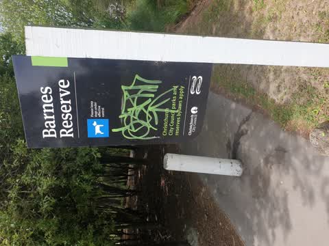
 Graffiti on sign
Also reported on Barnes Road
- 65 Barnes Road — 53 reports
- 49 Barnes Road — 10 reports
- 83 Barnes Road — 7 reports
- 87 Barnes Road — 5 reports
- 65–69 Barnes Road — 5 reports
- 75 Barnes Road — 4 reports
- 70 Barnes Road — 4 reports
- 63 Barnes Road — 3 reports
The street’s crash record
NZTA’s record names Barnes Road in 3 crashes that hurt somebody since 2006 — 1 seriously hurt, nobody killed.
The green nearby
- Barnes Reserve — 10 m to the edge · 2 ha
- Aylsham Reserve — 56 m to the edge
- Redwood Park — 213 m to the edge · Sports ground · 7 ha
- Cavendish Stream Landscape Reserve — 299 m to the edge
- Marlene Reserve — 302 m to the edge
Parks within half a kilometre, measured to the boundary — the council’s open data.
On the doorstep
- Redpath Electrical Supply — 136 m away · Electrical
- G. G. Don Plumbing, Roofing and Sheet Metal — 148 m away · Plumbers
- Kordia — 159 m away · Consulting
- Air Rescue and Community Services — 178 m away · Ngo
Businesses within four hundred metres, measured at the pin — OpenStreetMap and the council directories.
The bus nearby
- Regent's Park Dr near Primrose Hill Ln — 273 m away · route 27
- Regents Park Dr near Woodhurst Dr — 321 m away · route 27
The closest Metro stops, within four hundred and fifty metres.
The tracks through here
- Walk and bike track through Casebrook — 38 m to the line · walk · bike
- Walk and bike track through Casebrook — 56 m to the line · walk · bike
- Walk and bike track through Casebrook — 96 m to the line · walk · bike
- Walk and bike track through Casebrook — 118 m to the line · walk · bike
- Walk and bike track through Casebrook — 128 m to the line · walk · bike
Tracks whose line passes within half a kilometre, measured to the line itself — the council’s open data.
The named ground
Named water within 500 m of this address, measured to the line or the edge; Named places within 1.5 km of this address; the council’s own structure register — bridges, boardwalks and steps standing nearby — the open map’s record.
Renting nearby
new bonds in Casebrook ran about $598 a week — $48 above the city median of $550 — the suburb page keeps the rent record →.
The civic layer
This ground votes in Harewood ward — the Fendalton-Waimairi-Harewood community board. Ward lines don’t always follow suburb lines; this one is measured at the pin, not the suburb’s centre.
What stood on this ground → · On the map → · From the air — the Crown’s aerials back to 1936; search the address on RetroLens →
Questions, answered briefly
22 council reports on record since January 2021 — most often dumped rubbish (6), overgrown vegetation (3), graffiti on a fence, building or structure (3).
Casebrook, Christchurch — on Barnes Road.
Nothing on the heritage register at this exact spot — the record around this ground →
Barnes Reserve — 10 m to its edge, 2 ha.