Casebrook, Christchurch
2,974 council reports since June 2015, the 51st busiest suburb in the city. 2,326 photographs on record. 6,720 people at the 2023 Census, 1,953 to the square kilometre across 3.4 km².
The record also holds about $598 a week to rent· 2023 Census snapshot· 2,326 photographs· 1 school· 13 parks· 1 civic facility· 8 tracks· 4 names on the map· 7.4% of the outline mapped liquefied· graded mostly TC2 in 2011· the record drew water over 12% of the outline· ecological sites over 3% of the outline· landscape schedules over 4% of the outline· noise overlays over the whole outline· setback strips over 9% of the outline· 791 SCIRT photographs filed on this ground· 7.2 km of cycleway crosses the outline· 1 remembered name on this ground· 6 drawn rules bind this ground· 4 parcels on the dangerous-work register· 218 parcels of made ground· 4 parcels with a cleanup on file· the 2019 model grades this ground mostly possible· 37 council structures on the register· 19 recreation register records· 2,599 trees on the register· the plan’s word on this ground· 2% of the outline reserved· 75 injury crashes· 993 recorded victimisations· 32 bus stops· 39 businesses· the council’s fix times· 15 documents· 2 mentions on the wire
Live source links
Link-outs to the source’s own live pages, chch.live does not copy their live values or source text.
Living here rent · the ground · the day-to-day
$598/week
middle half $583–$697
New bonds here ran at about $598 a week in the April–June 2026 quarter, the middle half of them between $583 and $697, across 27 bonds lodged, down 8% on a year ago. That’s about $48 a week above the city’s own quarter median of $550. Tenancy Services counts these under the Casebrook and Regents Park areas combined, approximately this suburb.
By dwelling type and bedrooms, April–June 2026 quarter
- 1-bedroom house, $595 a week · 12 new bonds
- 3-bedroom house, $620 a week · 9 new bonds
Median and quartiles of weekly rents on new private bonds, by quarter; suburb figures are a bond-weighted blend of the areas. New bonds are fresh lodgements, not the whole rental stock; under five bonds the rent is withheld, and counts are randomly rounded. Source: Tenancy Services rental bond data: provisional while the bond system migrates.
The ground: the February 2011 survey drew liquefaction over 7% of it; the 2011 grading filed it mostly TC2, the rest of the watch is drawn further down.
Day to day it holds 1 school, 13 parks, 1 civic facility, 8 tracks and 32 bus stops, each is counted further down.
Lately the record’s mostly trees & parks, 620 reports in the year to 12 October 2026, the newest 11 October 2026.
One for the quiz, Its busiest day on record was 4 September 2026, 15 reports in a single day.
2023 Census snapshot SA1 areas grouped here
About 6,090 people and 2,382 occupied private households in the “Casebrook” and “Regents Park” areas, grouped from 36 SA1 areas. Several statistical areas are combined here, so this is a grouped proxy rather than a count for one suburb boundary.
More of the 2023 Census
- Born overseas21% of stated birthplace
- European ethnicity84% of ethnicity responses
- Māori ethnicity9% of ethnicity responses
- Pacific Peoples ethnicity3% of ethnicity responses
- Asian ethnicity12% of ethnicity responses
- Households with internet90% of stated households
- Households with two or more vehicles61% of stated households
Ethnicity is a multiple-response measure, so those percentages are not meant to add to 100%.
Stats NZ’s 2023 Census uses fixed random rounding to base 3. Unavailable or confidential cells are left out, not treated as zero. individuals · households · geography · CC BY 4.0.
About the suburb
Casebrook is a suburb on the northern side of Christchurch city.
As reported 2,326 on record
The shape of it outline © OpenStreetMap · recent reports, pinned
The record on Casebrook
- Casebrook enters the written record on 22 August 2000, “REGISTER”, New Zealand Gazette.
- “Casebrook” appears somewhere in 15 of the archive’s records, title, description or body.
- The first report the feed ever carried here: roading/streets, 10 June 2015, at 30.
- Its busiest day on record was 4 September 2026, 15 reports in a single day.
- The street that keeps coming up is Cavendish Road, reported on 249 separate days.
- For elections the suburb’s centre falls inside Harewood ward, the Fendalton-Waimairi-Harewood community board is its local layer. The whole roll is at /wards.
Lately the newest reports


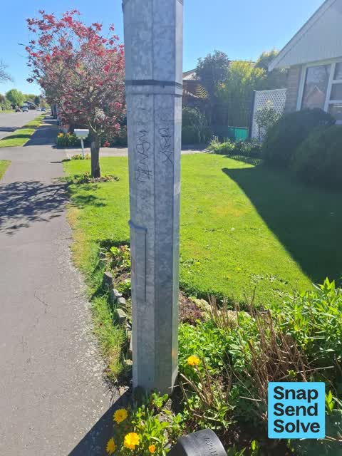
Overgrown Vegetation230 Highsted Rd
Walkway between John Paul Crescent and Highsted Road grass area has not had all its landscaping completed and is still fenced off at one end.


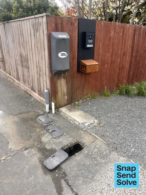
Water Leak11A Kimberley St
120A Highsted Road. Was on a private leak detection job. Customer was losing 0.8lPM. There is also a leak on the council connection. Request for meter…


Reports per year up 4% 2024→2025
15
27
16
34
17
57
18
69
19
149
20
190
21
190
22
287
23
437
24
519
25
539
What gets reported
Exactly what people say
How fast the council fixes things here 5,700 finished jobs on record
The median council work order pinned in Casebrook took 7 days to resolve, the city-wide median is 3 days, so this ground runs slower than the city as a whole. The slowest tenth waited 4 months or longer. 200 tickets are open here now, the oldest was filed 19 December 2018.
Work orders, not the resident reports above, the council’s MyCouncilTicket stream, and one job can appear in both. A median counts only finished jobs; open ones are named as open, never averaged in. The ticket roll · the whole city’s fix times.
Alcohol rules on this ground
One sensitive site stands here, Casebrook Intermediate, and the Local Alcohol Policy restricts new off-licences within 200 m of it.
The council’s bylaw zones and the Local Alcohol Policy’s buffer list, read from the Regulatory open-data service. A ban rules drinking in public places; it says nothing about whether a premises may sell, that is the licence register’s job.
The suburb today
Schools here 1
- Casebrook IntermediateIntermediate · decile 6 · EQI 466
Zoned for Casebrook Intermediate · Christchurch Adventist School · Emmanuel Christian School · Marian College · Middleton Grange School · Papanui High School · and 9 more zones, the drawn zone is indicative; the Ministry’s written scheme is the legal boundary.
Decile and EQI describe the community a school draws from, not how well it teaches.
The green here 13
- Tulett ParkSports ground · 8 ha · playground, 49 pieces
- Barnes Reserve2 ha
- Grampian Reserve1 ha · playground, 5 pieces
- Aylsham Reserveplayground, 8 pieces
- Sharnbrook Reserve
- Regents Park Reserve
- Larch Reserveplayground, 4 pieces
- Sisson Parkplayground, 2 pieces
The first eight of 13, Parks and reserves in the council’s open data, a park lands in the suburb its centre falls inside. The whole roll is at /parks.
The civic shelf 1
- Styx Mill Refuse StationTransfer station · Transfer Station / Recycling Centre
Libraries, halls, cemeteries and the rest in the council’s open data, a facility lands in the suburb its point or centre falls inside. The whole shelf is at /facilities.
The tracks through here 8
- Walk and bike track through Casebrook4.8 km · Christchurch · walk · bike
- Walk and bike track through Casebrook1.8 km · Christchurch · walk · bike
- Walk and bike track through Casebrook474 m · Christchurch · walk · bike
- Walk and bike track through Casebrook339 m · Christchurch · walk · bike
- Walk and bike track through Casebrook239 m · Christchurch · walk · bike
- Walk and bike track through Casebrook238 m · Christchurch · walk · bike
- Walk and bike track through Casebrook88 m · Christchurch · walk · bike
- Walk and bike track through Casebrook65 m · Christchurch · walk · bike
Tracks in the council’s open data, a line belongs to every suburb it passes through. The whole network is at /tracks.
The names on this ground 4
The February 2011 survey drew mapped ground failure over 7.4% of this outline, about 26 hectares. A patch is a footprint, not a finding about an address; the count for the whole city is at /liquefaction.
The 2011 grading filed 13.4% of this outline, about 46 hectares, mostly TC2, with TC3 16 ha · TC2 30 ha. A graded area files under the suburb its middle sits in, and a category is a verdict for a patch of ground, not a finding about an address; the grades are drawn at /technical-categories.
The flood record drew water over 11.8% of this outline, about 41 hectares, across 1 named event. A patch is one event’s observation, not a live hazard finding; the whole record is drawn at /floods.
4 parcels inside this outline sit on the hazardous-activities register, mostly cemeteries and waste recycling, treatment and disposal, vehicle refuelling, service and repair, chemical manufacture, application and bulk storage, 1 still doing the work. A listing records the work, not a soil test; the whole register is drawn at /hazards.
The files record 218 parcels of made or characterised ground inside this outline, about 78 hectares, mostly engineered fill, silt, pitrun, 3 carry fill the file can’t vouch for. A record is the file’s word on what was laid, not a fresh survey; the whole layer is drawn at /fill.
4 parcels inside this outline carry a cleanup on the file. A cleanup on the file is the register’s word, not a clearance; the whole register is drawn at /remediated.
The 2019 liquefaction study put 52% of this outline in the possible class. A class is the model’s verdict on a patch of ground, not a finding about an address; the whole study is drawn at /vulnerability.
The council’s structure register stands 37 assets on this ground, 15 bridges, 7 boardwalks, 6 ramps, 4 sets of steps, sited at Tulett Park, Aylsham Reserve, Gardiners Drainage Reserve, Styx Mill Conservation Reserve. The register’s site names are its own labels for the ground an asset stands in; the layer is drawn at the map.
The recreation register keeps 19 records inside this outline, bookable surfaces for 17 football, 1 learn to ride, 1 cricket. Seasons and surfaces are the register’s record, not this week’s draw; the layer is drawn at the map.
The register counts 2,599 living trees inside this outline, 4 veterans among them, 10 carrying a protection, mostly Manna Ash, Sweet Gum, Flowering Cherry. The file remembers 672 trees felled here. A tree record is the register’s word on what stands or stood; the whole canopy is drawn at /trees.
The plan files 34% of this outline under Residential New Neighbourhood, 68% residential, the rest mostly Residential Suburban 34%, Transport 14%. A zone is a permission, not a description, the mix is read from a sampled join of the plan’s polygons; the whole district is drawn at /zones.
The plan reserves about 6 hectares of this outline, 2%, under 2 designations, mostly learning, movement. A designation is a claim on the ground, not a build date, the mix is read from a sampled join; the whole register is drawn at /designations.
The plan’s ecological schedules cover 3% of this outline, about 11 hectares across 1 scheduled site, all protected under Schedule A. Shares read from a sampled join; a recognition overlay, not a survey. The whole ledger is drawn at /ecology.
The plan’s landscape schedules cover 4% of this outline, about 15 hectares across 1 scheduled area. Shares read from a sampled join; a protection overlay, not a ranking of views. The kept view is drawn at /landscape.
No high-hazard flood area covers this outline. The broader flood-management watch covers 41% of it, Lower Styx River. Shares read from a sampled join; a model’s map, not a promise. The waiting water is drawn at /flood-hazard.
The plan’s noise overlays cover all of this outline, about 344 hectares across 2 mapped overlays, 4% of it inside the airport’s air-noise contours, where the 55 dB line bites, and inside the airport’s bird-strike buffer. Shares read from a sampled join; a planning line, not a meter’s reading. The quiet lines are drawn at /noise.
The plan’s water-margin layers cross this outline, 105 classified reaches, the plan calling Styx Drain and Cavendish Stream by name, 9% of it inside the setback strips, the widest holding 20 m off the bank, and an esplanade line holds a public edge here. The margin is the plan’s drawing, not a survey of the bank; the reaches, strips and held edges are mapped at /water-margin.
The rebuild’s cameras filed 791 photographs on this ground, 2010–2014, wastewater work mostly. Each frame is a receipt the dig left behind, a work log, not a survey of what stands now; the whole record is drawn at /rebuild.
The pedal network threads this ground, 7.2 km of cycleway crosses the outline, 2.4 km of it separated from the traffic, Northern Line. A segment counts under every suburb its path enters; the whole network is drawn at /cycleways.
The remembered names stand on this ground, 1 inscribed plaque, Tulett Park among the grounds. The plaque is the register’s pin, not a surveyed spot; the whole roll is kept at /plaques.
The rulebook binds this ground, 6 drawn instruments, 3 of them dog rules, 3 bottle-store buffers; the outline sits inside the takiwā of Te Ngai Tuahuriri Runanga. The bylaw is the instrument, this the map of it, the whole rulebook is drawn at /rules.
- Community Spiritartwork · Jesse Geary
- Barnes Reserve Pondpond
- Railway Drainwaterway · 1.4 km
- Styx Riverwaterway · 19.8 km
The named waterways, bays, headlands, monuments, summits and old sites OpenStreetMap puts inside this outline, a pin is the mapper’s own; a waterway belongs to every suburb it crosses. Every roll, counted: /geography.
The crash record 75 injury crashes
75 crashes that hurt somebody on record inside Casebrook's outline, 1 person killed, 21 seriously hurt.
The corner that keeps appearing: Styx Mill Road at Cavendish Road, 10 injury crashes.
The crime record 993 recorded victimisations
993 victimisations on the Police record inside Casebrook’s outline, September 2022–August 2026, mostly theft, about 41 a year per 1,000 residents. Up 23% on the year before. Reported is not all, how much never reaches the record depends on the offence.
The buses through it 32 stops
32 Metro stops inside Casebrook's outline, in ECan’s stop record, served by route 27, route 107, route 28.
- Aylsham Ln near Regents Park Dr
- Cavendish Rd near Barnes Rd
- Cavendish Rd near Northcote Rd near Cavendish Rd
- Cavendish Rd near Northcote Rd near Cavendish Rd
- Cavendish Rd near Sturrocks Rd
- Claridges Rd near Opal Pl near Claridges Rd
- Claridges Rd near Opal Pl near Claridges Rd
- Grampian St near Cavendish Rd near Grampian St
- Grampian St near Cavendish Rd near Grampian St
- Highsted Rd
- Highsted Rd
- Highsted Rd near Glenmore Ave near Highsted Rd
- Highsted Rd near Glenmore Ave near Highsted Rd
- Highsted Rd near Ludhiana St near Highsted Rd
- Highsted Rd near Ludhiana St near Highsted Rd
- Highsted Rd near Sapphire St near Highsted Rd
Businesses here 39 in the directory
39 premises in Casebrook across 25 kinds, from OpenStreetMap, the council’s licensed-premises register and its 2024 Find Christchurch directory. Each kind below opens at this suburb’s shelf.
- Company10
- Consulting3
- Accountants2
- Fast food2
- Plumbers2
- Advertising Agency1
- Alternative1
- Architects1
- Attractions1
- Cafés1
- Car repair1
- Clubs1
- Dairies & convenience1
- Doctors & clinics1
- Electrical1
- Garden centres1
- Government1
- Gyms & fitness1
- Hairdressers1
- Lawyers1
- Ngo1
- Pharmacies1
- Restaurants1
- Security1
- Storage1
Among them, the ones the record says most about:
Before any of that
Documents 15
What the archive’s sources say about Casebrook, titled for it, turned up by a search for one of its places, or carrying its name in the text. These are leads and citations: the originals live at the provider, linked from each row.
62000s
92010s
REGISTER
…RANGA Care Chemists (Mt Maunganui) Limited Cnr Girven Road & Grenada Street, MT MAUNGANUI Casebrook Pharmacy (1981) Limited 14 Grampian Street, Bishopdale, CHRISTCHURCH Castle Pharmacy Limited 96 Jell…New Zealand Gazette · Department of Internal Affairs · · text held
Taking marks and a discus results at QE2 Stadium
…grandstand, the results board displays the Year 8 discus results: first, Lauren Welsh of Casebrook Intermediate, second, Nicole Watts of Kirkwood Intermediate, and third, Jennifer Naoupu of Casebrook…Greg O’Beirne collection · Canterbury Stories · Christchurch City Libraries ·
In Bankruptcy
…parangi, Wellington, at 1.50 p.m.Mannering, Damaris Jane, housewife, of 1/2 Heaphy Place, Casebrook, Christchurch, at 12.20 p.m.Pullen, Garrison James, unemployed, of 6A Elmslie Road, Pinehaven, Upper…New Zealand Gazette · Department of Internal Affairs · · text held
In Bankruptcy
…Fitzgerald Street, Kawerau, at 12.13pm.Coster, Bobby Brian, unemployed, 2/11 Omega Place, Casebrook, Christchurch, at 3.35pm.McEwen, Christine Helen, unemployed, 35 Egmont Street, Patea, at 9.45am.Smi…New Zealand Gazette · Department of Internal Affairs · · text held
Bankruptcies
…5 River Road, Richmond, Christchurch – 2 December 2008.Wratt, Shane, 5A Kimberley Street, Casebrook, Christchurch – 2 December 2008.Zabaglo, Margaret, 4 Eastland Road, Richmond Park, Manukau – 1 Decem…New Zealand Gazette · Department of Internal Affairs · · text held
Bankruptcies
…nd Leonard, 65 Savage Road, Waihi – 24 July 2009.Nesbitt, Tracy Anne, 45A Jocelyn Street, Casebrook, Christchurch – 28 July 2009.Orrell, David Brent, 163 Coatesville/Riverhead Road, Kumeu, Auckland –…New Zealand Gazette · Department of Internal Affairs · · text held
Bankruptcies
…23 Waimea Highway, RD 6, Gore - 22 December 2009.Brewer, Royce James, 323 Highstead Road, Casebrook, Christchurch - 23 December 2009.Brickell, Graeme Cameron, 359 Kimptons Road, Brookby, Auckland - 14…New Zealand Gazette · Department of Internal Affairs · · text held
LIST OF CIVIL UNION CELEBRANTS
…ianne Heather, 13A Dinsdale Road, Hamilton.McCormack, Christina Mary, 25 Applewood Place, Casebrook, Christchurch.McCosh, Glenis Parks, 2/14 Aramu Road, One Tree Hill, Auckland.McCrystal, Shirley-Ann,…New Zealand Gazette · Department of Internal Affairs · · text held
Notice of Intention to Restore Companies to the Register
…, Te Awamutu 3800. JAHAN TILING LIMITED. Applicant: Emad Fahmy Ibrahim, 8 Marlene Street, Casebrook, Christchurch 8051. JAYDEEZ RENTAL PROPERTIES (KAPITI) LIMITED. Applicant: Richard Van Eck (Lowtax L…New Zealand Gazette · Department of Internal Affairs · · text held
Notice of Intention to Remove Companies From the Register
…RVING EDGE LIMITED.CARWEN INVESTMENTS LIMITED.CASA DEVELOPMENTS LIMITED.CASAMITCH LIMITED.CASEBROOK PHARMACY (2010) LIMITED.CASHBOX LIMITED.CASHIE GROUP LIMITED.CASSAVA INVESTMENTS LIMITED.CASTLE WOOL…New Zealand Gazette · Department of Internal Affairs · · text held
The rest are a search away, the whole shelf, for the name →
The wire on Casebrook 2 lately
Anas seen — Casebrook, Christchurch 8051, New ZealandiNaturalist · baronsamedi ·
Next door
Compare Casebrook with Northcote · Redwood · Northwood · Bishopdale · PAPANUI · Harewood, same record, side by side.
Questions, answered briefly
What is Casebrook?
Casebrook is a suburb on the northern side of Christchurch city. The public record holds 2,974 council reports for it, the first filed in June 2015.
How many people live in Casebrook?
6,720 people at the 2023 Census, 1,953 per square kilometre across 3.4 km².
How many people does the 2023 Census count for Casebrook?
About 6,090 people and 2,382 occupied private households (combined SA2s): grouped from Stats NZ SA1 areas through this site’s suburb join. Indicative, not a LIM.
What gets reported in Casebrook?
2,974 reports on record, most often trees & parks (812), roads & footpaths (600), rubbish & dumping (526). 620 of them in the year to 12 October 2026.
How many crashes has Casebrook had?
75 injury crashes on the police record inside the suburb’s outline, 1 person killed, 21 seriously hurt. The suburb’s crashes, mapped →
What did the earthquakes grade Casebrook?
The 2011 technical categories filed 13.4% of the suburb’s outline, about 46 hectares, mostly TC2. TC1 meant standard foundations sufficed, TC2 enhanced, TC3 site-specific engineering, a verdict for the patch of ground, not a finding about any one address. The grades, drawn →
Every suburb in Christchurch → · Its decade, charted → · the whole A–Z →