17 Whareora Terrace
6 council reports since December 2022, 3 carrying a photograph. The most-reported address on Whareora Terrace.
On the register here
- Dwelling and Setting, Whareora, 63 Dyers Pass Road (138m)
- Cashmere Hills Presbyterian Church and Setting, 2 MacMillan Avenue (217m)
From the air, then
Sourced from Canterbury Maps and partners. RNZAF, CC BY 3.0 NZ. Each frame is cut from Environment Canterbury’s historic imagery MapServer for that decade, only where the Footprints layer names a CC BY survey (NZAM-covered spots stay out). RetroLens holds more Crown aerials →
The green nearby
- Cashmere Village Green, 159 m to the edge · playground, 1 pieces
- Purau Reserve, 286 m to the edge
- Holliss Reserve, 360 m to the edge · 1 ha · playground, 62 pieces
- Rossmore Reserve, 408 m to the edge
- Landsdowne Reserve, 483 m to the edge
Parks within half a kilometre, measured to the boundary, the council’s open data. The whole roll is at /parks.
The tracks through here
- Walk and bike track through Cashmere, 461 m to the line · walk · bike
Tracks whose line passes within half a kilometre, the council’s open data.
The named ground
Named places within 1.5 km of this address; the council’s own structure register, bridges, boardwalks and steps standing nearby, the open map’s record.
The remembered names nearby
- This Tree Commemorates the Establishment of the Guiding, 182 m away ·
THIS TREE COMMEMORATES THE ESTABLISHMENT OF THE GUIDING MOVEMENT IN CASHMERE HILLS MAY 192
· 2008 - Cashmere Garden Club in Commemoration of Their 60th, 186 m away ·
Cashmere Garden Club in commemoration of their 60th Anniversary 1940–2000
· 2008 - A Ngati Mamoe and Ngai Tahu Trail Once Crossed This Land, 189 m away ·
A Ngati Mamoe and Ngai Tahu trail once crossed this land on the way from Putaringamotu (Ri
· 2003
Inscribed plaques within two hundred and fifty metres, the register’s pins, not surveyed spots. The whole roll is at /plaques.
Renting nearby
new bonds in Cashmere ran about $707 a week, $157 above the city median of $550, the suburb page keeps the rent record →.
What gets reported here
Photographed here 3 on record


What’s on record
 Pothole, 29 Jan 2026
 Potholes forming outside 15A and 17 Whareora Tce
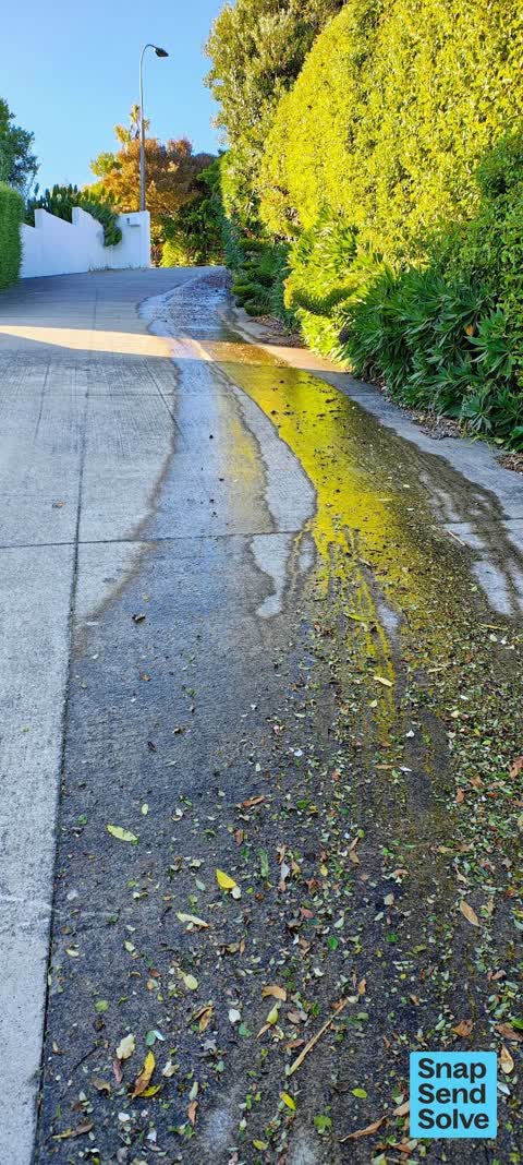
 Water Leak, 18 Nov 2025
 Hi, there is a leaking water Toby at 21A Whareroa Terrace. It's blown twice in the last 2 to 3 years. Water is running down drive which term
 Pavement - General, 24 Jan 2024
 A contractor worked at 17 Whareora Ave and truck before Xmas put its stabilisers onto the footpath and caused square indents into the footpa
- Pavement - Damaged, 7 Nov 2023
- Street Gutters / Storm Water, 22 Jan 2023
- Street Cleaning, 18 Dec 2022
Elsewhere on Whareora Terrace
- 3A Whareora Terrace, 5 reports
- 41 Whareora Terrace, 4 reports
- 8 Whareora Terrace, 3 reports
- 30 Whareora Terrace, 3 reports
- 6 Whareora Terrace, 2 reports
- 44 Whareora Terrace, 2 reports
- 36 Whareora Terrace, 2 reports
- 3 Whareora Terrace, 2 reports
The street’s crash record
NZTA’s record names Whareora Terrace in 1 crash that hurt somebody since 2006, 0 seriously hurt, nobody killed.
The civic layer
This ground votes in Cashmere ward, the Spreydon-Cashmere-Heathcote community board is its local layer. Ward lines don’t always follow suburb lines; this one is measured at the pin, not the suburb’s centre. The whole roll is at /wards.
Whareora Terrace, the whole record → · Everything about Cashmere → · What stood on this ground → · On the map → · From the air, RetroLens holds the Crown’s aerials back to 1936; search the address there →
Questions, answered briefly
6 council reports on record since December 2022, most often water leak (1), street gutters / storm water (1), street cleaning (1).
Cashmere, Christchurch, on Whareora Terrace.
The heritage register names 2 places at or beside it, Dwelling and Setting, Whareora, Cashmere Hills Presbyterian Church and Setting.
Cashmere Village Green, 159 m to its edge.