30A Dyers Pass Road
10 council reports since February 2019, 10 carrying a photograph. The street’s heaviest record is 66B Dyers Pass Road, 34 reports on file.
On the register here
- St Augustine's Anglican Church and Setting, 5 Cracroft Terrace (126m)
From the air, then
Sourced from Canterbury Maps and partners. RNZAF, CC BY 3.0 NZ. Each frame is cut from Environment Canterbury’s historic imagery MapServer for that decade, only where the Footprints layer names a CC BY survey (NZAM-covered spots stay out). RetroLens holds more Crown aerials →
The green nearby
- Purau Reserve, you are in it
- Cashmere Village Green, 318 m to the edge · playground, 1 pieces
- Rossmore Reserve, 371 m to the edge
- Cashmere Riverbank Reserve, 379 m to the edge · 1 ha
- Cashmere Valley Reserve, 419 m to the edge · 2 ha · playground, 26 pieces
Parks within half a kilometre, measured to the boundary, the council’s open data. The whole roll is at /parks.
On the doorstep
- Cashmere Fish Supply, 363 m away · Fast food
- Cashmere Medical Practice, 392 m away · Doctors & clinics
Businesses within four hundred metres, measured at the pin, OpenStreetMap and the council directories.
The bus nearby
- Cashmere Rd, 345 m away · route 1, the Orbiter (clockwise)
- Cashmere Rd, 348 m away · route 1, the Orbiter (anticlockwise)
The closest Metro stops, within four hundred and fifty metres.
The tracks through here
- Walk and bike track through Cashmere, 315 m to the line · walk · bike
- Walk and bike track through Cashmere, 327 m to the line · walk · bike
- Walk and bike track through Cashmere, 343 m to the line · walk · bike
- Walk and bike track through Cashmere, 350 m to the line · walk · bike
- Walk and bike track through Cashmere, 365 m to the line · walk · bike
Tracks whose line passes within half a kilometre, the council’s open data.
The named ground
Named water within 500 m of this address, measured to the line or the edge; Named places within 1.5 km of this address; the council’s own structure register, bridges, boardwalks and steps standing nearby, the open map’s record.
Renting nearby
new bonds in Cashmere ran about $707 a week, $157 above the city median of $550, the suburb page keeps the rent record →.
What gets reported here
Photographed here 10 on record




What’s on record
 Pavement - General, 30 Mar 2026
 Toby lid needs replacing properly in the footpath by 30a Dyers Pass Road. Currently an OHS risk to pedestrians.
 Trees - General, 9 Jan 2026
 there is a dead branch hanging from this tree at the top end of Purau Reserve by Dyers Pass Rd.
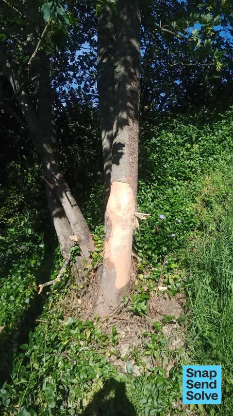
 Trees - General, 1 Nov 2025
 This mature tree was damaged by a car that crashed into the council bank last week. Not sure if the tree can be saved with this much bark mi
 General Request, 20 Oct 2025
 Abandoned couch in reserve
 Graffiti on a fence, building or structure, 19 Jul 2025
 On post Halfway up purau reserve steps
 Trees - General, 24 Aug 2024
 Tree is clearly dead, will not last much longer. Near a council asset of stairs. Danger to the public Requires arborist removal
 Pavement - Damaged, 5 Dec 2023
 Gutter has broken open and earth underneath is exposed and eroding with stormwater
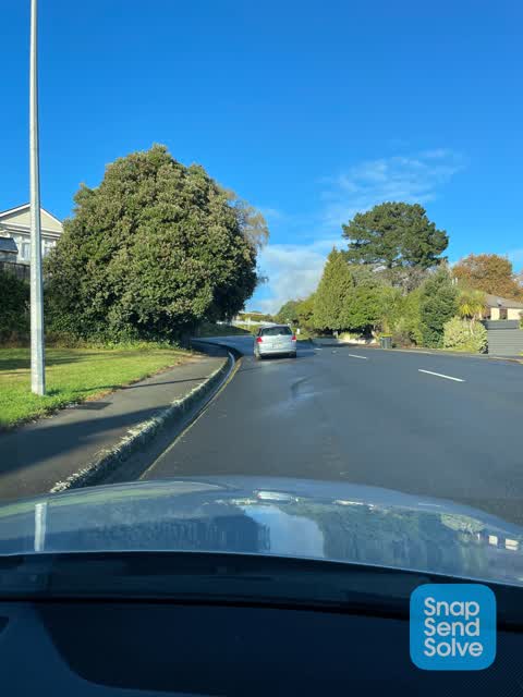
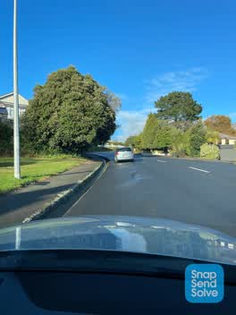 Roading/Streets, 21 Jun 2022
 Cars have to swing toward centre of Rd. Dangerous inconsiderate parking
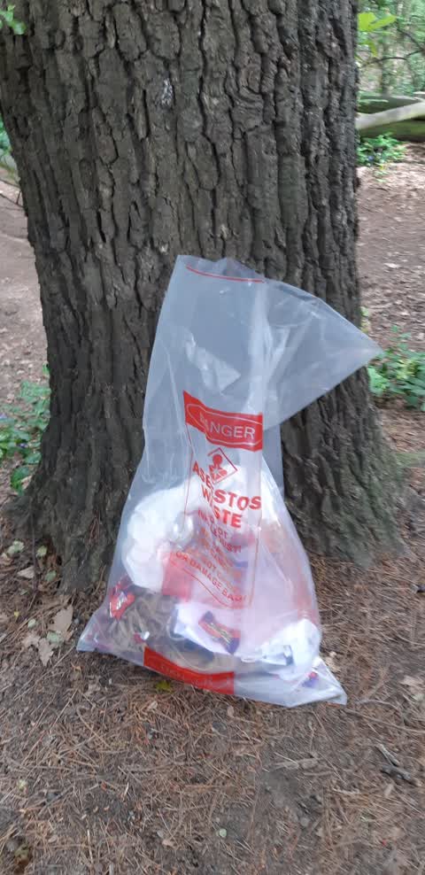
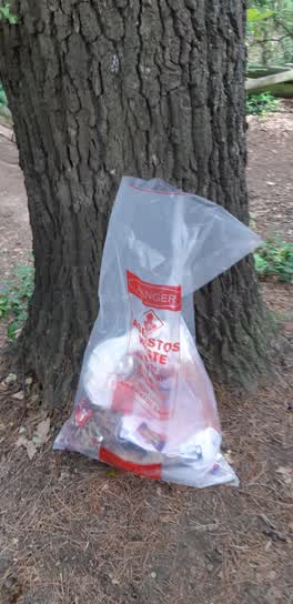 Rubbish/Recycling, 11 Oct 2021
 Rubbish bag at the top of the Purau Reserve
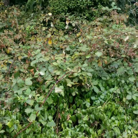
Parks, 7 Feb 2019
This council reserve on Dyers Pass Rd is getting over run with blackberry. It is marching up the hill into our property at 1 Cracroft Tce an
Elsewhere on Dyers Pass Road
- 66B Dyers Pass Road, 34 reports
- 501 Dyers Pass Road, 30 reports
- 95b Dyers Pass Road, 13 reports
- 116 Dyers Pass Road, 13 reports
- 551 Dyers Pass Road, 12 reports
- 95B Dyers Pass Road, 10 reports
- 32 Dyers Pass Road, 10 reports
- 222 Dyers Pass Road, 10 reports
The street’s crash record
NZTA’s record names Dyers Pass Road in 187 crashes that hurt somebody since 2006, 5 people killed, 42 seriously hurt.
The civic layer
This ground votes in Cashmere ward, the Spreydon-Cashmere-Heathcote community board is its local layer. Ward lines don’t always follow suburb lines; this one is measured at the pin, not the suburb’s centre. The whole roll is at /wards.
Dyers Pass Road, the whole record → · Everything about Cashmere → · What stood on this ground → · On the map → · From the air, RetroLens holds the Crown’s aerials back to 1936; search the address there →
Questions, answered briefly
10 council reports on record since February 2019, most often trees - general (3), rubbish/recycling (1), roading/streets (1).
Cashmere, Christchurch, on Dyers Pass Road.
The heritage register names a place at or beside it, St Augustine's Anglican Church and Setting.
Purau Reserve, the address is inside it.