66B Dyers Pass Road, Cashmere
34 reports on record since November 2017 · 21 with photographs. The most-reported address on Dyers Pass Road. Indicative rating valuation and school zones, hazards, bin day and what stood here before.
What gets reported here
- Rubbish and Bins - General — 12
- Park - General Request — 4
- Facility - General Request — 4
- Parks — 3
- Water Leak — 2
- Water Fountain — 2
Photographed here 21 on record






Reported here
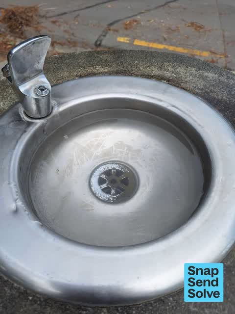
 Water Fountain —
 drinking fountain blocked and drain blocked in well used park
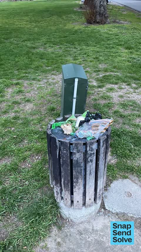
 Rubbish and Bins - General —
 Overflowing bin. Been like that a couple of days
 Water Fountain —
 A pipe is broken at the Green on Dyers pass. It leaking water. Almost looks like someone kicked it.
 Water Leak —
 Water gushing out of fountain
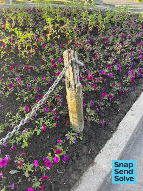
 Facility - General Request —
 The bollards at the feature garden on the corner of MacMillan Ave and Dyers Pass Road are bent, crooked and broken. They are beautiful herit
 Rubbish and Bins - General —
 Overflowing again – poo must be too heavy to carry home for the poor dog walkers
 Rubbish and Bins - General —
 Bon over flowing
 Dumped Rubbish —
 Overflowing rubbish bin
 Rubbish and Bins - General —
 Overfull
 Rubbish and Bins - General —
 Overflowing bin
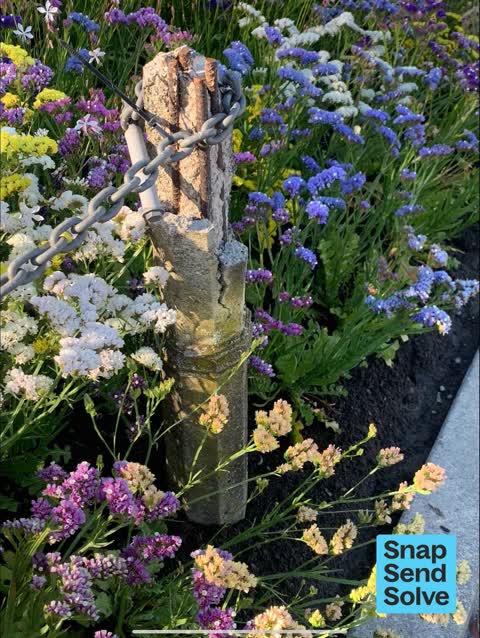
 Facility - General Request —
 Residents have asked if the damaged posts (2-3) around the flower bed can be replaced with something sympathetic to match the existing posts
 Street Gutters / Storm Water —
 Drain blocked with leaves etc
 Litter —
 Please empty bin
 Hazard — vehicle —
 Big truck parked permanently corner of Dyers Pass Rd and Macmillan Ave. it obstructs the view of motorists exiting Macmillan Ave which is a
 Water Leak —
 Leaking tap
 Rubbish and Bins - General —
 Overflowing with dog poo bags
- Rubbish and Bins - General —
- Rubbish and Bins - General —
- Park - General Request —
- Facility - General Request —
- Facility - General Request —
- Pit and Equipment - General —
- Park - General Request —
- Street Gutters / Storm Water —
- Rubbish and Bins - General —
- Rubbish and Bins - General —
- Park - General Request —
- Park - General Request —
- Rubbish and Bins - General —
 Rubbish and Bins - General —
 Needs emptying more often. How many times does this happen.
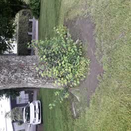 Parks —
 whole park is in urgent need for trees to be trimmed of new sucklings growning this is complaints from residents about park
Parks —
Water Supply —
Parks —
Weeds (wilding trees) in garden plots on roadside and in park. Are these contractors blind, ignorant or stupid.
Also reported on Dyers Pass Road
- 501 Dyers Pass Road — 30 reports
- 95b Dyers Pass Road — 13 reports
- 116 Dyers Pass Road — 13 reports
- 551 Dyers Pass Road — 12 reports
- 95B Dyers Pass Road — 10 reports
- 32 Dyers Pass Road — 10 reports
- 30A Dyers Pass Road — 10 reports
- 222 Dyers Pass Road — 10 reports
The street’s crash record
NZTA’s record names Dyers Pass Road in 187 crashes that hurt somebody since 2006 — 5 people killed, 42 seriously hurt.
The green nearby
- Cashmere Village Green — you are in it
- Purau Reserve — 289 m to the edge
- Cashmere Valley Reserve — 438 m to the edge · 2 ha
Parks within half a kilometre, measured to the boundary — the council’s open data.
On the doorstep
- NV Wines — 292 m away · Bottle stores
- Ngaio Marsh House — 363 m away · Museums
- Dame Ngaio Marsh's House — 389 m away · Attractions
Businesses within four hundred metres, measured at the pin — OpenStreetMap and the council directories.
The bus nearby
- Hackthorne Rd near Dyers Pass Rd — 429 m away · route 1
The closest Metro stops, within four hundred and fifty metres.
The named ground
Named places within 1.5 km of this address; the council’s own structure register — bridges, boardwalks and steps standing nearby — the open map’s record.
The remembered names nearby
- Cashmere Garden Club in Commemoration of Their 60th — 2 m away ·
Cashmere Garden Club in commemoration of their 60th Anniversary 1940–2000
· 2008 - This Tree Commemorates the Establishment of the Guiding — 7 m away ·
THIS TREE COMMEMORATES THE ESTABLISHMENT OF THE GUIDING MOVEMENT IN CASHMERE HILLS MAY 192
· 2008 - A Ngati Mamoe and Ngai Tahu Trail Once Crossed This Land — 99 m away ·
A Ngati Mamoe and Ngai Tahu trail once crossed this land on the way from Putaringamotu (Ri
· 2003
Inscribed plaques within two hundred and fifty metres — the register’s pins, not surveyed spots. The whole roll is at /plaques.
Renting nearby
new bonds in Cashmere ran about $707 a week — $157 above the city median of $550 — the suburb page keeps the rent record →.
What was here — Cashmere Hills Presbyterian Church and Setting
42 m away · 2 MacMillan Avenue · located to ±15 m · the place’s own record →
On the register. Nothing researched here yet.
What was here — Dwelling and Setting
114 m away · 54 Dyers Pass Road · located to ±16 m · the place’s own record →
On the register. Nothing researched here yet.
What was here — Dwelling and Setting, Whareora
123 m away · 63 Dyers Pass Road · located to ±17 m · the place’s own record →
On the register. Nothing researched here yet.
What was here — Dwelling and Setting
200 m away · 2 Whisby Road · located to ±12 m · the place’s own record →
On the register. Nothing researched here yet.
The civic layer
This ground votes in Cashmere ward — the Spreydon-Cashmere-Heathcote community board. Ward lines don’t always follow suburb lines; this one is measured at the pin, not the suburb’s centre.
What stood on this ground → · On the map → · From the air — the Crown’s aerials back to 1936; search the address on RetroLens →
Questions, answered briefly
34 council reports on record since November 2017 — most often rubbish and bins - general (12), park - general request (4), facility - general request (4).
Cashmere, Christchurch — on Dyers Pass Road.
The heritage register names 4 places at or beside it — Cashmere Hills Presbyterian Church and Setting, Dwelling and Setting.
Cashmere Village Green — the address is inside it.