70 Colombo Street, Cashmere
27 reports on record since August 2019 · 24 with photographs. The street’s heaviest record is 66 Colombo Street — 56 reports on file. Indicative rating valuation and school zones, hazards, bin day and what stood here before.
What gets reported here
Photographed here 24 on record




Reported here
 Flooding —
 Blocked drainage creating flooding and mud. Dangerous and slippery for market goers and vendors alike. Feels negligent of a market that brin
 Litter —
 road cone in river (next to South library construction site)
 Dumped Rubbish —
 Dumped car part
 Street Gutters / Storm Water —
 Drainage blocked causing flooding down the street. Particularly problematic as there is a local farmer’s market held here weekly.
 Animal - Deceased —
 Dead possum needs removal from the footpath by 70 Colombo Street by the bridge.
 Graffiti on a sign, mural or public art —
 Graffiti on South Library project sign located on fence at Intersection of Colombo Street and Hunter Terrace, Cashmere.
 Trees - General —
 Hanging branch
 Overgrown Vegetation —
 Grass around the Colombo Street Library needs mowing. This space is still used for a farmers market. Normally families picnic and children p
 Graffiti on a road, footpath or bridge —
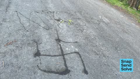
 Offensive graffiti on Hunter Tce esplanade by library work site - swasikas and offensive language
 Public Toilet —
 Just got locked in the toilet. The lock seems to be broken on the right hand toilet.
 Graffiti somewhere else —
 Graffiti on rails along bridge
 Damaged Street Sign —
 Damaged blue “keep left” road sign on pedestrian refuge island on Colombo Street, Cashmere. The damaged sign is located on the island in the
 Damaged Road —
 Damaged yellow tubular steel barrier/handrail on pedestrian refuge island on Colombo Street, Cashmere. The damaged barrier/handrail is locat
 Pavement - Damaged —
 Someone has run over the island and crushed the handrail leaving no space for pedestrians
 Graffiti on a fence, building or structure —
 BALLAD black paint tag on top rail of River Avon footbridge by 70 Colombo Street.
 Graffiti on a fence, building or structure —
 KAEPE white paint tag on top rail of footbridge on Colombo Street over the River Avon.
 Graffiti somewhere else —
  Graffiti on a sign, mural or public art —
 Graffiti (sticker) on the rear face of a road sign on Colombo Street outside Christchurch South Library. The road sign is behind a wire site
- Graffiti —
- Graffiti —
- Accessibility —
 Roading/Streets —
 The Colombo St pedestrian bridge over Heathcote R is tricky to negotiate. The damp leaves restrict full pedestrian access and could be hazar
 Graffiti —
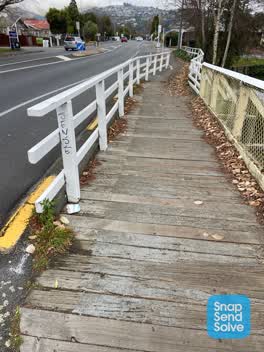
 SENSE black paint tag on end rail of River Heathcote Bridge on Colombo Street by Ashgrove Terrace.
 Graffiti —
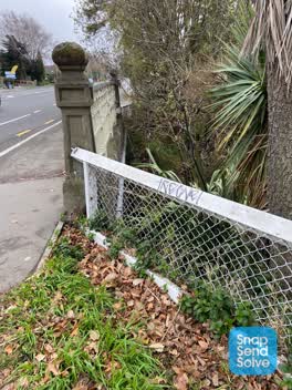
 Black paint tag on railing by the bridge a tad east of Waimea Terrace on Colombo Street.
 Rubbish/Recycling —
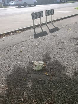
 Nappies on road behind Beckenham (river side)
Parks —
please pick up and disposed of Himalaysn balsam stalks on road opposite South Library. Dispose to Landfill. I have double bagged the flowerh
Rubbish/Recycling —
windscreen on road. swept up
Also reported on Colombo Street
- 66 Colombo Street — 56 reports
- 50 Colombo Street — 21 reports
- 27 Colombo Street — 16 reports
- 20 Colombo Street — 16 reports
- 52 Colombo Street — 13 reports
- 2 Colombo Street — 13 reports
- 62 Colombo Street — 11 reports
- 22 Colombo Street — 11 reports
The street’s crash record
NZTA’s record names Colombo Street in 30 crashes that hurt somebody since 2006 — 11 seriously hurt, nobody killed.
The green nearby
- Ernle Clark Reserve — 230 m to the edge · Botanic · 2 ha
- Waimea Reserve — 249 m to the edge
- Colombo Reserve — 360 m to the edge
- Thorrington Reserve — 424 m to the edge
Parks within half a kilometre, measured to the boundary — the council’s open data.
The civic shelf nearby
- South Christchurch Library — 22 m away · Library · 66 Colombo St, Cashmere, Christchurch 8022
- Beckenham Service Centre — 34 m away · Service centre
Libraries, halls and the rest within half a kilometre — the council’s open data.
On the doorstep
- Opawa Farmers' Market — 17 m away · Markets
- Malthouse Costumes — 70 m away · Rental
- Canterbury Childrens Theatre — 76 m away · Cinemas & theatres
- Novel Cafe Beckenham — 85 m away · Cafés
Businesses within four hundred metres, measured at the pin — OpenStreetMap and the council directories.
The bus nearby
The closest Metro stops, within four hundred and fifty metres.
The tracks through here
- Walk and bike track through Cashmere — 10 m to the line · walk · bike
- Walk and bike track through Cashmere — 38 m to the line · walk · bike
- Walk and bike track through Cashmere — 39 m to the line · walk · bike
- Walk and bike track through Cashmere — 59 m to the line · walk · bike
- Walk and bike track through Cashmere — 200 m to the line · walk · bike
Tracks whose line passes within half a kilometre, measured to the line itself — the council’s open data.
The named ground
Named water within 500 m of this address, measured to the line or the edge; the council’s own structure register — bridges, boardwalks and steps standing nearby — the open map’s record.
Renting nearby
new bonds in Cashmere ran about $707 a week — $157 above the city median of $550 — the suburb page keeps the rent record →.
What was here — The Malthouse and Setting
81 m away · 69 Colombo Street · located to ±21 m · the place’s own record →
On the register. Nothing researched here yet.
The civic layer
This ground votes in Cashmere ward — the Spreydon-Cashmere-Heathcote community board. Ward lines don’t always follow suburb lines; this one is measured at the pin, not the suburb’s centre.
What stood on this ground → · On the map → · From the air — the Crown’s aerials back to 1936; search the address on RetroLens →
Questions, answered briefly
27 council reports on record since August 2019 — most often graffiti (4), rubbish/recycling (2), graffiti somewhere else (2).
Cashmere, Christchurch — on Colombo Street.
The heritage register names a place at or beside it — The Malthouse and Setting.
Ernle Clark Reserve — 230 m to its edge, 2 ha.