11 Liverpool Street
8 council reports since January 2017, 5 carrying a photograph. The street’s heaviest record is 7 Liverpool Street, 19 reports on file.
On the register here
- Façade and Setting, Former New Zealand Farmers’ Co-operative Association of Canterbury Ltd, 214 Cashel Street (116m)
- 167 Hereford Street, 167 Hereford Street (124m)
- 159 Manchester Street, 159 Manchester Street (152m)
- Shands Emporium: Former Commercial Building, 217 Manchester Street (153m)
- Former Trinity Congregational Church and Setting, 124 Worcester Street (168m)
From the air, then
Sourced from Canterbury Maps and partners. LINZ, CC BY 3.0 NZ. Each frame is cut from Environment Canterbury’s historic imagery MapServer for that decade, only where the Footprints layer names a CC BY survey (NZAM-covered spots stay out). RetroLens holds more Crown aerials →
The green nearby
- Latimer Square, 151 m to the edge · Botanic · 2 ha
- City Mall, 191 m to the edge
- High Street Triangles, 218 m to the edge
- Excelsior Hotel Reserve, 221 m to the edge · Botanic
- The Stewart Plaza, 271 m to the edge
Parks within half a kilometre, measured to the boundary, the council’s open data. The whole roll is at /parks.
The civic shelf nearby
- Triangle, 270 m away · Car park
- Turanga Library, 371 m away · Library
- Re:start - Lichfield Street, 435 m away · Car park
- St Asaph, 479 m away · Car park
Libraries, halls and the rest within half a kilometre, the council’s open data.
On the doorstep
- Kensington Fun House Bar, 74 m away · Venues & events
- Stock Xchange Bar & Cafe - Manchester St, 80 m away · Restaurants
- Bahn Mi Kitchen & Espresso, 81 m away · Restaurants
- Banh Mi Kitchen, 82 m away · Restaurants
Businesses within four hundred metres, measured at the pin, OpenStreetMap and the council directories.
The bus nearby
- Hereford St near Latimer Square, 86 m away · route 60
- Hereford St near Latimer Square, 105 m away · route 60
The closest Metro stops, within four hundred and fifty metres.
The tracks through here
- Walk and bike track through Christchurch Central City, 64 m to the line · walk · bike
- Walk and bike track through Christchurch Central City, 173 m to the line · walk · bike
- Walk and bike track through Christchurch Central City, 312 m to the line · walk · bike
- Walk and bike track through Christchurch Central City, 316 m to the line · walk · bike
- Walk and bike track through Christchurch Central City, 415 m to the line · walk · bike
Tracks whose line passes within half a kilometre, the council’s open data.
The named ground
Named water within 500 m of this address, measured to the line or the edge; Named places within 1.5 km of this address; the council’s own structure register, bridges, boardwalks and steps standing nearby, the open map’s record.
The remembered names nearby
- Te Kiheru Wai o Tahu / the Canoe Bailer of Tahu / 2015, 177 m away ·
Te Kiheru Wai o Tahu / The Canoe Bailer of Tahu / 2015 / (MÄori text and English translat
· 2015
Inscribed plaques within two hundred and fifty metres, the register’s pins, not surveyed spots. The whole roll is at /plaques.
Renting nearby
new bonds in Christchurch Central City ran about $508 a week, $42 below the city median of $550, the suburb page keeps the rent record →.
What gets reported here
Photographed here 5 on record


What’s on record
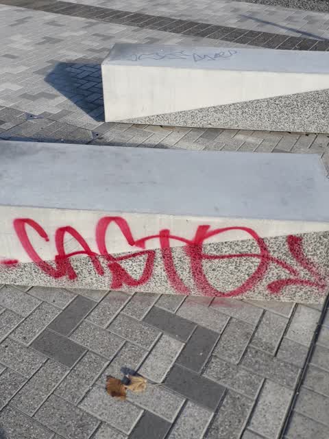
 Graffiti on a fence, building or structure, 16 Jul 2025
 Poles and Signage - General, 6 Oct 2024
PARKING SIGN REMOVED: Drunk idiots removed the sign on Saturday night. Taken from Huanui Lane between Gloucester and Worcester, dumped in Ra
 Graffiti somewhere else, 7 Apr 2024
 Damaged Street Sign, 11 Dec 2023
This P120 street sign and one to the left (facing the apartment construction) has been knocked over into the garden beds.
- Graffiti, 7 Nov 2023
 Graffiti, 31 May 2020
- Rubbish/Recycling, 29 Sept 2017
Colman avenue Upper Riccarton. Sea of broken glass after Police closed down noisy party. Need a street sweeper.
- Parks, 31 Jan 2017
Please note that this photograph is of the seating located mid way along the Sumner Esplanade walkway. You will note that the seating is bro
Elsewhere on Liverpool Street
- 7 Liverpool Street, 19 reports
- 8 Liverpool Street, 10 reports
- 9 Liverpool Street, 5 reports
- 14 Liverpool Street, 4 reports
- 12 Liverpool Street, 3 reports
The street’s crash record
NZTA’s record names Liverpool Street in 1 crash that hurt somebody since 2006, 0 seriously hurt, nobody killed.
The civic layer
This ground votes in Central ward, the Papanui-Innes-Central community board is its local layer. Ward lines don’t always follow suburb lines; this one is measured at the pin, not the suburb’s centre. The whole roll is at /wards.
Liverpool Street, the whole record → · Everything about Christchurch Central City → · What stood on this ground → · On the map → · From the air, RetroLens holds the Crown’s aerials back to 1936; search the address there →
Questions, answered briefly
8 council reports on record since January 2017, most often graffiti (2), rubbish/recycling (1), poles and signage - general (1).
Christchurch Central City, Christchurch, on Liverpool Street.
The heritage register names 5 places at or beside it, Façade and Setting, Former New Zealand Farmers’ Co-operative Association of Canterbury Ltd, 167 Hereford Street.
Latimer Square, 151 m to its edge, 2 ha.