125G 125G
1 council report since February 2021, 1 carrying a photograph.
On the register here
- New Regent Street Shops and Setting, 17 New Regent Street (86m)
- Edmonds Band Rotunda Area including Rotunda, Shelter, Balustrades, Landing and Lamp Standards and Setting, 230 Cambridge Terrace (99m)
- Theatre Royal Façade, Dome, Staircase and Setting, 145 Gloucester Street (106m)
- K2 Telephone Box and Setting (151m)
- Commercial Building and Setting, Former Cook and Ross, 201/779 Colombo Street (152m)
From the air, then
Sourced from Canterbury Maps and partners. LINZ, CC BY 3.0 NZ. Each frame is cut from Environment Canterbury’s historic imagery MapServer for that decade, only where the Footprints layer names a CC BY survey (NZAM-covered spots stay out). RetroLens holds more Crown aerials →
The green nearby
- Edmonds Band Rotunda, 88 m to the edge · Botanic
- Victoria Square, 142 m to the edge · Botanic · 2 ha
- Cathedral Square, 232 m to the edge · Botanic
- Canterbury Provincial Council Reserve, 291 m to the edge · Botanic
- Godley Statue Reserve, 294 m to the edge · Botanic
Parks within half a kilometre, measured to the boundary, the council’s open data. The whole roll is at /parks.
The civic shelf nearby
- Turanga Library, 183 m away · Library
- Aldersgate, 412 m away · Car park
- Armagh Street, 436 m away · Car park
- Triangle, 466 m away · Car park
Libraries, halls and the rest within half a kilometre, the council’s open data.
On the doorstep
- Urban Gourmand, 34 m away · Fast food
- Belle, 35 m away · Cafés
- The Piano, 41 m away · Cinemas & theatres
- Rollickin Gelato Cafe, 43 m away · Cafés
Businesses within four hundred metres, measured at the pin, OpenStreetMap and the council directories.
The bus nearby
- Kilmore St near Manchester St, 226 m away · route 1, route 27, route 29, route 95
- Manchester St Super Stop, 262 m away · route 1, route 5, route 7, route 8, route 27, route 29, route 44, route 86, route 91, route 92, route 95
The closest Metro stops, within four hundred and fifty metres.
The tracks through here
- Walk and bike track through Christchurch Central City, 10 m to the line · walk · bike
- Walk and bike track through Christchurch Central City, 112 m to the line · walk · bike
- Walk and bike track through Christchurch Central City, 153 m to the line · walk · bike
- Walk and bike track through Christchurch Central City, 260 m to the line · walk · bike
- Walk and bike track through Christchurch Central City, 276 m to the line · walk · bike
Tracks whose line passes within half a kilometre, the council’s open data.
The named ground
Named water within 500 m of this address, measured to the line or the edge; Named places within 1.5 km of this address; the council’s own structure register, bridges, boardwalks and steps standing nearby, the open map’s record.
The remembered names nearby
- Poplar Crescent 1929, 96 m away ·
POPLAR CRESCENT 1929
· 2009 - This Rotunda Shelter and Circular Seat Were Presented, 104 m away ·
THIS ROTUNDA SHELTER AND CIRCULAR SEAT WERE PRESENTED BY T.J. EDMONDS TO CELEBRATE FIFTY Y
· 2009 - Margaret Mahy Family Playground, 138 m away ·
MARGARET MAHY FAMILY PLAYGROUND / Officially opened on 22 December 2015 by / Elsie Mahy /
· 2017
Inscribed plaques within two hundred and fifty metres, the register’s pins, not surveyed spots. The whole roll is at /plaques.
Renting nearby
new bonds in Christchurch Central City ran about $508 a week, $42 below the city median of $550, the suburb page keeps the rent record →.
What gets reported here
- Graffiti, 1
Photographed here 1 on record
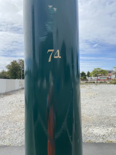
What’s on record
 Graffiti, 12 Feb 2021
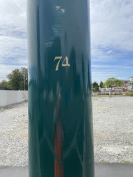
 Black paint tag on tramlines pole 74, which also needs a touch up on the 4 of 74, on Armagh Street.
The civic layer
This ground votes in Central ward, the Papanui-Innes-Central community board is its local layer. Ward lines don’t always follow suburb lines; this one is measured at the pin, not the suburb’s centre. The whole roll is at /wards.
Everything about Christchurch Central City → · What stood on this ground → · On the map → · From the air, RetroLens holds the Crown’s aerials back to 1936; search the address there →
Questions, answered briefly
1 council report on record since February 2021, most often graffiti (1).
Christchurch Central City, Christchurch, on G.
The heritage register names 5 places at or beside it, New Regent Street Shops and Setting, Edmonds Band Rotunda Area including Rotunda, Shelter, Balustrades, Landing and Lamp Standards and Setting.
Edmonds Band Rotunda, 88 m to its edge.