137 Cambridge Terrace, Christchurch Central City
42 reports on record since August 2016 · 32 with photographs. The street’s heaviest record is 2 Cambridge Terrace — 251 reports on file. Indicative rating valuation and school zones, hazards, bin day and what stood here before.
What gets reported here
Photographed here 32 on record


Reported here
 Graffiti on a fence, building or structure —
 Accessibility —
Fence down on footpath. Nite the elderly guy who had to navigate it.
 Water Pollution - Sediment —
opposite Harley chambers demolition
 Rubbish and Bins - General —
this rubbish bin has been overflowing alot lately. it isnt on our rubbish run, but weve had to change it a few times. Am not sure if its Wa
 Poles and Signage - General —
missing pole sign as per photo
 Graffiti on a fence, building or structure —
Graffiti on a wall
 Graffiti on a fence, building or structure —
 Graffiti on a fence, building or structure —
 Poles and Signage - General —
There's a big cavity at the base of this streetlight pole. Looks like other pavers could fall into the hole if it gets worse.
 Graffiti on a fence, building or structure —
 Graffiti on a fence, building or structure —
Graffiti on rubbish bin. Red top on rubbish bin.
 Graffiti somewhere else —
 Graffiti on a cabinet, pole or railway asset —
Graffiti
 Graffiti on a fence, building or structure —
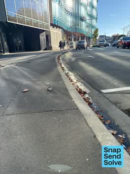 Pavement - General —
These three signpost inserts sticking out of the footpath are a trip hazard.
 Hazard — vehicle —
Meter broken screen non functioning
 Graffiti —
 Fallen Tree —
Two branches. One has fallen and the the river, the other, is broken but still in the tree.
 Graffiti —
- Graffiti —
- Graffiti —
- Graffiti —
- Graffiti —
- Graffiti —
- Graffiti —
- Graffiti —
- Graffiti —
- Graffiti —
- Accessibility —
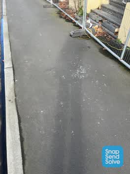 Roading/Streets —
Smashed glass in footpath
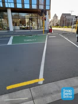 Roading/Streets —
Audible tactile indicators not working at lights Cambridge terrace with Gloucester street
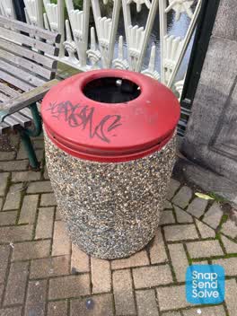 Graffiti —
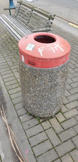
Black paint tag on rubbish bin lid on Avon River bridge on Worcester Street corner of Durham Street.
 Graffiti —
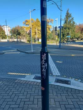
Graffiti on old fashioned style lamppost. Corner of Cambridge Terrace and Worcester Blvd, outside Harley bldg
 Graffiti —
 Graffiti —
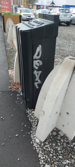
Rubbish bin Worcester Blvd. Opposite Harley St buildings.
 Graffiti —
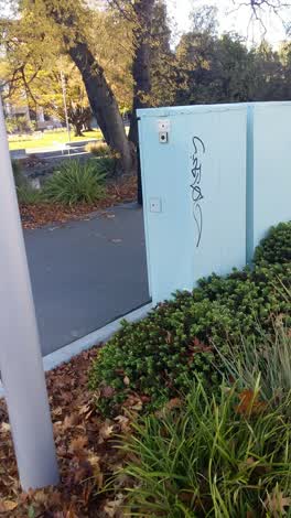 Graffiti —
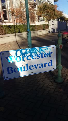 Graffiti —
Flooding —
There is not normally flowing water here. Kate Shepard memorial Park
Roading/Streets —
Tree has been snapped off
Roading/Streets —
Planters on bridge - no maintenance. Poor planting. Needs soil - not a good reflection of city
Graffiti —
On bridge
Also reported on Cambridge Terrace
- 2 Cambridge Terrace — 251 reports
- 357 Cambridge Terrace — 116 reports
- 88 Cambridge Terrace — 92 reports
- 351 Cambridge Terrace — 81 reports
- 129 Cambridge Terrace — 80 reports
- 343 Cambridge Terrace — 79 reports
- 230 Cambridge Terrace — 74 reports
- 131 Cambridge Terrace — 72 reports
The street’s crash record
NZTA’s record names Cambridge Terrace in 44 crashes that hurt somebody since 2006 — 11 seriously hurt, nobody killed.
The green nearby
- Scott Statue Reserve — 52 m to the edge · Botanic
- Canterbury Provincial Council Reserve — 143 m to the edge · Botanic
- Godley Statue Reserve — 233 m to the edge · Botanic
- Bridge Of Remembrance — 235 m to the edge · Botanic
- Friendship Corner — 257 m to the edge · Botanic
Parks within half a kilometre, measured to the boundary — the council’s open data.
The civic shelf nearby
- Civic Offices — 136 m away · Council office
- Armagh St — 270 m away · Car park
- Scales — 322 m away · Car park
- Aldersgate — 323 m away · Car park
- Turanga Library — 359 m away · Library · Cathedral Square, Christchurch
- Rolleston Avenue — 397 m away · Car park
- Triangle — 403 m away · Car park
Libraries, halls and the rest within half a kilometre — the council’s open data.
On the doorstep
- Sawyer — 55 m away · Bars & pubs
- Canterbury Club — 63 m away · Clubs
- South by Southeast Architects — 74 m away · Architects
- Doubles — 76 m away · Cafés
Businesses within four hundred metres, measured at the pin — OpenStreetMap and the council directories.
The bus nearby
- Hereford St near Montreal St — 193 m away · route 8
- Hereford St near Montreal St — 204 m away · route 8
The closest Metro stops, within four hundred and fifty metres.
The tracks through here
- Walk and bike track through Christchurch Central City — 23 m to the line · walk · bike
- Walk and bike track through Christchurch Central City — 36 m to the line · walk · bike
- Walk and bike track through Christchurch Central City — 81 m to the line · walk · bike
- Walk and bike track through Christchurch Central City — 107 m to the line · walk · bike
- Walk and bike track through Christchurch Central City — 157 m to the line · walk · bike
Tracks whose line passes within half a kilometre, measured to the line itself — the council’s open data.
The named ground
Named water within 500 m of this address, measured to the line or the edge; Named places within 1.5 km of this address; the council’s own structure register — bridges, boardwalks and steps standing nearby — the open map’s record.
The remembered names nearby
- Avon Riverbank Central City plaque — 12 m away ·
(illegible – inscription panel at memorial)
- Avon Riverbank Central City plaque — 37 m away ·
(no text found)
· 2000 - Kate Sheppard Memorial plaque — 60 m away ·
(illegible – ground plaque near riverside path)
Inscribed plaques within two hundred and fifty metres — the register’s pins, not surveyed spots. The whole roll is at /plaques.
Renting nearby
new bonds in Christchurch Central City ran about $508 a week — $42 below the city median of $550 — the suburb page keeps the rent record →.
What was here — Worcester Street Bridge and Setting
24 m away · located to ±17 m · the place’s own record →
On the register. Nothing researched here yet.
What was here — Canterbury Club Hitching Post and Setting
29 m away · the place’s own record →
On the register. Nothing researched here yet.
What was here — Canterbury Club Gas Lamp and Setting
31 m away · the place’s own record →
On the register. Nothing researched here yet.
What was here — Digby's Commercial School/Worcester Chambers and Setting
50 m away · 69 Worcester Street · located to ±19 m · the place’s own record →
On the register. Nothing researched here yet.
What was here — Canterbury Club and Setting
51 m away · 129 Cambridge Terrace · located to ±28 m · the place’s own record →
On the register. Nothing researched here yet.
The civic layer
This ground votes in Central ward — the Papanui-Innes-Central community board. Ward lines don’t always follow suburb lines; this one is measured at the pin, not the suburb’s centre.
What stood on this ground → · On the map → · From the air — the Crown’s aerials back to 1936; search the address on RetroLens →
Questions, answered briefly
42 council reports on record since August 2016 — most often graffiti (19), graffiti on a fence, building or structure (7), roading/streets (4).
Christchurch Central City, Christchurch — on Cambridge Terrace.
The heritage register names 5 places at or beside it — Worcester Street Bridge and Setting, Canterbury Club Hitching Post and Setting.
Scott Statue Reserve — 52 m to its edge.