14 Cathedral Square, Christchurch Central City
35 reports on record since July 2019 · 25 with photographs. The street’s heaviest record is 105 Cathedral Square — 173 reports on file. Indicative rating valuation and school zones, hazards, bin day and what stood here before.
What gets reported here
Photographed here 25 on record


Reported here
 Graffiti on a fence, building or structure —
 graffiti on ccc cabinets
 Graffiti on a fence, building or structure —
 graffiti on bollard
 Graffiti on a fence, building or structure —
 Graffiti
 Graffiti on a fence, building or structure —
 graffiti on building
 Graffiti on a sign, mural or public art —
 offensive language on mural and graffiti
 Pavement - General —
 Trip hazard
 Graffiti on a sign, mural or public art —
  Road Signage —
 The Give Way sign on the corner of Worcester St and Colombo St on the eastern side of the Cathedral has been vandalised/removed and dumped o
- Street Light Outage —
a streetlight outside ogb at the back of the cathedral is flashing and it's unsafe.
 Street Light Outage —
 Street lights out of action back of the cathedral.
 Graffiti on a fence, building or structure —
 Graffiti on planter
 Damaged Road —
 Some lowlife has pushed some of the young kowhai alongside the cathedral over. One is partially across the road. They need some TLC
 Damaged Road —
 Drainage grate missing from road. Serious fall Hazzard for pedestrians and potential for serious vehicle damage
 Graffiti on a fence, building or structure —
  Graffiti somewhere else —
 Seats near gumption restaurant
 Pavement - General —
 Coach blocking footpath
 Hazard — vehicle —
 Illegally parked and blocking access to site
- Graffiti —
- Roads - General —
- Graffiti —
- Graffiti —
- Graffiti —
- Hazard — vehicle —
- Graffiti —
- Graffiti —
- Graffiti —
 Graffiti —
 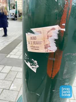 Graffiti —
 Anti vax misinformation sticky tags need removal from green tramlines floodlight pole in Cathedral Square near Distinction Hotel.
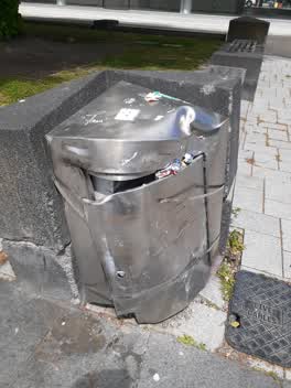 Rubbish/Recycling —
 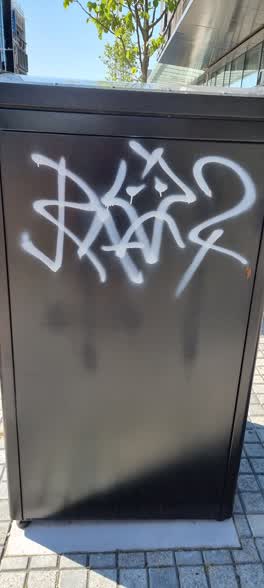 Graffiti —
 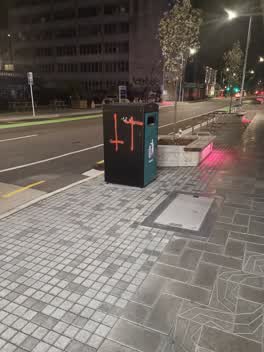 Graffiti —
 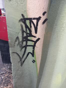 Graffiti —
 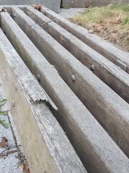 Parks —
 dangerous splinter risk on park bench
Graffiti —
graffiti tagging on the north face of the Distinction Hotel building - not a good look for tourists and visitors to ChCh
Roading/Streets —
Broken and uneven paving slabs and cobble stones in Cathedral Sq outside Heritage and Distinction Hotels.
Also reported on Cathedral Square
- 105 Cathedral Square — 173 reports
- 53 Cathedral Square — 108 reports
- 100 Cathedral Square — 95 reports
- 9 Cathedral Square — 91 reports
- 31 Cathedral Square — 82 reports
- 99 Cathedral Square — 81 reports
- 2 Cathedral Square — 79 reports
- 50 Cathedral Square — 54 reports
The street’s crash record
NZTA’s record names Cathedral Square in 8 crashes that hurt somebody since 2006 — 0 seriously hurt, nobody killed.
The green nearby
- Cathedral Square — 28 m to the edge · Botanic
- City Mall — 98 m to the edge
- The Stewart Plaza — 113 m to the edge
- Godley Statue Reserve — 120 m to the edge · Botanic
- High Street Triangles — 159 m to the edge
Parks within half a kilometre, measured to the boundary — the council’s open data.
The civic shelf nearby
- Turanga Library — 142 m away · Library · Cathedral Square, Christchurch
- Triangle — 161 m away · Car park
- Re:start - Lichfield St — 404 m away · Car park
- Civic Offices — 475 m away · Council office
- Armagh St — 499 m away · Car park
Libraries, halls and the rest within half a kilometre — the council’s open data.
On the doorstep
- Old Government Building Suites — 11 m away · Hotels
- Distinction Hotel Christchurch — 15 m away · Hotels
- gumP-tion Restaurant & Bar — 15 m away · Restaurants
- Gumption — 17 m away · Restaurants
Businesses within four hundred metres, measured at the pin — OpenStreetMap and the council directories.
The bus nearby
The closest Metro stops, within four hundred and fifty metres.
The tracks through here
- Walk and bike track through Christchurch Central City — 167 m to the line · walk · bike
- Walk and bike track through Christchurch Central City — 174 m to the line · walk · bike
- Walk and bike track through Christchurch Central City — 195 m to the line · walk · bike
- Walk and bike track through Christchurch Central City — 290 m to the line · walk · bike
- Walk and bike track through Christchurch Central City — 298 m to the line · walk · bike
Tracks whose line passes within half a kilometre, measured to the line itself — the council’s open data.
The named ground
Named water within 500 m of this address, measured to the line or the edge; Named places within 1.5 km of this address; the council’s own structure register — bridges, boardwalks and steps standing nearby — the open map’s record.
The remembered names nearby
- Citizens’ War Memorial / Originally Dedicated on 9 June 1937 — 127 m away ·
Citizens’ War Memorial / Originally dedicated on 9 June 1937 / Damaged by the Canterbury E
· 2023 - The Combined Services / [service Crests] / Navy — 130 m away ·
THE COMBINED SERVICES / [service crests] / NAVY / NEW ZEALAND ARMY / AIR FORCE / MERCHANT
· 2023 - Godley Statue Reserve plaque — 135 m away · 1899
Inscribed plaques within two hundred and fifty metres — the register’s pins, not surveyed spots. The whole roll is at /plaques.
Renting nearby
new bonds in Christchurch Central City ran about $508 a week — $42 below the city median of $550 — the suburb page keeps the rent record →.
What was here — ChristChurch Cathedral and Setting
68 m away · 100 Cathedral Square · located to ±44 m · the place’s own record →
On the register. Nothing researched here yet.
What was here — Former Government Buildings and Setting
78 m away · 26/28 Cathedral Square · located to ±43 m · the place’s own record →
On the register. Nothing researched here yet.
What was here — Cathedral Square and Setting
on this spot · located to ±138 m · the place’s own record →
On the register. Nothing researched here yet.
What was here — Commercial Building Façade and Setting, Former A W Smith and Son's Central Garage/Mayfair-Cinerama Theatre
105 m away · 115A Worcester Street · located to ±12 m · the place’s own record →
On the register. Nothing researched here yet.
What was here — Triangle Reserve and Setting
121 m away · 291F High Street · located to ±18 m · the place’s own record →
On the register. Nothing researched here yet.
The civic layer
This ground votes in Central ward — the Papanui-Innes-Central community board. Ward lines don’t always follow suburb lines; this one is measured at the pin, not the suburb’s centre.
What stood on this ground → · On the map → · From the air — the Crown’s aerials back to 1936; search the address on RetroLens →
Questions, answered briefly
35 council reports on record since July 2019 — most often graffiti (13), graffiti on a fence, building or structure (6), street light outage (2).
Christchurch Central City, Christchurch — on Cathedral Square.
The heritage register names 5 places at or beside it — ChristChurch Cathedral and Setting, Former Government Buildings and Setting.
Cathedral Square — 28 m to its edge.