141 Cambridge Terrace, Christchurch Central City
17 reports on record since August 2019 · 10 with photographs. The street’s heaviest record is 2 Cambridge Terrace — 251 reports on file. Indicative rating valuation and school zones, hazards, bin day and what stood here before.
What gets reported here
Photographed here 10 on record


Reported here
 Poles and Signage - General —
Sign missing needs replacement unable to enforce parking restrictions
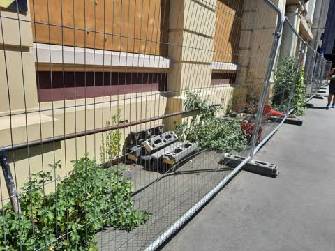
 Overgrown Vegetation —
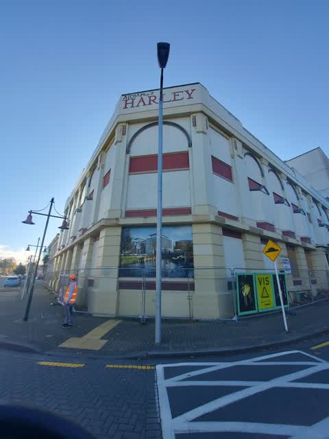
Harley building.
 Animal - Deceased —
Dead and squashed pigeon
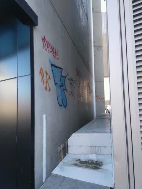
 Graffiti somewhere else —
 Pavement - General —
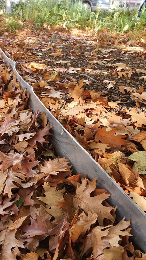
Aluminium edge to tree pit needs timber strip added to it to protect scooter riders and cyclist
 General Request —
Graffiti by punt stop
- Graffiti —
- Graffiti —
- Graffiti —
- Hazard — vehicle —
- Damaged Street Sign —
- Graffiti —
- Graffiti —
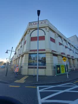 Graffiti —
Graffiti on lamp post says "Ben jamin my nuts down ya throat" On corner of Cambridge Terrace and Worcester Blvd
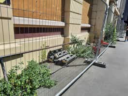 Roading/Streets —
Disgusting weeds & rubbish in a high for traffic area.
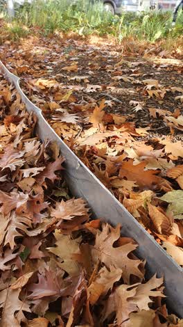 Roading/Streets —
Steel batten near tree on edge of shared path on cambridge tce has a sharp piece hanging of it that needs to be removed. The whole thing is
Graffiti —
Also reported on Cambridge Terrace
- 2 Cambridge Terrace — 251 reports
- 357 Cambridge Terrace — 116 reports
- 88 Cambridge Terrace — 92 reports
- 351 Cambridge Terrace — 81 reports
- 129 Cambridge Terrace — 80 reports
- 343 Cambridge Terrace — 79 reports
- 230 Cambridge Terrace — 74 reports
- 131 Cambridge Terrace — 72 reports
The street’s crash record
NZTA’s record names Cambridge Terrace in 44 crashes that hurt somebody since 2006 — 11 seriously hurt, nobody killed.
The green nearby
- Scott Statue Reserve — 76 m to the edge · Botanic
- Canterbury Provincial Council Reserve — 106 m to the edge · Botanic
- Godley Statue Reserve — 235 m to the edge · Botanic
- Cranmer Square — 248 m to the edge · Botanic · 2 ha
- Victoria Square — 257 m to the edge · Botanic · 2 ha
Parks within half a kilometre, measured to the boundary — the council’s open data.
The civic shelf nearby
- Civic Offices — 173 m away · Council office
- Armagh St — 226 m away · Car park
- Aldersgate — 279 m away · Car park
- Turanga Library — 348 m away · Library · Cathedral Square, Christchurch
- Scales — 363 m away · Car park
- Rolleston Avenue — 398 m away · Car park
- Triangle — 425 m away · Car park
Libraries, halls and the rest within half a kilometre — the council’s open data.
On the doorstep
- Sawyer — 20 m away · Bars & pubs
- South by Southeast Architects — 30 m away · Architects
- Manu — 44 m away · Restaurants
- Manu Restaurant And Bar — 46 m away · Restaurants
Businesses within four hundred metres, measured at the pin — OpenStreetMap and the council directories.
The bus nearby
- Hereford St near Montreal St — 225 m away · route 8
- Hereford St near Montreal St — 238 m away · route 8
The closest Metro stops, within four hundred and fifty metres.
The tracks through here
- Walk and bike track through Christchurch Central City — 54 m to the line · walk · bike
- Walk and bike track through Christchurch Central City — 63 m to the line · walk · bike
- Walk and bike track through Christchurch Central City — 78 m to the line · walk · bike
- Walk and bike track through Christchurch Central City — 115 m to the line · walk · bike
- Walk and bike track through Christchurch Central City — 192 m to the line · walk · bike
Tracks whose line passes within half a kilometre, measured to the line itself — the council’s open data.
The named ground
Named water within 500 m of this address, measured to the line or the edge; Named places within 1.5 km of this address; the council’s own structure register — bridges, boardwalks and steps standing nearby — the open map’s record.
The remembered names nearby
- Avon Riverbank Central City plaque — 15 m away ·
(no text found)
· 2000 - Avon Riverbank Central City plaque — 39 m away ·
(illegible – inscription panel at memorial)
- Kate Sheppard Memorial plaque — 49 m away ·
(illegible – ground plaque near riverside path)
Inscribed plaques within two hundred and fifty metres — the register’s pins, not surveyed spots. The whole roll is at /plaques.
Renting nearby
new bonds in Christchurch Central City ran about $508 a week — $42 below the city median of $550 — the suburb page keeps the rent record →.
What was here — Digby's Commercial School/Worcester Chambers and Setting
53 m away · 69 Worcester Street · located to ±19 m · the place’s own record →
On the register. Nothing researched here yet.
What was here — Worcester Street Bridge and Setting
54 m away · located to ±17 m · the place’s own record →
On the register. Nothing researched here yet.
What was here — Former Municipal Chambers and Setting
64 m away · 159 Oxford Terrace · located to ±15 m · the place’s own record →
On the register. Nothing researched here yet.
What was here — Canterbury Club Hitching Post and Setting
73 m away · the place’s own record →
On the register. Nothing researched here yet.
What was here — Canterbury Club Gas Lamp and Setting
74 m away · the place’s own record →
On the register. Nothing researched here yet.
The civic layer
This ground votes in Central ward — the Papanui-Innes-Central community board. Ward lines don’t always follow suburb lines; this one is measured at the pin, not the suburb’s centre.
What stood on this ground → · On the map → · From the air — the Crown’s aerials back to 1936; search the address on RetroLens →
Questions, answered briefly
17 council reports on record since August 2019 — most often graffiti (7), roading/streets (2), poles and signage - general (1).
Christchurch Central City, Christchurch — on Cambridge Terrace.
The heritage register names 5 places at or beside it — Digby's Commercial School/Worcester Chambers and Setting, Worcester Street Bridge and Setting.
Scott Statue Reserve — 76 m to its edge.