151 Cambridge Terrace, Christchurch Central City
26 reports on record since July 2015 · 23 with photographs. The street’s heaviest record is 2 Cambridge Terrace — 251 reports on file. Indicative rating valuation and school zones, hazards, bin day and what stood here before.
What gets reported here
- Graffiti — 8
- Roading/Streets — 6
- Road Signage — 2
- Hazard — vehicle — 2
- Rubbish/Recycling — 1
- Road Blockage — 1
Photographed here 23 on record


Reported here
- Road Signage —
sign is facing the building making the zone unenforceable p$60 mon to fri 9am to 5pm
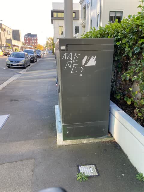
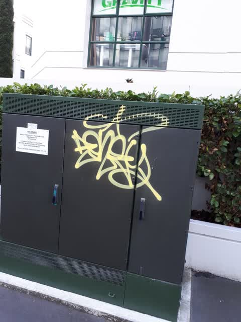
 Graffiti on a fence, building or structure —
 Yellow paint tag on building wall at 151 Cambridge Terrace facing the footpath.
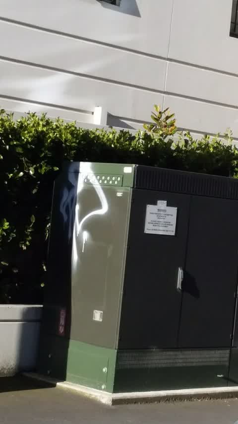
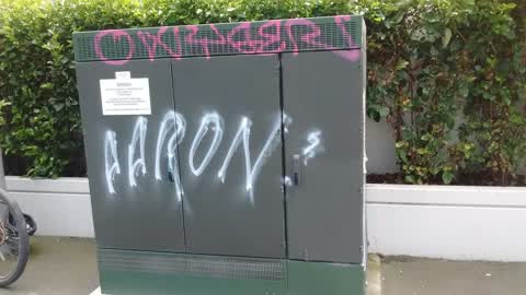
 Graffiti on a cabinet, pole or railway asset —
 Paint tags on Vodafone asset
 Animal - Deceased —
 Dead kereru by Lane Neave building. Assuming window strike.
 Graffiti somewhere else —
  Graffiti —
  Road Blockage —
 Signage sitting inside disabled parking bay preventing access No real reason for signage to exist at all as no evidence of works
- Poles and Signage - General —
- Road Signage —
 Hazard — vehicle —
 Hey! Gangs all here! Where the hell are you? Oh well. Same time, same place, Tuesday? We'll be here. Car blocking driveway. Again. Glouc
 Hazard — vehicle —
 Same car in same place at same time as last report. And the one before that. And the phones report. Parked car over the Gloucester st entran
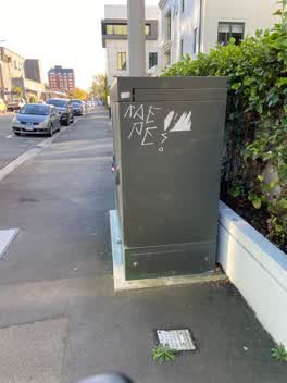 Graffiti —
 White and blue paint tags on Vodafone asset in Gloucester Street west of Cambridge Terrace.
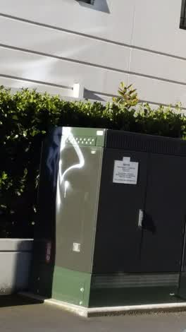 Graffiti —
 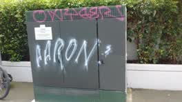 Graffiti —
 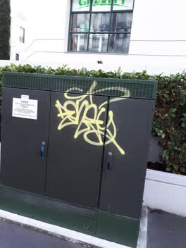 Graffiti —
 Graffiti —
poor tree
Graffiti —
Graffiti —
Roading/Streets —
This road landscape site has not been touched for a long time
Roading/Streets —
Vehicle Blocking footpath
Roading/Streets —
Excessive sound pollution in the early hours of the morning (starting approx 3am), and clearly heard at Barbadoes Street.
Parks —
The drinking fountain is in a disgusting mess and water is leaking from the spout and the weeds in the rose garden are taller than the roses
Roading/Streets —
Sign are all wrong. Building was made and street is still have yellow line with meter.
Roading/Streets —
Road cones in the water by new in-river sculpture. Also several in water off Manchester St bridge.
Rubbish/Recycling —
Litter in central city. Same for weeks.
Roading/Streets —
Also reported on Cambridge Terrace
- 2 Cambridge Terrace — 251 reports
- 357 Cambridge Terrace — 116 reports
- 88 Cambridge Terrace — 92 reports
- 351 Cambridge Terrace — 81 reports
- 129 Cambridge Terrace — 80 reports
- 343 Cambridge Terrace — 79 reports
- 230 Cambridge Terrace — 74 reports
- 131 Cambridge Terrace — 72 reports
The street’s crash record
NZTA’s record names Cambridge Terrace in 44 crashes that hurt somebody since 2006 — 11 seriously hurt, nobody killed.
The green nearby
- Canterbury Provincial Council Reserve — 70 m to the edge · Botanic
- Scott Statue Reserve — 107 m to the edge · Botanic
- Victoria Square — 218 m to the edge · Botanic · 2 ha
- Cranmer Square — 223 m to the edge · Botanic · 2 ha
- Godley Statue Reserve — 236 m to the edge · Botanic
Parks within half a kilometre, measured to the boundary — the council’s open data.
The civic shelf nearby
- Armagh St — 185 m away · Car park
- Civic Offices — 213 m away · Council office
- Aldersgate — 237 m away · Car park
- Turanga Library — 335 m away · Library · Cathedral Square, Christchurch
- Scales — 405 m away · Car park
- Rolleston Avenue — 412 m away · Car park
- Triangle — 443 m away · Car park
Libraries, halls and the rest within half a kilometre — the council’s open data.
On the doorstep
- City Social — 7 m away · Cafés
- Manu — 7 m away · Restaurants
- Manu Restaurant And Bar — 12 m away · Restaurants
- Vivace Espresso — 16 m away · Cafés
Businesses within four hundred metres, measured at the pin — OpenStreetMap and the council directories.
The bus nearby
- Hereford St near Montreal St — 264 m away · route 8
- Hereford St near Montreal St — 277 m away · route 8
The closest Metro stops, within four hundred and fifty metres.
The tracks through here
- Walk and bike track through Christchurch Central City — 73 m to the line · walk · bike
- Walk and bike track through Christchurch Central City — 92 m to the line · walk · bike
- Walk and bike track through Christchurch Central City — 104 m to the line · walk · bike
- Walk and bike track through Christchurch Central City — 130 m to the line · walk · bike
- Walk and bike track through Christchurch Central City — 151 m to the line · walk · bike
Tracks whose line passes within half a kilometre, measured to the line itself — the council’s open data.
The named ground
Named water within 500 m of this address, measured to the line or the edge; Named places within 1.5 km of this address; the council’s own structure register — bridges, boardwalks and steps standing nearby — the open map’s record.
The remembered names nearby
- Planted by / Miss R. Medlicott / Dominion President 1968–69 — 26 m away ·
PLANTED BY / Miss R. MEDLICOTT / DOMINION PRESIDENT 1968–69 / TO MARK THE / 21st ANNUAL GE
· 2000 - … Golden Jubilee / 1962 — 38 m away ·
… GOLDEN JUBILEE / 1962
· 2000 - Avon Riverbank Central City plaque — 50 m away ·
(no text found)
· 2000
Inscribed plaques within two hundred and fifty metres — the register’s pins, not surveyed spots. The whole roll is at /plaques.
Renting nearby
new bonds in Christchurch Central City ran about $508 a week — $42 below the city median of $550 — the suburb page keeps the rent record →.
What was here — Former CSA / CoCA Gallery and Setting
79 m away · 66 Gloucester Street · located to ±22 m · the place’s own record →
On the register. Nothing researched here yet.
What was here — Former Municipal Chambers and Setting
85 m away · 159 Oxford Terrace · located to ±15 m · the place’s own record →
On the register. Nothing researched here yet.
What was here — Digby's Commercial School/Worcester Chambers and Setting
87 m away · 69 Worcester Street · located to ±19 m · the place’s own record →
On the register. Nothing researched here yet.
What was here — Gloucester Street Bridge and Setting
89 m away · located to ±26 m · the place’s own record →
On the register. Nothing researched here yet.
What was here — Worcester Street Bridge and Setting
92 m away · located to ±17 m · the place’s own record →
On the register. Nothing researched here yet.
The civic layer
This ground votes in Central ward — the Papanui-Innes-Central community board. Ward lines don’t always follow suburb lines; this one is measured at the pin, not the suburb’s centre.
What stood on this ground → · On the map → · From the air — the Crown’s aerials back to 1936; search the address on RetroLens →
Questions, answered briefly
26 council reports on record since July 2015 — most often graffiti (8), roading/streets (6), road signage (2).
Christchurch Central City, Christchurch — on Cambridge Terrace.
The heritage register names 5 places at or beside it — Former CSA / CoCA Gallery and Setting, Former Municipal Chambers and Setting.
Canterbury Provincial Council Reserve — 70 m to its edge.