181 Madras Street, Christchurch Central City
19 reports on record since December 2017 · 16 with photographs. The street’s heaviest record is 153 Madras Street — 73 reports on file. Indicative rating valuation and school zones, hazards, bin day and what stood here before.
What gets reported here
Photographed here 16 on record


Reported here
 Litter —
Broken glass and smashed bottles on cycleway
 Litter —
Broken glass and smashed bottles on cycleway
 Graffiti on a fence, building or structure —
There is graffiti on this building.
 Pavement - Damaged —
Dangerous post remnant on footpath. Tripping hazard especially as it’s hidden by autumn leaves. Hazard for pedestrians/ Stadium goers
 Bus Shelter Issue —
Broken bus stop window madras st, glass everywhere
 Graffiti on a fence, building or structure —
Graffiti on boxing around garden
 Graffiti on a fence, building or structure —
Hi Can your team please help us with the graffiti on our wall. Thanks ARA
 Pavement - Damaged —
Sink hole/ failed pavement in live lane. Madras street opposite ara in front of bus stop
 Poles and Signage - General —
Very large very deep hole in traffic lane
 Graffiti on a cabinet, pole or railway asset —
Black and orange paint tags on concrete lamp pole opposite Plains FM on Madras Street
 Graffiti somewhere else —
 Graffiti somewhere else —
 Graffiti —
Planter box
- Pavement - General —
- Graffiti —
- Graffiti —
Rubbish/Recycling —
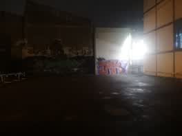 Graffiti —
Willson carpark
Roading/Streets —
Blocking the footpath and left hand turning traffic . No driver visible was there greater than 5 minutes
Also reported on Madras Street
- 153 Madras Street — 73 reports
- 169 Madras Street — 50 reports
- 145 Madras Street — 49 reports
- 282 Madras Street — 37 reports
- 160 Madras Street — 35 reports
- 163 Madras Street — 32 reports
- 281 Madras Street — 29 reports
- 167 Madras Street — 28 reports
The street’s crash record
NZTA’s record names Madras Street in 161 crashes that hurt somebody since 2006 — 17 seriously hurt, nobody killed.
The green nearby
- Wilson Park — 20 m to the edge
- Excelsior Hotel Reserve — 303 m to the edge · Botanic
- Gasson Reserve — 382 m to the edge
- Washington Way Reserve — 422 m to the edge · Sports ground
- Science Alive Reserve — 442 m to the edge
Parks within half a kilometre, measured to the boundary — the council’s open data.
The civic shelf nearby
- St Asaph — 105 m away · Car park
Libraries, halls and the rest within half a kilometre — the council’s open data.
On the doorstep
- Zaytun — 7 m away · Fast food
- Flux - Boxed Quarter — 11 m away · Bars & pubs
- Monotone — 11 m away · Clothing
- Ride On Super Sound — 11 m away · Music
Businesses within four hundred metres, measured at the pin — OpenStreetMap and the council directories.
The bus nearby
- Madras St near Southwark St — 36 m away · route 8, route 84, route 85, route 95
- Ara Institute — 132 m away · route 1, route 3, route 5, route 80, route 81
The closest Metro stops, within four hundred and fifty metres.
The tracks through here
- Walk and bike track through Christchurch Central City — 32 m to the line · walk · bike
- Walk and bike track through Christchurch Central City — 32 m to the line · walk · bike
- Walk and bike track through Christchurch Central City — 152 m to the line · walk · bike
- Walk and bike track through Christchurch Central City — 236 m to the line · walk · bike
- Walk and bike track through Christchurch Central City — 363 m to the line · walk · bike
Tracks whose line passes within half a kilometre, measured to the line itself — the council’s open data.
The named ground
Named places within 1.5 km of this address; the council’s own structure register — bridges, boardwalks and steps standing nearby — the open map’s record.
The remembered names nearby
- ‘corgis on High’ — Christchurch City Public Artwork — 220 m away ·
‘Corgis on High’ — Christchurch City public artwork, 6 December 2003
· 2009 - The First Public Water Supply Well Was Drilled Near This — 225 m away ·
THE FIRST PUBLIC WATER SUPPLY WELL was drilled near this site on 10 February 1864 by the C
· 2009
Inscribed plaques within two hundred and fifty metres — the register’s pins, not surveyed spots. The whole roll is at /plaques.
Renting nearby
new bonds in Christchurch Central City ran about $508 a week — $42 below the city median of $550 — the suburb page keeps the rent record →.
What was here — 129 High Street
58 m away · 1/129 High Street · located to ±17 m · the place’s own record →
On the register. Nothing researched here yet.
What was here — Commercial Building and Setting. Duncan's Buildings
97 m away · 147 High Street · located to ±45 m · the place’s own record →
On the register. Nothing researched here yet.
What was here — Commercial Building Façade and Setting, Former A J Whites
182 m away · 181 High Street · located to ±20 m · the place’s own record →
On the register. Nothing researched here yet.
What was here — 319 St Asaph Street
214 m away · 319 St Asaph Street · located to ±21 m · the place’s own record →
On the register. Nothing researched here yet.
What was here — Triangle Reserve and Setting
231 m away · 189F High Street · located to ±17 m · the place’s own record →
On the register. Nothing researched here yet.
The civic layer
This ground votes in Central ward — the Papanui-Innes-Central community board. Ward lines don’t always follow suburb lines; this one is measured at the pin, not the suburb’s centre.
What stood on this ground → · On the map → · From the air — the Crown’s aerials back to 1936; search the address on RetroLens →
Questions, answered briefly
19 council reports on record since December 2017 — most often graffiti (4), graffiti on a fence, building or structure (3), pavement - damaged (2).
Christchurch Central City, Christchurch — on Madras Street.
The heritage register names 5 places at or beside it — 129 High Street, Commercial Building and Setting. Duncan's Buildings.
Wilson Park — 20 m to its edge.