184 Oxford Terrace, Christchurch Central City
109 reports on record since December 2019 · 93 with photographs. The street’s heaviest record is 159 Oxford Terrace — 180 reports on file. Indicative rating valuation and school zones, hazards, bin day and what stood here before.
What gets reported here
Photographed here 93 on record






Reported here the newest 80 of 109
 Graffiti on a playground or in a park —
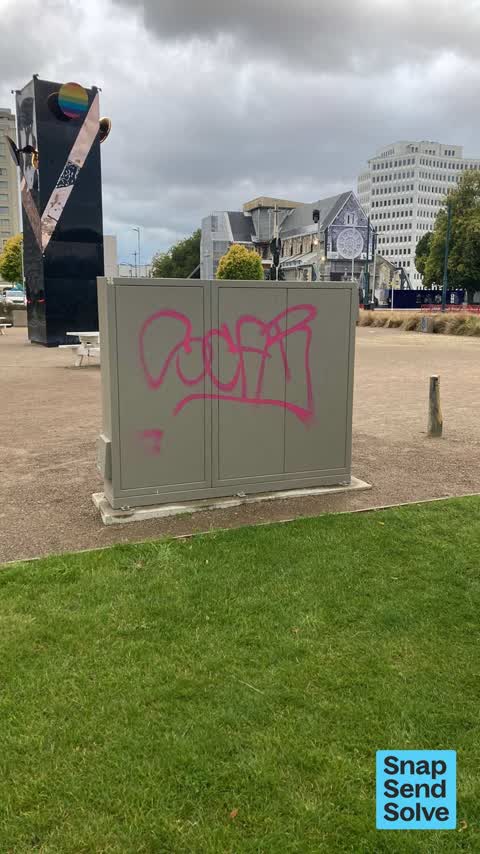
Tagging on cabinet in square
 Graffiti on a playground or in a park —
Tagging on small cabinet by Convention Center
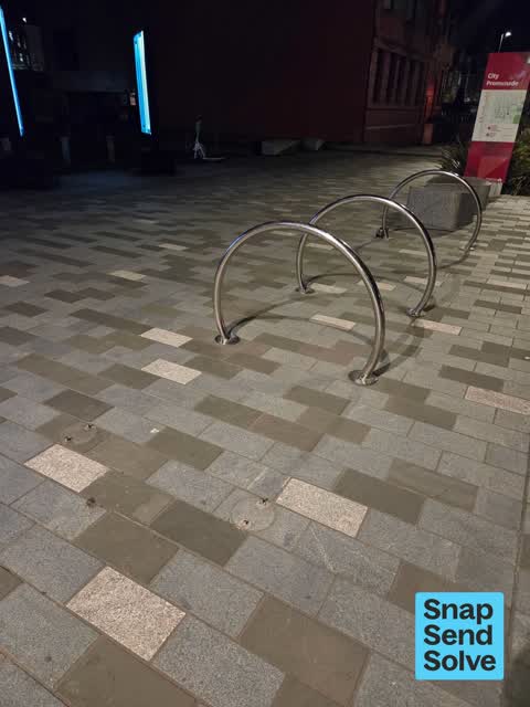
 Pavement - Damaged —
2 bike racks gone leaving bolts sticking out of ground. trip hazard.
 Graffiti on a fence, building or structure —
graffiti
 Graffiti on a sign, mural or public art —
 Graffiti on a traffic light pole or cabinet, or wa —
Parks team couldn’t remove
 Graffiti on a bus stop or public toilet —
Parks team couldn’t remove
 Graffiti on a fence, building or structure —
 Water Leak —
water supply valve is leaking
 Graffiti on a fence, building or structure —
 Poles and Signage - General —
Trip hazard. Sign pole missing leaving hazard.
 Graffiti on a fence, building or structure —
Grey bix in Square near Te Pae
 General Request —
Not sure but says main earthing conductor
 Park - General Request —
Park bench beside Te Pae plus another one already sent
 Park - General Request —
Picnic table beside Te Pae
 Pavement - Damaged —
missing bike rack. bolts sticking up out of pavement make for a tripping hazard
 Public Toilet —
This is an absolute disgrace - no toilet seats, no soap - surely with the amount of tourists that come to Christchurch deserve better than
 Poles and Signage - General —
 Graffiti on a fence, building or structure —
Graffiti
 Graffiti on a sign, mural or public art —
Tagging on a sign
 Graffiti on a fence, building or structure —
On city pr0minzde near Gloucester Street Bridge and river
 Graffiti on a fence, building or structure —
 Graffiti on a fence, building or structure —
 Graffiti on a fence, building or structure —
 Graffiti on a fence, building or structure —
 Graffiti on a bus stop or public toilet —
Graffiti on a public toilet wall
 General Request —
Broken art installation
 Poles and Signage - General —
Every pole in the CBD?
 Graffiti on a fence, building or structure —
 Graffiti on a fence, building or structure —
 Rubbish and Bins - General —
Damaged ccc bin
 Graffiti on a fence, building or structure —
Grafitti
 Graffiti on a fence, building or structure —
 Graffiti on a fence, building or structure —
 Graffiti on a fence, building or structure —
 Graffiti on a fence, building or structure —
Graffiti depicting a swastika, clearly visible painted on a building outside Te Pae
 Graffiti on a road, footpath or bridge —
 Graffiti on a fence, building or structure —
 Graffiti on a fence, building or structure —
 Animal - Deceased —
Deceased pigeon at the Convention centre vicinity
 Graffiti on a fence, building or structure —
 Graffiti on a fence, building or structure —
Graffiti on table
 Graffiti on a fence, building or structure —
Eastside of Gloucester st bridge
 Graffiti on a sign, mural or public art —
 Graffiti on a fence, building or structure —
 Graffiti on a fence, building or structure —
Naveya and Sloane building
 Graffiti on a fence, building or structure —
 Graffiti on a fence, building or structure —
 Graffiti on a fence, building or structure —
 Graffiti on a fence, building or structure —
 Graffiti on a sign, mural or public art —
 Graffiti on a fence, building or structure —
 Graffiti on a sign, mural or public art —
 Graffiti on a fence, building or structure —
 Graffiti on a fence, building or structure —
 Graffiti on a sign, mural or public art —
 Graffiti on a fence, building or structure —
 Graffiti on a fence, building or structure —
 Graffiti on a fence, building or structure —
 Graffiti on a sign, mural or public art —
 Graffiti on a fence, building or structure —
 Graffiti on a fence, building or structure —
 Graffiti on a sign, mural or public art —
 Graffiti somewhere else —
Multiple large white tables have graffiti on them grassed area sea pics
 Graffiti on a fence, building or structure —
 Graffiti somewhere else —
Box 216
 Graffiti somewhere else —
 Graffiti on a fence, building or structure —
 Vandalism - General —
 Graffiti somewhere else —
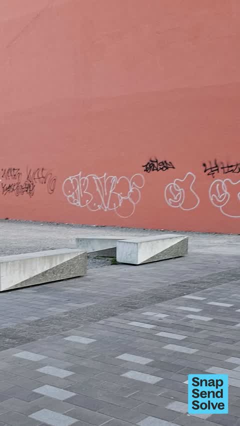
On side of brick red building Oxford tce south of conference Centre
 Dumped Rubbish —
 Vandalism - General —
 Graffiti on a fence, building or structure —
 Graffiti somewhere else —
 Graffiti on a fence, building or structure —
Tagging on building
 Street Light Outage —
Street light not working
 Street Light Outage —
Street light not working
 Graffiti on a cabinet, pole or railway asset —
Tags all over power box on wooden post in the front of the pae.
 Graffiti on a fence, building or structure —
Building opposite Ta Pae.
 Graffiti on a fence, building or structure —
29 more on record — the live page pages them.
Also reported on Oxford Terrace
- 159 Oxford Terrace — 180 reports
- 153 Oxford Terrace — 174 reports
- 95 Oxford Terrace — 126 reports
- 211 Oxford Terrace — 125 reports
- 182 Oxford Terrace — 122 reports
- 294 Oxford Terrace — 92 reports
- 152 Oxford Terrace — 87 reports
- 54 Oxford Terrace — 73 reports
The street’s crash record
NZTA’s record names Oxford Terrace in 56 crashes that hurt somebody since 2006 — 1 person killed, 11 seriously hurt.
The green nearby
- Canterbury Provincial Council Reserve — 39 m to the edge · Botanic
- Scott Statue Reserve — 133 m to the edge · Botanic
- Godley Statue Reserve — 141 m to the edge · Botanic
- Victoria Square — 148 m to the edge · Botanic · 2 ha
- Cathedral Square — 171 m to the edge · Botanic
Parks within half a kilometre, measured to the boundary — the council’s open data.
The civic shelf nearby
- Armagh St — 214 m away · Car park
- Turanga Library — 218 m away · Library · Cathedral Square, Christchurch
- Aldersgate — 243 m away · Car park
- Civic Offices — 302 m away · Council office
- Triangle — 377 m away · Car park
- Scales — 480 m away · Car park
Libraries, halls and the rest within half a kilometre — the council’s open data.
On the doorstep
- Miro — 37 m away · Restaurants
- Crane Brothers — 46 m away · Clothing
- Cafe Miro — 61 m away · Cafés
- Avon River Precinct — 82 m away · Attractions
Businesses within four hundred metres, measured at the pin — OpenStreetMap and the council directories.
The bus nearby
- Hereford St near Colombo St — 344 m away · route 8
- Hereford St near Colombo St — 346 m away · route 8
The closest Metro stops, within four hundred and fifty metres.
The tracks through here
- Walk and bike track through Christchurch Central City — 23 m to the line · walk · bike
- Walk and bike track through Christchurch Central City — 67 m to the line · walk · bike
- Walk and bike track through Christchurch Central City — 108 m to the line · walk · bike
- Walk and bike track through Christchurch Central City — 134 m to the line · walk · bike
- Walk and bike track through Christchurch Central City — 134 m to the line · walk · bike
Tracks whose line passes within half a kilometre, measured to the line itself — the council’s open data.
The named ground
Named water within 500 m of this address, measured to the line or the edge; Named places within 1.5 km of this address; the council’s own structure register — bridges, boardwalks and steps standing nearby — the open map’s record.
The remembered names nearby
- Antony Gormley / Stay 2015 — 75 m away ·
Antony Gormley / STAY 2015 / Commissioned by Christchurch City Council for integration int
- Provincial Council Building 1865 — Canterbury Centenary — 78 m away ·
PROVINCIAL COUNCIL BUILDING 1865 — Canterbury Centenary plaque
· 2009 - … Golden Jubilee / 1962 — 81 m away ·
… GOLDEN JUBILEE / 1962
· 2000
Inscribed plaques within two hundred and fifty metres — the register’s pins, not surveyed spots. The whole roll is at /plaques.
Renting nearby
new bonds in Christchurch Central City ran about $508 a week — $42 below the city median of $550 — the suburb page keeps the rent record →.
What was here — Gloucester Street Bridge and Setting
35 m away · located to ±26 m · the place’s own record →
On the register. Nothing researched here yet.
What was here — Former Midland Club and Setting
40 m away · 176 Oxford Terrace · located to ±18 m · the place’s own record →
On the register. Nothing researched here yet.
What was here — Canterbury Provincial Council Buildings Courtyard/Grounds
80 m away · 280 Durham Street North · located to ±64 m · the place’s own record →
On the register. Nothing researched here yet.
What was here — Canterbury Provincial Council Buildings
89 m away · 280 Durham Street North · located to ±51 m · the place’s own record →
On the register. Nothing researched here yet.
What was here — Canterbury Provincial Council Buildings Former Land Transfer Office
113 m away · 86 Armagh Street · located to ±15 m · the place’s own record →
On the register. Nothing researched here yet.
The civic layer
This ground votes in Central ward — the Papanui-Innes-Central community board. Ward lines don’t always follow suburb lines; this one is measured at the pin, not the suburb’s centre.
What stood on this ground → · On the map → · From the air — the Crown’s aerials back to 1936; search the address on RetroLens →
Questions, answered briefly
109 council reports on record since December 2019 — most often graffiti on a fence, building or structure (42), graffiti (22), graffiti on a sign, mural or public art (8).
Christchurch Central City, Christchurch — on Oxford Terrace.
The heritage register names 5 places at or beside it — Gloucester Street Bridge and Setting, Former Midland Club and Setting.
Canterbury Provincial Council Reserve — 39 m to its edge.