188 Durham Street South, Christchurch Central City
18 reports on record since October 2017 · 16 with photographs. The street’s heaviest record is 214 Durham Street South — 33 reports on file. Indicative rating valuation and school zones, hazards, bin day and what stood here before.
What gets reported here
Photographed here 16 on record


Reported here
 Graffiti on a fence, building or structure —
entrance to the alleyway between vino fino and underground coffee
 Graffiti on a fence, building or structure —
graffiti on grey wall
 Graffiti on a fence, building or structure —
Alleyway between vino fino and Underground coffee
 Graffiti on a fence, building or structure —
Alleyway between Vino Fino and Underground Coffee
 Graffiti on a fence, building or structure —
Window of Underground Coffee. On the alleyway between Underground and Vino Fino.
 Graffiti somewhere else —
 Graffiti on a fence, building or structure —
Corner of the Underground building on the alleyway between them and Vino Fino
 Graffiti on a fence, building or structure —
Side of Underground coffee in the alley by vino fino
 Graffiti somewhere else —
Looks like paint washed off
 Graffiti on a fence, building or structure —
Alley way between underground coffee and vino fino
 Hazard — vehicle —
Been parked in 30 min carpark all day and parked over a fire hydrant
- Hazard — vehicle —
Been parked in a 30 min carpark all day. Also parked over a fire hydrant
 Graffiti on a fence, building or structure —
Tagging on the walls of an alley next to Vino Fino
 Graffiti on a fence, building or structure —
Alley way between vino fino and underground
 Hazard — vehicle —
Parked well over the parking lines blocking entry and egress from driveway
- Graffiti —
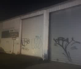 Graffiti —
Roading/Streets —
Unsealed enable trench in footpath. Please get them or contractors responsible to return and ac. Thanks
Also reported on Durham Street South
- 214 Durham Street South — 33 reports
- 176 Durham Street South — 30 reports
- 175 Durham Street South — 25 reports
- 241 Durham Street South — 22 reports
- 227 Durham Street South — 19 reports
- 158F Durham Street South — 19 reports
- 158 Durham Street South — 19 reports
- 200 Durham Street South — 16 reports
The street’s crash record
NZTA’s record names Durham Street South in 20 crashes that hurt somebody since 2006 — 4 seriously hurt, nobody killed.
The green nearby
- Tiffany Reserve — 308 m to the edge
- Friendship Corner — 321 m to the edge · Botanic
- Bridge Of Remembrance — 396 m to the edge · Botanic
- City Mall — 466 m to the edge
Parks within half a kilometre, measured to the boundary — the council’s open data.
The civic shelf nearby
- Re:start - Lichfield St — 289 m away · Car park
- Scales — 441 m away · Car park
Libraries, halls and the rest within half a kilometre — the council’s open data.
On the doorstep
- Vino Fino — 7 m away · Bottle stores
- Underground Coffee Roastery — 15 m away · Delis
- St John Shop — 38 m away · Op shops
- Peak Orthodontics — 49 m away · Dentists
Businesses within four hundred metres, measured at the pin — OpenStreetMap and the council directories.
The bus nearby
- St Asaph St near Colombo St — 158 m away · route 3, route 5, route 7, route 60, route 80, route 81, route 84, route 85, route 86
- South City (Northbound) — 285 m away · route 1, route 8, route 44
The closest Metro stops, within four hundred and fifty metres.
The tracks through here
- Walk and bike track through Christchurch Central City — 166 m to the line · walk · bike
- Walk and bike track through Christchurch Central City — 307 m to the line · walk · bike
- Walk and bike track through Christchurch Central City — 309 m to the line · walk · bike
- Walk and bike track through Christchurch Central City — 348 m to the line · walk · bike
- Walk and bike track through Christchurch Central City — 350 m to the line · walk · bike
Tracks whose line passes within half a kilometre, measured to the line itself — the council’s open data.
The named ground
Named water within 500 m of this address, measured to the line or the edge; Named places within 1.5 km of this address — the open map’s record.
Renting nearby
new bonds in Christchurch Central City ran about $508 a week — $42 below the city median of $550 — the suburb page keeps the rent record →.
What was here — St Michael's School Hall and Setting
192 m away · 243 Durham Street South · located to ±14 m · the place’s own record →
On the register. Nothing researched here yet.
What was here — St Michael's School Stone Building and Setting
230 m away · located to ±16 m · the place’s own record →
On the register. Nothing researched here yet.
The civic layer
This ground votes in Central ward — the Papanui-Innes-Central community board. Ward lines don’t always follow suburb lines; this one is measured at the pin, not the suburb’s centre.
What stood on this ground → · On the map → · From the air — the Crown’s aerials back to 1936; search the address on RetroLens →
Questions, answered briefly
18 council reports on record since October 2017 — most often graffiti on a fence, building or structure (10), hazard — vehicle (3), graffiti somewhere else (2).
Christchurch Central City, Christchurch — on Durham Street South.
The heritage register names 2 places at or beside it — St Michael's School Hall and Setting, St Michael's School Stone Building and Setting.
Tiffany Reserve — 308 m to its edge.