19 Ferry Road, Christchurch Central City
18 reports on record since October 2016 · 15 with photographs. The street’s heaviest record is 77 Ferry Road — 29 reports on file. Indicative rating valuation and school zones, hazards, bin day and what stood here before.
What gets reported here
Photographed here 15 on record


Reported here
 Graffiti on a bus stop or public toilet —
Tagged street light
 Graffiti on a road, footpath or bridge —
graffiti on edge of cycle track
 Graffiti on a bus stop or public toilet —
Graffiti on digital bus time table see pic
 Accessibility —
Tagged Street light
 Graffiti on a fence, building or structure —
Hi team More graffiti if you are able to help us out with this issue would be greatly appreciated. Cheers ARA
 Graffiti on a fence, building or structure —
 Graffiti on a fence, building or structure —
 Graffiti on a road, footpath or bridge —
 Graffiti somewhere else —
 Graffiti on a cabinet, pole or railway asset —
HABIT white paint tag on metal lamp pole on St Asaph Street west of Barbadoes Street.
 Graffiti —
Opposite exit from ara on to Ferry Rd
- Vandalism - General —
- Graffiti —
- Graffiti —
 Graffiti —
White paint tag on metal lamp pole by Ara carpark on St Asaph Street.
 Graffiti —
Black paint tag on reverse side of Ara parking sign facing the footpath on St Asaph Street.
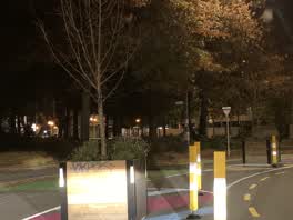 Graffiti —
Roading/Streets —
Car parked on yellow lines blocking driveway into car park.
Also reported on Ferry Road
- 77 Ferry Road — 29 reports
- 71 Ferry Road — 25 reports
- 62 Ferry Road — 21 reports
- 49 Ferry Road — 20 reports
- 67 Ferry Road — 18 reports
- 60 Ferry Road — 18 reports
- 47 Ferry Road — 18 reports
- 11 Ferry Road — 18 reports
The street’s crash record
NZTA’s record names Ferry Road in 30 crashes that hurt somebody since 2006 — 5 seriously hurt, nobody killed.
The green nearby
- Wilson Park — 52 m to the edge
- Washington Way Reserve — 386 m to the edge · Sports ground
- Gasson Reserve — 424 m to the edge
- Excelsior Hotel Reserve — 430 m to the edge · Botanic
- Science Alive Reserve — 491 m to the edge
Parks within half a kilometre, measured to the boundary — the council’s open data.
The civic shelf nearby
- St Asaph — 97 m away · Car park
Libraries, halls and the rest within half a kilometre — the council’s open data.
On the doorstep
- Good Habit — 60 m away · Cafés
- Visions on Campus — 94 m away · Restaurants
- The Pantry — 96 m away · Fast food
- Seido Karate — 100 m away · Sports centres
Businesses within four hundred metres, measured at the pin — OpenStreetMap and the council directories.
The bus nearby
- Ara Institute — 38 m away · route 1, route 3, route 5, route 80, route 81
- St Asaph St near Barbadoes St — 49 m away · route 80
The closest Metro stops, within four hundred and fifty metres.
The tracks through here
- Walk and bike track through Christchurch Central City — 19 m to the line · walk · bike
- Walk and bike track through Christchurch Central City — 149 m to the line · walk · bike
- Walk and bike track through Christchurch Central City — 160 m to the line · walk · bike
- Walk and bike track through Christchurch Central City — 368 m to the line · walk · bike
- Walk and bike track through Christchurch Central City — 368 m to the line · walk · bike
Tracks whose line passes within half a kilometre, measured to the line itself — the council’s open data.
The named ground
Named places within 1.5 km of this address; the council’s own structure register — bridges, boardwalks and steps standing nearby — the open map’s record.
Renting nearby
new bonds in Christchurch Central City ran about $508 a week — $42 below the city median of $550 — the suburb page keeps the rent record →.
What was here — 319 St Asaph Street
70 m away · 319 St Asaph Street · located to ±21 m · the place’s own record →
On the register. Nothing researched here yet.
What was here — 129 High Street
201 m away · 1/129 High Street · located to ±17 m · the place’s own record →
On the register. Nothing researched here yet.
What was here — Commercial Building and Setting. Duncan's Buildings
240 m away · 147 High Street · located to ±45 m · the place’s own record →
On the register. Nothing researched here yet.
The civic layer
This ground votes in Central ward — the Papanui-Innes-Central community board. Ward lines don’t always follow suburb lines; this one is measured at the pin, not the suburb’s centre.
What stood on this ground → · On the map → · From the air — the Crown’s aerials back to 1936; search the address on RetroLens →
Questions, answered briefly
18 council reports on record since October 2016 — most often graffiti (6), graffiti on a fence, building or structure (3), graffiti on a road, footpath or bridge (2).
Christchurch Central City, Christchurch — on Ferry Road.
The heritage register names 3 places at or beside it — 319 St Asaph Street, 129 High Street.
Wilson Park — 52 m to its edge.