192 Barbadoes Street
11 council reports since May 2020, 10 carrying a photograph. The street’s heaviest record is 390 Barbadoes Street, 65 reports on file.
On the register here
- 319 St Asaph Street, 319 St Asaph Street (72m)
From the air, then
Sourced from Canterbury Maps and partners. LINZ, CC BY 3.0 NZ. Each frame is cut from Environment Canterbury’s historic imagery MapServer for that decade, only where the Footprints layer names a CC BY survey (NZAM-covered spots stay out). RetroLens holds more Crown aerials →
The green nearby
- Wilson Park, 185 m to the edge
- Latimer Square, 466 m to the edge · Botanic · 2 ha
- Excelsior Hotel Reserve, 474 m to the edge · Botanic
- Washington Way Reserve, 493 m to the edge · Sports ground
Parks within half a kilometre, measured to the boundary, the council’s open data. The whole roll is at /parks.
The civic shelf nearby
- St Asaph, 178 m away · Car park
Libraries, halls and the rest within half a kilometre, the council’s open data.
On the doorstep
- Henry's, 25 m away · Bottle stores
- Magnitude Cafe & Roastery, 48 m away · Cafés
- Galaxy Arcade, 73 m away · Bars & pubs
- Arcadia Retro Arcade & Pinball Emporia, 74 m away · Arcades
Businesses within four hundred metres, measured at the pin, OpenStreetMap and the council directories.
The bus nearby
- St Asaph St near Barbadoes St, 99 m away · route 80
- Ara Institute, 177 m away · route 1, route 3, route 5, route 80, route 81
The closest Metro stops, within four hundred and fifty metres.
The tracks through here
- Walk and bike track through Christchurch Central City, 42 m to the line · walk · bike
- Walk and bike track through Christchurch Central City, 149 m to the line · walk · bike
- Walk and bike track through Christchurch Central City, 262 m to the line · walk · bike
- Walk and bike track through Christchurch Central City, 387 m to the line · walk · bike
- Walk and bike track through Christchurch Central City, 387 m to the line · walk · bike
Tracks whose line passes within half a kilometre, the council’s open data.
The named ground
Named places within 1.5 km of this address; the council’s own structure register, bridges, boardwalks and steps standing nearby, the open map’s record.
Renting nearby
new bonds in Christchurch Central City ran about $508 a week, $42 below the city median of $550, the suburb page keeps the rent record →.
What gets reported here
- Graffiti, 5
- Graffiti on a fence, building or structure, 2
- Pavement - General, 1
- Graffiti somewhere else, 1
- Graffiti on a sign, mural or public art, 1
- General Request, 1
Photographed here 10 on record


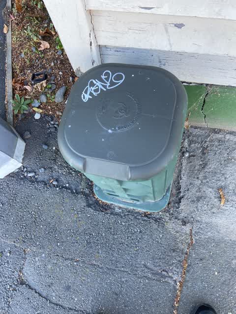
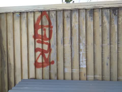
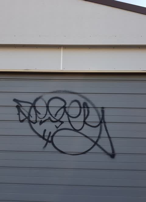
What’s on record
 Graffiti somewhere else, 5 Feb 2025
 Graffiti on a fence, building or structure, 12 Jan 2025
 Graffiti on a fence, building or structure, 12 Jan 2025
 Pavement - General, 7 Nov 2024
Loose telco cables on the footpath by 192 Barbadoes Street need tidying up before someone trips over them.
 Graffiti on a sign, mural or public art, 7 Nov 2024
Silver and red paint tags on front of the road sign plus a black paint tag on the back, by 192 Barbadoes Street.
 General Request, 11 Sept 2024
Loose cables need removing or tying up by 182 Barbadoes Street. May belong to Enable?
- Graffiti, 24 Nov 2022
 Graffiti, 31 Aug 2022
ORGANZ white paint tag on telecommunications asset which also needs a new number, opposite 182 Barbadoes Street.
 Graffiti, 16 Apr 2022
ORGANZ white paint tag on green telecommunications asset opposite 182 Barbadoes Street. This asset also needs a new number.
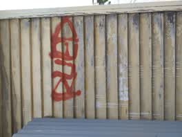 Graffiti, 6 Dec 2020
painted out by volunteer
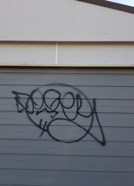 Graffiti, 27 May 2020
185 Barbados Street, garage door Christchurch
Elsewhere on Barbadoes Street
- 390 Barbadoes Street, 65 reports
- 259 Barbadoes Street, 51 reports
- 384 Barbadoes Street, 47 reports
- 321 Barbadoes Street, 37 reports
- 377 Barbadoes Street, 36 reports
- 288 Barbadoes Street, 29 reports
- 407 Barbadoes Street, 28 reports
- 324 Barbadoes Street, 28 reports
The street’s crash record
NZTA’s record names Barbadoes Street in 213 crashes that hurt somebody since 2006, 1 person killed, 31 seriously hurt.
The civic layer
This ground votes in Central ward, the Papanui-Innes-Central community board is its local layer. Ward lines don’t always follow suburb lines; this one is measured at the pin, not the suburb’s centre. The whole roll is at /wards.
Barbadoes Street, the whole record → · Everything about Christchurch Central City → · What stood on this ground → · On the map → · From the air, RetroLens holds the Crown’s aerials back to 1936; search the address there →
Questions, answered briefly
11 council reports on record since May 2020, most often graffiti (5), graffiti on a fence, building or structure (2), pavement - general (1).
Christchurch Central City, Christchurch, on Barbadoes Street.
The heritage register names a place at or beside it, 319 St Asaph Street.
Wilson Park, 185 m to its edge.