196 Fitzgerald Avenue, Christchurch Central City
20 reports on record since July 2017 · 16 with photographs. The street’s heaviest record is 162 Fitzgerald Avenue — 79 reports on file. Indicative rating valuation and school zones, hazards, bin day and what stood here before.
What gets reported here
Photographed here 16 on record


Reported here
 Pothole —
potholes
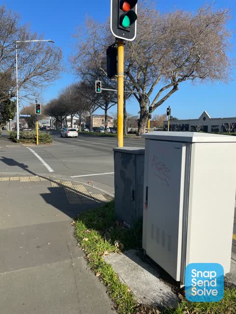
 Graffiti on a fence, building or structure —
Red paint tag on fence by 196 Fitzgerald Avenue corner of Armagh Street.
 Dumped Rubbish —
 Damaged Road —
Speed sign has been snapped off also the corresponding sign on the Stanmore Rd end has been tampered with. We need these signs to keep our S
 Graffiti on a fence, building or structure —
 Graffiti somewhere else —
 Graffiti somewhere else —
 Graffiti somewhere else —
Orion
 Dumped Rubbish —
Green waste left in a Kosco trolley
 Graffiti —
 Graffiti —
- Water Leak —
- Road Signage —
- Graffiti —
- Road Signage —
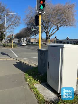 Graffiti —
Graffiti at Armagh street. At the signal
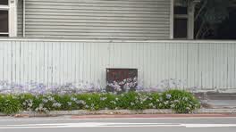 Graffiti —
Graffiti —
Rubbish/Recycling —
On Armagh St Fitzgerald Ave corner. Pile has been growing
Also reported on Fitzgerald Avenue
- 162 Fitzgerald Avenue — 79 reports
- 67 Fitzgerald Avenue — 43 reports
- 100 Fitzgerald Avenue — 41 reports
- 112 Fitzgerald Avenue — 40 reports
- 187 Fitzgerald Avenue — 34 reports
- 234 Fitzgerald Avenue — 31 reports
- 64 Fitzgerald Avenue — 30 reports
- 107 Fitzgerald Avenue — 28 reports
The street’s crash record
NZTA’s record names Fitzgerald Avenue in 283 crashes that hurt somebody since 2006 — 5 people killed, 41 seriously hurt.
The green nearby
- William Brittan — 220 m to the edge
- Worcester Pump Station Park — 248 m to the edge
- Chester Street East Reserve — 267 m to the edge
- Avon Riverbank Central City — 271 m to the edge · 6 ha
- Beverley Park — 309 m to the edge · 3 ha
Parks within half a kilometre, measured to the boundary — the council’s open data.
On the doorstep
- Trinity Glass — 59 m away · Craft
- McGirr Motors — 138 m away · Car repair
- Figlo Laundromat — 154 m away · Laundromats
- e-motors — 161 m away · Car repair
Businesses within four hundred metres, measured at the pin — OpenStreetMap and the council directories.
The bus nearby
- Fitzgerald Ave near Armagh St — 84 m away · route 7
- Fitzgerald Ave near Avonside Dr — 123 m away · route 7
The closest Metro stops, within four hundred and fifty metres.
The tracks through here
- Walk and bike track through Christchurch Central City — 6 m to the line · walk · bike
- Walk and bike track through Christchurch Central City — 29 m to the line · walk · bike
- Walk and bike track through Christchurch Central City — 29 m to the line · walk · bike
- Walk and bike track through Christchurch Central City — 29 m to the line · walk · bike
- Walk and bike track through Christchurch Central City — 244 m to the line · walk · bike
Tracks whose line passes within half a kilometre, measured to the line itself — the council’s open data.
The named ground
Named water within 500 m of this address, measured to the line or the edge; Named places within 1.5 km of this address; the council’s own structure register — bridges, boardwalks and steps standing nearby — the open map’s record.
The remembered names nearby
- William Guise Brittan Historical Garden on 26 November 1994 — 224 m away ·
WILLIAM GUISE BRITTAN HISTORICAL GARDEN On 26 November 1994 the first shrubs were planted
· 2009 - He Tohu Whakamaumahara o Matou Tipuna — 233 m away ·
He tohu whakamaumahara o matou tipuna
· 2009 - Thanks to / Käinga ORA — 242 m away ·
Thanks to / KÄinga Ora / for their contribution to this seat / and the local community
Inscribed plaques within two hundred and fifty metres — the register’s pins, not surveyed spots. The whole roll is at /plaques.
Renting nearby
new bonds in Christchurch Central City ran about $508 a week — $42 below the city median of $550 — the suburb page keeps the rent record →.
What was here — Dwelling and Setting
on this spot · 196 Fitzgerald Avenue · located to ±10 m · the place’s own record →
On the register. Nothing researched here yet.
What was here — Former Boiler House and Setting
178 m away · 175 Chester Street East · located to ±10 m · the place’s own record →
On the register. Nothing researched here yet.
What was here — Dwelling and Setting, Englefield
197 m away · 230 Fitzgerald Avenue · located to ±14 m · the place’s own record →
On the register. Nothing researched here yet.
What was here — Former Maturing Cellars and Administration Offices and Setting
243 m away · 294 Kilmore Street · located to ±24 m · the place’s own record →
On the register. Nothing researched here yet.
The civic layer
This ground votes in Central ward — the Papanui-Innes-Central community board. Ward lines don’t always follow suburb lines; this one is measured at the pin, not the suburb’s centre.
What stood on this ground → · On the map → · From the air — the Crown’s aerials back to 1936; search the address on RetroLens →
Questions, answered briefly
20 council reports on record since July 2017 — most often graffiti (7), graffiti somewhere else (3), road signage (2).
Christchurch Central City, Christchurch — on Fitzgerald Avenue.
The heritage register names 4 places at or beside it — Dwelling and Setting, Former Boiler House and Setting.
William Brittan — 220 m to its edge.