2 Gloucester Street, Christchurch Central City
42 reports on record since April 2019 · 24 with photographs. The street’s heaviest record is 267 Gloucester Street, 108 reports on file. Indicative rating valuation and school zones, hazards, bin day and what stood here before.
What gets reported here
Photographed here 24 on record



Reported here
 Graffiti on a fence, building or structure,
lamppost at park Rolleston Ave by Gloucester St
 Graffiti on a traffic light pole or cabinet, or wa,
traffic signals control box Rolleston Ave opposite Christ's college
 Hazard, vehicle,
Parked on coach stop. Please ticket or remove them
 Graffiti on a fence, building or structure,
Graffiti on ccc box
 Water Leak,
Broken pipe under footpath outside Christ's College
 Graffiti on a traffic light pole or cabinet, or wa,
All traffic light poles, light poles, and tram electrical poles slamming the length of Rolleston Ave and streets have illegally placed poste
 Pavement - Damaged,
Newly replaced street lights spanning Gloucester Street & Rolleston Ave require immediate completion - the tar seal surrounding the base of
 Water Leak,
Water leaking from broken pipe under pavement.
 Road Signage,
Loading zone sign missing (it’s lying on the floor near 53 Gloucester Street)
 Graffiti somewhere else,
On Orion box at Rolleston Ave by Gloucester st
 Graffiti somewhere else,
On traffic signals control box at Rolleston Ave Gloucester st
 Graffiti on a fence, building or structure,
 Graffiti somewhere else,
 Graffiti on a cabinet, pole or railway asset,
Graffiti on cabinet corner of Gloucester Street & Rolleston Ave.
 Damaged Street Sign,
Gloucester Street appears to be missing a sign at the junction with Rolleston Avenue?
 Vandalism - General,
 Vandalism - General,
3 Parking signs in the trees in the school
 Graffiti,
Illegally placed bills to be removed.
 Graffiti,
 Graffiti,
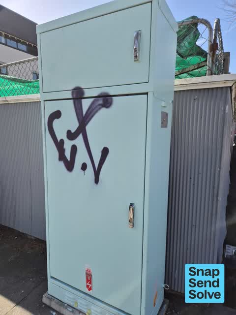
black graffiti on teal power box
- Graffiti,
- Graffiti,
- Pavement - Damaged,
- Damaged Street Sign,
- Water Leak,
- Dumped Rubbish,
- Pavement - Damaged,
- General Request,
- Pavement - Damaged,
- Road Signage,
- General Request,
- Vandalism - General,
- Vandalism - General,
- Overgrown Vegetation,
- Litter,
- Overgrown Vegetation,
- Graffiti,
- Graffiti,
 Graffiti,
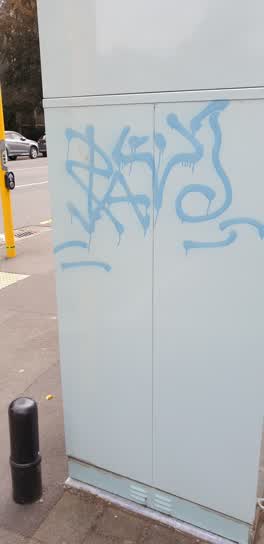
traffic signals box gloucester St rolleston Ave junction
Roading/Streets,
red light not working
Roading/Streets,
this car has been parked on these broken yellow lines since 5.30am. it is now 12pm. they park here on a regular basis. it is NOT a car park
Roading/Streets,
The lights at Gloucester Street and park avenue are changing from Park Ave to Gloucester without being triggered or a normal timed change. I
Also reported on Gloucester Street
- 267 Gloucester Street, 108 reports
- 89 Gloucester Street, 88 reports
- 278 Gloucester Street, 69 reports
- 194 Gloucester Street, 64 reports
- 146 Gloucester Street, 60 reports
- 195 Gloucester Street, 53 reports
- 332 Gloucester Street, 51 reports
- 192 Gloucester Street, 44 reports
From the air, then
Sourced from Canterbury Maps and partners. LINZ, CC BY 3.0 NZ. Each frame is cut from Environment Canterbury’s historic imagery MapServer for that decade, only where the Footprints layer names a CC BY survey (NZAM-covered spots stay out). RetroLens holds more Crown aerials →
The street’s crash record
NZTA’s record names Gloucester Street in 113 crashes that hurt somebody since 2006, 4 people killed, 18 seriously hurt.
The green nearby
- Botanic Gardens, 64 m to the edge · Botanic · 21 ha
- Hagley Park North, 110 m to the edge · Sports ground · 91 ha
- Armagh Reserve, 132 m to the edge
- Cranmer Square, 228 m to the edge · Botanic · 2 ha
- Scott Statue Reserve, 481 m to the edge · Botanic
Parks within half a kilometre, measured to the boundary, the council’s open data.
The civic shelf nearby
- Rolleston Avenue, 77 m away · Car park
- Civic Offices, 383 m away · Council office
- Armagh Street, 442 m away · Car park
- Christchurch Hospital Grounds, 464 m away · Car park
- Scales, 471 m away · Car park
- Aldersgate, 490 m away · Car park
Libraries, halls and the rest within half a kilometre, the council’s open data.
On the doorstep
- Christ's College Guided Tours, 28 m away · Attractions
- Uniform Shop, 58 m away · Clothing
- University of Otago, Department of General Practice, 73 m away · Department
- Ravenscar House, 85 m away · Galleries
Businesses within four hundred metres, measured at the pin: OpenStreetMap and the council directories.
The bus nearby
- Rolleston Ave near Gloucester St, 35 m away · route 8
- Rolleston Ave near Gloucester St, 45 m away · route 8
The closest Metro stops, within four hundred and fifty metres.
The tracks through here
- Walk and bike track through Christchurch Central City, 50 m to the line · walk · bike
- Walk and bike track through Christchurch Central City, 122 m to the line · walk · bike
- Walk and bike track through Christchurch Central City, 122 m to the line · walk · bike
- Walk and bike track through Christchurch Central City, 122 m to the line · walk · bike
- Walk and bike track through Christchurch Central City, 122 m to the line · walk · bike
Tracks whose line passes within half a kilometre, measured to the line itself, the council’s open data.
The named ground
Named water within 500 m of this address, measured to the line or the edge; Named places within 1.5 km of this address; the council’s own structure register, bridges, boardwalks and steps standing nearby, the open map’s record.
The remembered names nearby
- Botanic Gardens, 154 m away ·
BOTANIC GARDENS / THIS FENCE, ERECTED TO COMMEMORATE THE CENTENARY OF THE BOTANIC GARDENS
· 2004 - Botanic Gardens, 162 m away ·
BOTANIC GARDENS / ADMINISTERED BY THE CHRISTCHURCH DOMAINS BOARD UNTIL 1946 AND SINCE BY T
· 2004 - Christchurch Botanic Gardens - Donated by Llewellyn, 166 m away ·
CHRISTCHURCH BOTANIC GARDENS - DONATED BY LLEWELLYN J MITCHELL
· 1998
Inscribed plaques within two hundred and fifty metres, the register’s pins, not surveyed spots. The whole roll is at /plaques.
Renting nearby
new bonds in Christchurch Central City ran about $508 a week, $42 below the city median of $550, the suburb page keeps the rent record →.
What was here, Former Dwelling and Setting, Rolleston House
25 m away · 2 Gloucester Street · located to ±12 m · the place’s own record →
On the register. Nothing researched here yet.
What was here, Christ's College Administration Building and Setting
44 m away · 33Q Rolleston Avenue · located to ±11 m · the place’s own record →
On the register. Nothing researched here yet.
What was here, Christ's College Memorial Dining Hall and Setting
57 m away · 33J Rolleston Avenue · located to ±20 m · the place’s own record →
On the register. Nothing researched here yet.
What was here, Christ's College Dining Hall Tower and Hospital and Setting
77 m away · 33 Rolleston Avenue · located to ±16 m · the place’s own record →
On the register. Nothing researched here yet.
What was here, Christ's College Former New Classrooms and Setting
90 m away · 33 Rolleston Avenue · located to ±21 m · the place’s own record →
On the register. Nothing researched here yet.
The civic layer
This ground votes in Central ward, the Papanui-Innes-Central community board. Ward lines don’t always follow suburb lines; this one is measured at the pin, not the suburb’s centre.
What stood on this ground → · On the map → · From the air, the Crown’s aerials back to 1936; search the address on RetroLens →
Questions, answered briefly
42 council reports on record since April 2019, most often graffiti (8), vandalism - general (4), pavement - damaged (4).
Christchurch Central City, Christchurch, on Gloucester Street.
The heritage register names 5 places at or beside it, Former Dwelling and Setting, Rolleston House, Christ's College Administration Building and Setting.
Botanic Gardens, 64 m to its edge, 21 ha.