208 Cashel Street, Christchurch Central City
42 reports on record since April 2018 · 32 with photographs. The street’s heaviest record is 210 Cashel Street, 53 reports on file. Indicative rating valuation and school zones, hazards, bin day and what stood here before.
What gets reported here
Photographed here 32 on record


Reported here
 Graffiti on a fence, building or structure,
 Trees - General,
I am the owner of one of these homes opposite Rauora park and reported these missing trees a few times. There are a total of 3 missing in t
 Graffiti on a playground or in a park,
TAGGING. Along Rauora Park edging, in front of 212 Cashel St. Please remove chemically, and not with grey paint, to protect the aesthetic of
 Poles and Signage - General,
Sign removed by drunk stadium attendees. Corner Huanui Lane and Cashel Street.
 Graffiti on a sign, mural or public art,
Tagging on the sign by Raoura Park corner if Cashel St and Huanui Lane. Also someone has broken the street sign and it’s laying on the path.
 Damaged Street Sign,
 Graffiti on a sign, mural or public art,
Tagging on Berlin Wall sign
 Hazard, vehicle,
Illegal parking
 Hazard, vehicle,
Car parked on pavement
 Graffiti on a sign, mural or public art,
Spray paint
 Park - General Request,
Seat near Rauora park sign
 General Request,
 Graffiti on a fence, building or structure,
 Graffiti on a fence, building or structure,
TAGGING on park edging. Please chemically remove, not grey paint it. Thank you! This is opposite the two story brick buildings near the Berl
 Graffiti on a fence, building or structure,
 General Request,
Graffiti on cabinet next to Berlin Wall Pieces.
 Graffiti somewhere else,
 Graffiti somewhere else,
 Graffiti somewhere else,
 Graffiti on a sign, mural or public art,
 Hazard, vehicle,
 Hazard, vehicle,
Car parked on footpath
- Graffiti,
- Graffiti,
- Graffiti,
- Graffiti,
- Graffiti,
- Pavement - Damaged,
- Graffiti,
- Hazard, vehicle,
- Graffiti,
- Graffiti,
 Graffiti,
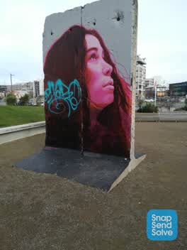 Graffiti,
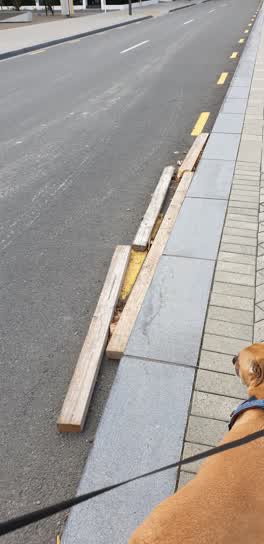 Rubbish/Recycling,
Rubbish on road
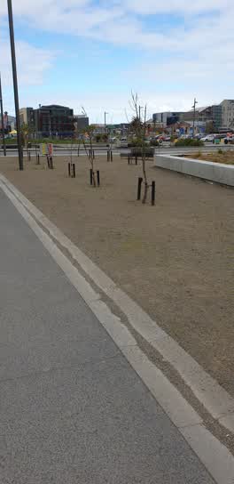 Parks,
Weeds over growing
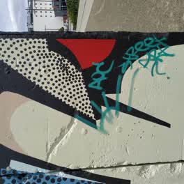 Graffiti,
Someone has graffitied over the Berlin Wall installation. A piece of history lost.
Parks,
Seat bolts loose or missing. I found one, reinserted and hand tightened it... It will fall out again (only noticed as wood slat was sticking
Roading/Streets,
Persistent illegal parking here in the early evening
Roading/Streets,
Missing bollards are back but they appear broken
Graffiti,
On wooden bench
Also reported on Cashel Street
- 210 Cashel Street, 53 reports
- 219 Cashel Street, 46 reports
- 202 Cashel Street, 42 reports
- 76 Cashel Street, 39 reports
- 7 Cashel Street, 37 reports
- 135 Cashel Street, 37 reports
- 75 Cashel Street, 34 reports
- 127 Cashel Street, 34 reports
From the air, then
Sourced from Canterbury Maps and partners. LINZ, CC BY 3.0 NZ. Each frame is cut from Environment Canterbury’s historic imagery MapServer for that decade, only where the Footprints layer names a CC BY survey (NZAM-covered spots stay out). RetroLens holds more Crown aerials →
The street’s crash record
NZTA’s record names Cashel Street in 103 crashes that hurt somebody since 2006, 1 person killed, 9 seriously hurt.
The green nearby
- Excelsior Hotel Reserve, 160 m to the edge · Botanic
- Latimer Square, 178 m to the edge · Botanic · 2 ha
- City Mall, 213 m to the edge
- High Street Triangles, 241 m to the edge
- The Stewart Plaza, 314 m to the edge
Parks within half a kilometre, measured to the boundary, the council’s open data.
The civic shelf nearby
- Triangle, 303 m away · Car park
- St Asaph, 395 m away · Car park
- Re:start - Lichfield Street, 420 m away · Car park
- Turanga Library, 451 m away · Library · Cathedral Square, Christchurch
Libraries, halls and the rest within half a kilometre, the council’s open data.
On the doorstep
- Caffeine Kick Cafe, 67 m away · Cafés
- Les Mills Gym, 77 m away · Gyms & fitness
- Kai Run, 81 m away · Fast food
- Gelatiamo, 88 m away · Fast food
Businesses within four hundred metres, measured at the pin: OpenStreetMap and the council directories.
The bus nearby
- Hereford St near Latimer Square, 129 m away · route 60
- Hereford St near Latimer Square, 150 m away · route 60
The closest Metro stops, within four hundred and fifty metres.
The tracks through here
- Walk and bike track through Christchurch Central City, 95 m to the line · walk · bike
- Walk and bike track through Christchurch Central City, 232 m to the line · walk · bike
- Walk and bike track through Christchurch Central City, 233 m to the line · walk · bike
- Walk and bike track through Christchurch Central City, 253 m to the line · walk · bike
- Walk and bike track through Christchurch Central City, 384 m to the line · walk · bike
Tracks whose line passes within half a kilometre, measured to the line itself, the council’s open data.
The named ground
Named places within 1.5 km of this address; the council’s own structure register, bridges, boardwalks and steps standing nearby, the open map’s record.
The remembered names nearby
- Te Kiheru Wai o Tahu / the Canoe Bailer of Tahu / 2015, 188 m away ·
Te Kiheru Wai o Tahu / The Canoe Bailer of Tahu / 2015 / (MÄori text and English translat
· 2015 - The First Public Water Supply Well Was Drilled Near This, 213 m away ·
THE FIRST PUBLIC WATER SUPPLY WELL was drilled near this site on 10 February 1864 by the C
· 2009 - ‘corgis on High’ — Christchurch City Public Artwork, 216 m away ·
‘Corgis on High’ — Christchurch City public artwork, 6 December 2003
· 2009
Inscribed plaques within two hundred and fifty metres, the register’s pins, not surveyed spots. The whole roll is at /plaques.
Renting nearby
new bonds in Christchurch Central City ran about $508 a week, $42 below the city median of $550, the suburb page keeps the rent record →.
What was here, Façade and Setting, Former New Zealand Farmers’ Co-operative Association of Canterbury Ltd
52 m away · 214 Cashel Street · located to ±26 m · the place’s own record →
On the register. Nothing researched here yet.
What was here, 159 Manchester Street
121 m away · 159 Manchester Street · located to ±14 m · the place’s own record →
On the register. Nothing researched here yet.
What was here, Triangle Reserve and Setting
139 m away · 192F High Street · located to ±17 m · the place’s own record →
On the register. Nothing researched here yet.
What was here, Triangle Reserve and Setting
164 m away · 215F High Street · located to ±17 m · the place’s own record →
On the register. Nothing researched here yet.
What was here, Commercial Building and Setting
175 m away · 225 High Street · located to ±19 m · the place’s own record →
On the register. Nothing researched here yet.
The civic layer
This ground votes in Central ward, the Papanui-Innes-Central community board. Ward lines don’t always follow suburb lines; this one is measured at the pin, not the suburb’s centre.
What stood on this ground → · On the map → · From the air, the Crown’s aerials back to 1936; search the address on RetroLens →
Questions, answered briefly
42 council reports on record since April 2018, most often graffiti (13), hazard, vehicle (5), graffiti on a sign, mural or public art (4).
Christchurch Central City, Christchurch, on Cashel Street.
The heritage register names 5 places at or beside it, Façade and Setting, Former New Zealand Farmers’ Co-operative Association of Canterbury Ltd, 159 Manchester Street.
Excelsior Hotel Reserve, 160 m to its edge.