224 Barbadoes Street, Christchurch Central City
28 reports on record since October 2018 · 21 with photographs. The street’s heaviest record is 390 Barbadoes Street, 65 reports on file. Indicative rating valuation and school zones, hazards, bin day and what stood here before.
What gets reported here
Photographed here 21 on record


Reported here
 Graffiti on a fence, building or structure,
 Graffiti on a fence, building or structure,
graffiti on light lamp post pole nearby
 Graffiti on a fence, building or structure,
graffiti on light lamp post pole
 Graffiti on a fence, building or structure,
graffiti on light lamp post pole
 Graffiti on a fence, building or structure,
graffiti on light lamp post pole
 Poles and Signage - General,
graffiti on light lamp post pole
 Graffiti on a fence, building or structure,
graffiti on light lamp post pole
 Graffiti on a fence, building or structure,
graffiti on light lamp post pole
 Accessibility,
Open day at the stadium, only one lift working to provide accessible access to L1 and at the opposite end of the building ti the main entran
 Graffiti on a fence, building or structure,
graffiti on light lamp post pole
 Graffiti on a traffic light pole or cabinet, or wa,
 Graffiti on a fence, building or structure,
Graffiti on building. We have the matching paint on site
 Graffiti on a fence, building or structure,
Third time our building has been Grafited, in 6 months. Also stadium fence.
 Graffiti on a fence, building or structure,
Friday nite ,and Sunday night, just finished paint job on our building. Stadium fence got hit at same time. Note you have camara on your Sta
 Graffiti somewhere else,
 Vandalism - General,
Locked doors have been vandalised on CH CO asset and are hanging loose on Barbadoes Street a tad north from Lichfield Street.
 Graffiti on a fence, building or structure,
Red paint tag on white concrete wall facing the footpath by 224 Barbadoes Street.
- Graffiti,
- Graffiti,
- Graffiti,
- Graffiti,
- Graffiti,
- Graffiti,
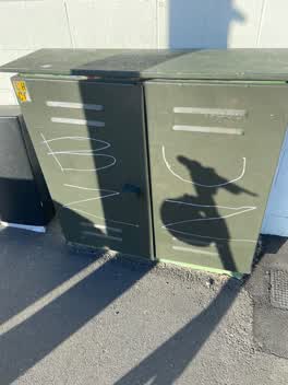 Graffiti,
BUZZ white paint tag on CH CO dark green asset on Barbadoes Street a tad north of Lichfield Street.
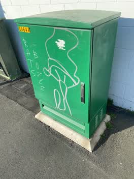 Graffiti,
RATSBUZZ white paint tag plus a silver paint tag on CN644 asset near the corner of Barbadoes and Lichfield Streets.
- Roading/Streets,
Services covers make it hell for bicycles.
Roading/Streets,
Service covers are really dangerous holes here. May as well be potholes. They are invisible and right in the natural line of cyclists. Pleas
Roading/Streets,
Service covers are really dangerous holes here. May as well be potholes. They are invisible and right in the natural line of cyclists. Pleas
Also reported on Barbadoes Street
- 390 Barbadoes Street, 65 reports
- 259 Barbadoes Street, 51 reports
- 384 Barbadoes Street, 47 reports
- 321 Barbadoes Street, 37 reports
- 377 Barbadoes Street, 36 reports
- 288 Barbadoes Street, 29 reports
- 407 Barbadoes Street, 28 reports
- 324 Barbadoes Street, 28 reports
From the air, then
Sourced from Canterbury Maps and partners. LINZ, CC BY 3.0 NZ. Each frame is cut from Environment Canterbury’s historic imagery MapServer for that decade, only where the Footprints layer names a CC BY survey (NZAM-covered spots stay out). RetroLens holds more Crown aerials →
The street’s crash record
NZTA’s record names Barbadoes Street in 215 crashes that hurt somebody since 2006, 1 person killed, 31 seriously hurt.
The green nearby
- Latimer Square, 318 m to the edge · Botanic · 2 ha
- Wilson Park, 324 m to the edge
- Excelsior Hotel Reserve, 472 m to the edge · Botanic
Parks within half a kilometre, measured to the boundary, the council’s open data.
The civic shelf nearby
- St Asaph, 293 m away · Car park
Libraries, halls and the rest within half a kilometre, the council’s open data.
On the doorstep
- Auto City, 15 m away · Tyre shops
- Naylor Love, 68 m away · Construction Company
- Galaxy Bar, 82 m away · Bars & pubs
- Galaxy Arcade & Bar, 110 m away · Business
Businesses within four hundred metres, measured at the pin: OpenStreetMap and the council directories.
The bus nearby
- Tuam St near Duke St, 217 m away · route 80
- Hereford St near Barbadoes St, 228 m away · route 60
The closest Metro stops, within four hundred and fifty metres.
The tracks through here
- Walk and bike track through Christchurch Central City, 141 m to the line · walk · bike
- Walk and bike track through Christchurch Central City, 301 m to the line · walk · bike
- Walk and bike track through Christchurch Central City, 367 m to the line · walk · bike
- Walk and bike track through Christchurch Central City, 380 m to the line · walk · bike
- Walk and bike track through Christchurch Central City, 380 m to the line · walk · bike
Tracks whose line passes within half a kilometre, measured to the line itself, the council’s open data.
The named ground
Named places within 1.5 km of this address; the council’s own structure register, bridges, boardwalks and steps standing nearby, the open map’s record.
Renting nearby
new bonds in Christchurch Central City ran about $508 a week, $42 below the city median of $550, the suburb page keeps the rent record →.
What was here, St Luke's Chapel and Setting
212 m away · 272 Hereford Street · located to ±6 m · the place’s own record →
On the register. Nothing researched here yet.
What was here, 319 St Asaph Street
240 m away · 319 St Asaph Street · located to ±21 m · the place’s own record →
On the register. Nothing researched here yet.
The civic layer
This ground votes in Central ward, the Papanui-Innes-Central community board. Ward lines don’t always follow suburb lines; this one is measured at the pin, not the suburb’s centre.
What stood on this ground → · On the map → · From the air, the Crown’s aerials back to 1936; search the address on RetroLens →
Questions, answered briefly
28 council reports on record since October 2018, most often graffiti on a fence, building or structure (12), graffiti (8), roading/streets (3).
Christchurch Central City, Christchurch, on Barbadoes Street.
The heritage register names 2 places at or beside it, St Luke's Chapel and Setting, 319 St Asaph Street.
Latimer Square, 318 m to its edge, 2 ha.