23 Bedford Row, Christchurch Central City
15 reports on record since April 2022 · 9 with photographs. The street’s heaviest record is 19 Bedford Row — 26 reports on file. Indicative rating valuation and school zones, hazards, bin day and what stood here before.
What gets reported here
Photographed here 9 on record




Reported here
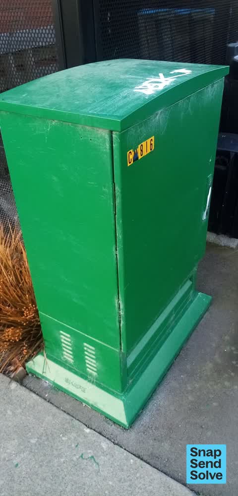
 Graffiti on a traffic light pole or cabinet, or wa —
Graffiti on cabinet.
 Graffiti somewhere else —
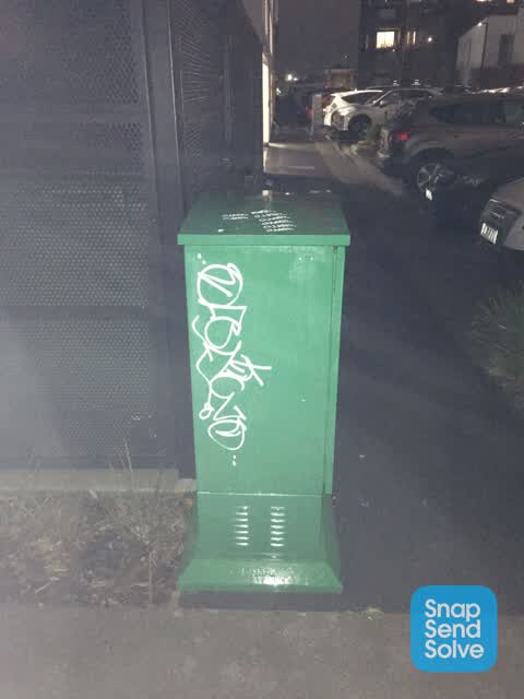
 Graffiti on a cabinet, pole or railway asset —
Graffiti on green cabinet
 Graffiti somewhere else —
 Graffiti somewhere else —
- Graffiti —
- Graffiti —
- Graffiti —
- Graffiti —
- Graffiti —
- Graffiti —
 Graffiti —
 Graffiti —
 Graffiti —
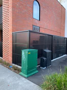 Graffiti —
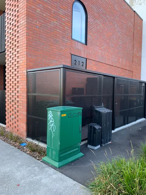
Graffiti on phone or power box. This is at the end of Bedford Row beside 212 Cashel Street.
Also reported on Bedford Row
- 19 Bedford Row — 26 reports
- 47 Bedford Row — 15 reports
- 24 Bedford Row — 12 reports
- 30 Bedford Row — 6 reports
- 46 Bedford Row — 5 reports
- 16 Bedford Row — 5 reports
- 28 Bedford Row — 4 reports
- 45 Bedford Row — 3 reports
The street’s crash record
NZTA’s record names Bedford Row in 4 crashes that hurt somebody since 2006 — 2 seriously hurt, nobody killed.
The green nearby
- Excelsior Hotel Reserve — 142 m to the edge · Botanic
- Latimer Square — 202 m to the edge · Botanic · 2 ha
- City Mall — 241 m to the edge
- High Street Triangles — 268 m to the edge
- The Stewart Plaza — 346 m to the edge
Parks within half a kilometre, measured to the boundary — the council’s open data.
The civic shelf nearby
- Triangle — 331 m away · Car park
- St Asaph — 350 m away · Car park
- Re:start - Lichfield St — 423 m away · Car park
- Turanga Library — 495 m away · Library · Cathedral Square, Christchurch
Libraries, halls and the rest within half a kilometre — the council’s open data.
On the doorstep
- Caffeine Kick Cafe — 82 m away · Cafés
- Pot Sticker Dumpling Bar — 87 m away · Restaurants
- Pot Stick on Poplar — 88 m away · Fast food
- The Loft Coworking Tech Hub — 90 m away · Venues & events
Businesses within four hundred metres, measured at the pin — OpenStreetMap and the council directories.
The bus nearby
- Hereford St near Latimer Square — 163 m away · route 60
- Hereford St near Latimer Square — 184 m away · route 60
The closest Metro stops, within four hundred and fifty metres.
The tracks through here
- Walk and bike track through Christchurch Central City — 116 m to the line · walk · bike
- Walk and bike track through Christchurch Central City — 191 m to the line · walk · bike
- Walk and bike track through Christchurch Central City — 191 m to the line · walk · bike
- Walk and bike track through Christchurch Central City — 294 m to the line · walk · bike
- Walk and bike track through Christchurch Central City — 338 m to the line · walk · bike
Tracks whose line passes within half a kilometre, measured to the line itself — the council’s open data.
The named ground
Named places within 1.5 km of this address; the council’s own structure register — bridges, boardwalks and steps standing nearby — the open map’s record.
The remembered names nearby
- The First Public Water Supply Well Was Drilled Near This — 175 m away ·
THE FIRST PUBLIC WATER SUPPLY WELL was drilled near this site on 10 February 1864 by the C
· 2009 - ‘corgis on High’ — Christchurch City Public Artwork — 177 m away ·
‘Corgis on High’ — Christchurch City public artwork, 6 December 2003
· 2009 - Te Kiheru Wai o Tahu / the Canoe Bailer of Tahu / 2015 — 213 m away ·
Te Kiheru Wai o Tahu / The Canoe Bailer of Tahu / 2015 / (MÄori text and English translat
· 2015
Inscribed plaques within two hundred and fifty metres — the register’s pins, not surveyed spots. The whole roll is at /plaques.
Renting nearby
new bonds in Christchurch Central City ran about $508 a week — $42 below the city median of $550 — the suburb page keeps the rent record →.
What was here — Façade and Setting, Former New Zealand Farmers’ Co-operative Association of Canterbury Ltd
50 m away · 214 Cashel Street · located to ±26 m · the place’s own record →
On the register. Nothing researched here yet.
What was here — 159 Manchester Street
131 m away · 159 Manchester Street · located to ±14 m · the place’s own record →
On the register. Nothing researched here yet.
What was here — Commercial Building and Setting, Former C F Cotter and Company
138 m away · 101/158 High Street · located to ±19 m · the place’s own record →
On the register. Nothing researched here yet.
What was here — Triangle Reserve and Setting
142 m away · 215F High Street · located to ±17 m · the place’s own record →
On the register. Nothing researched here yet.
What was here — Triangle Reserve and Setting
142 m away · 192F High Street · located to ±17 m · the place’s own record →
On the register. Nothing researched here yet.
The civic layer
This ground votes in Central ward — the Papanui-Innes-Central community board. Ward lines don’t always follow suburb lines; this one is measured at the pin, not the suburb’s centre.
What stood on this ground → · On the map → · From the air — the Crown’s aerials back to 1936; search the address on RetroLens →
Questions, answered briefly
15 council reports on record since April 2022 — most often graffiti (10), graffiti somewhere else (3), graffiti on a traffic light pole or cabinet, or wa (1).
Christchurch Central City, Christchurch — on Bedford Row.
The heritage register names 5 places at or beside it — Façade and Setting, Former New Zealand Farmers’ Co-operative Association of Canterbury Ltd, 159 Manchester Street.
Excelsior Hotel Reserve — 142 m to its edge.