24 Dorset Street, Christchurch Central City
16 reports on record since October 2015 · 10 with photographs. The most-reported address on Dorset Street. Indicative rating valuation and school zones, hazards, bin day and what stood here before.
What gets reported here
Photographed here 10 on record



Reported here
 General Request —
Hello Please see tag on an Orion pole . Could consideration be given to removing???
 Water Leak —
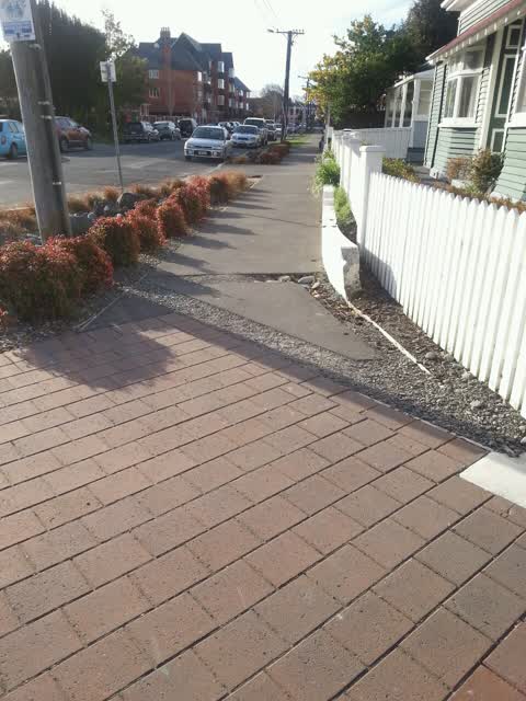
Water leaking from a patch in tarmac footpath next to the Mayfair Hotel, Dorset St.
 Water Leak —
I can not see the source but a significant amount of water is leaking from the ground. Sounds like a fountain of water. The location is acce
 Sewer - Leak / Blockage —
Water has been pouring out if this property for at least a day. First seen May 12. Getting worse.
 Noise - General —
Always going air con Like a plain landing. Especially at night
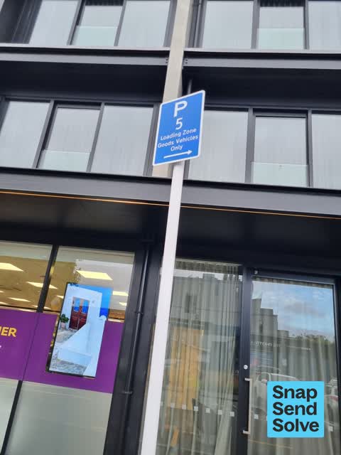
 Hazard — vehicle —
These loading bay signs are inconsistent and unable to be enforced. Thanks Julie
 Street Gutters / Storm Water —
Water leak continually running from a gap in the footpath
- Water Leak —
- Water Leak —
- Water Leak —
- Water Leak —
- Water Leak —
- Water Leak —
 Water Leak —
Water leaking under driveway and corroding the drive.
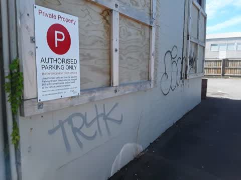
Graffiti —
Opposite Dorset st cellar of victories st
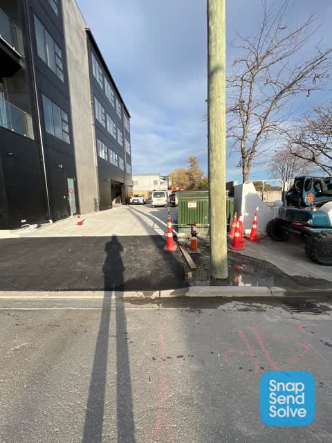
Roading/Streets —
Trench not sealed and in need of new backfill
Also reported on Dorset Street
- 2A Dorset Street — 16 reports
- 1 Dorset Street — 11 reports
- 3 Dorset Street — 6 reports
- 19 Dorset Street — 5 reports
- 28 Dorset Street — 4 reports
- 17 Dorset Street — 3 reports
- 14 Dorset Street — 3 reports
- 7 Dorset Street — 2 reports
The street’s crash record
NZTA’s record names Dorset Street in 14 crashes that hurt somebody since 2006 — 2 seriously hurt, nobody killed.
The green nearby
- Hagley Park North — 137 m to the edge · Sports ground · 91 ha
- Carlton Mill Riverbank — 287 m to the edge
- Little Hagley Park — 292 m to the edge · Botanic · 7 ha
- Aldred Reserve — 441 m to the edge
- Victoria Triangles — 463 m to the edge
Parks within half a kilometre, measured to the boundary — the council’s open data.
On the doorstep
- Majestic at Mayfair — 18 m away · Restaurants
- The Mayfair — 28 m away · Hotels
- Mauriora Kombucha — 35 m away · Bottle stores
- House of Travel — 49 m away · Travel agents
Businesses within four hundred metres, measured at the pin — OpenStreetMap and the council directories.
The bus nearby
- Victoria St near Dorset St — 70 m away · route 1, route 29, route 95
- Bealey Ave — 94 m away · route 1, route 29, route 95
The closest Metro stops, within four hundred and fifty metres.
The tracks through here
- Walk and bike track through Christchurch Central City — 58 m to the line · walk · bike
- Walk and bike track through Christchurch Central City — 130 m to the line · walk · bike
- Walk and bike track through Christchurch Central City — 145 m to the line · walk · bike
- Walk and bike track through Christchurch Central City — 186 m to the line · walk · bike
- Walk and bike track through Christchurch Central City — 229 m to the line · walk · bike
Tracks whose line passes within half a kilometre, measured to the line itself — the council’s open data.
The named ground
Named water within 500 m of this address, measured to the line or the edge; Named places within 1.5 km of this address; the council’s own structure register — bridges, boardwalks and steps standing nearby — the open map’s record.
The remembered names nearby
- Mischa Kuball / Solidarity Grid, 2013 / Sydney — 223 m away ·
Mischa Kuball / Solidarity Grid, 2013 / SYDNEY
· 2013 - Mischa Kuball / Solidarity Grid, 2015 / Christchurch — 238 m away ·
Mischa Kuball / Solidarity Grid, 2015 / CHRISTCHURCH / DORSET
· 2013 - Hagley Park North plaque — 243 m away ·
THE JOHN BURN BRIDGE / OPENED BY Cr JOHN BURN / CHAIRMAN, POLICY AND FINANCE COMMITTEE / 2
· 2009
Inscribed plaques within two hundred and fifty metres — the register’s pins, not surveyed spots. The whole roll is at /plaques.
Renting nearby
new bonds in Christchurch Central City ran about $508 a week — $42 below the city median of $550 — the suburb page keeps the rent record →.
What was here — Dwellings and Setting, Dorset Street Flats
54 m away · 8 Dorset Street · located to ±18 m · the place’s own record →
On the register. Nothing researched here yet.
What was here — Former Bishop's Chapel and Setting
85 m away · 100 Park Terrace · located to ±8 m · the place’s own record →
On the register. Nothing researched here yet.
What was here — Former Dwellings and Setting, Santa Barbara
99 m away · 169 Victoria Street · located to ±12 m · the place’s own record →
On the register. Nothing researched here yet.
What was here — Dwelling and Setting
112 m away · 122 Park Terrace · located to ±16 m · the place’s own record →
On the register. Nothing researched here yet.
What was here — Knox Church
156 m away · 28 Bealey Avenue · located to ±20 m · the place’s own record →
On the register. Nothing researched here yet.
The civic layer
This ground votes in Central ward — the Papanui-Innes-Central community board. Ward lines don’t always follow suburb lines; this one is measured at the pin, not the suburb’s centre.
What stood on this ground → · On the map → · From the air — the Crown’s aerials back to 1936; search the address on RetroLens →
Questions, answered briefly
16 council reports on record since October 2015 — most often water leak (9), street gutters / storm water (1), sewer - leak / blockage (1).
Christchurch Central City, Christchurch — on Dorset Street.
The heritage register names 5 places at or beside it — Dwellings and Setting, Dorset Street Flats, Former Bishop's Chapel and Setting.
Hagley Park North — 137 m to its edge, 91 ha.