25 Welles Street, Christchurch Central City
37 reports on record since October 2019 · 26 with photographs. The most-reported address on Welles Street. Indicative rating valuation and school zones, hazards, bin day and what stood here before.
What gets reported here
Photographed here 26 on record




Reported here
 Graffiti on a fence, building or structure —
graffiti on multiple garden planter boxs
 Graffiti on a fence, building or structure —
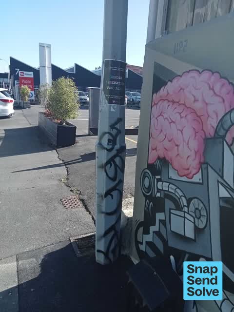
graffiti on light lamp post pole
 Pavement - General —
someone decided to poop ?? on the walkway. it was a massive ?? and even had toilet paper. at least their bum was clean after they finished.
 Graffiti on a fence, building or structure —
graffiti on light lamp post pole
 Graffiti on a fence, building or structure —
graffiti on structure
 Graffiti on a fence, building or structure —
graffiti on structure
 Graffiti on a fence, building or structure —
See pic
 Poles and Signage - General —
Missing pole sign P120 as per photos
 Graffiti on a fence, building or structure —
Graffiti on a ccc managed lamp post
 General Request —
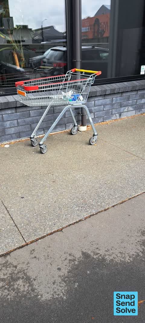
Abandoned trolley - Reduce to Clear
 Flooding —
Although this blocked drain is on private property (Welder car park), I believe that the ground under this puddle is slumping noticeably, an
 Graffiti on a fence, building or structure —
Graffiti on council parking area.
 Graffiti on a cabinet, pole or railway asset —
HB black paint tag on concrete lamp pole by 25 Welles Street.
 Graffiti somewhere else —
See pics walkway just off Welles st
 Graffiti somewhere else —
Graffiti on Planter boxes.
 Graffiti on a fence, building or structure —
Graffiti on side of the fence.
 Graffiti somewhere else —
 Graffiti somewhere else —
 Graffiti on a fence, building or structure —
Graffiti on the side of the fence.
 Street Gutters / Storm Water —
This drainage system always gets blocked up and floods when it rains. Has been happening for years now but never been fixed. Is again especi
 Damaged Street Sign —
This one-way sign appears to have been removed from St Asaph Street and dumped beside the Welder/Wilson's carpark. I think it's been there f
 Graffiti —
Graffiti tagged across planter boxes and paystation for the Welder car park area.
 Graffiti —
Walk way and welder carpark
- Hazard — vehicle —
- Graffiti —
- Graffiti —
- Graffiti —
- Graffiti —
- Pavement - Damaged —
- Graffiti —
- Sewer - Leak / Blockage —
- Graffiti —
- Pavement - General —
- Graffiti —
 Graffiti —
Black paint tags on Rockgas asset near 24 Welles Street.
 Graffiti —
Roading/Streets —
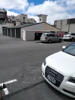
no TMP in place. Creates a very unsafe situation
Also reported on Welles Street
- 10 Welles Street — 33 reports
- 22 Welles Street — 29 reports
- 44 Welles Street — 28 reports
- 41 Welles Street — 27 reports
- 7 Welles Street — 23 reports
- 37 Welles Street — 18 reports
- 45 Welles Street — 17 reports
- 40 Welles Street — 13 reports
The street’s crash record
NZTA’s record names Welles Street in 6 crashes that hurt somebody since 2006 — 2 seriously hurt, nobody killed.
The green nearby
- Excelsior Hotel Reserve — 281 m to the edge · Botanic
- Wilson Park — 383 m to the edge
- City Mall — 403 m to the edge
- High Street Triangles — 423 m to the edge
- Carlyle Reserve — 486 m to the edge
Parks within half a kilometre, measured to the boundary — the council’s open data.
The civic shelf nearby
- Re:start - Lichfield St — 268 m away · Car park
- Triangle — 456 m away · Car park
- St Asaph — 459 m away · Car park
Libraries, halls and the rest within half a kilometre — the council’s open data.
On the doorstep
- Kokomo — 24 m away · Restaurants
- Grizzly — 28 m away · Bakeries
- Corkin and Friends — 30 m away · Hairdressers
- Ciao — 31 m away · Restaurants
Businesses within four hundred metres, measured at the pin — OpenStreetMap and the council directories.
The bus nearby
- Manchester St near Welles St — 146 m away · route 27
- St Asaph St near Colombo St — 195 m away · route 3, route 5, route 7, route 60, route 80, route 81, route 84, route 85, route 86
The closest Metro stops, within four hundred and fifty metres.
The tracks through here
- Walk and bike track through Christchurch Central City — 130 m to the line · walk · bike
- Walk and bike track through Christchurch Central City — 170 m to the line · walk · bike
- Walk and bike track through Christchurch Central City — 304 m to the line · walk · bike
- Walk and bike track through Christchurch Central City — 345 m to the line · walk · bike
- Walk and bike track through Christchurch Central City — 346 m to the line · walk · bike
Tracks whose line passes within half a kilometre, measured to the line itself — the council’s open data.
The named ground
Named places within 1.5 km of this address; the council’s own structure register — bridges, boardwalks and steps standing nearby — the open map’s record.
Renting nearby
new bonds in Christchurch Central City ran about $508 a week — $42 below the city median of $550 — the suburb page keeps the rent record →.
What was here — Former P & D Duncan Ltd Building and Setting
29 m away · 7/204 St Asaph Street · located to ±18 m · the place’s own record →
On the register. Nothing researched here yet.
What was here — Former R. Buchanan & Sons' City Foundry and Setting
43 m away · 2/210 St Asaph Street · located to ±14 m · the place’s own record →
On the register. Nothing researched here yet.
What was here — Colonial Motor Company Garage and Setting
91 m away · 201 St Asaph Street · located to ±40 m · the place’s own record →
On the register. Nothing researched here yet.
What was here — Commercial Building and Setting, Lawrie and Wilson Auctioneers
167 m away · 210 Tuam Street · located to ±14 m · the place’s own record →
On the register. Nothing researched here yet.
What was here — Former Tuam Street Hall and Setting
182 m away · 214 Tuam Street · located to ±12 m · the place’s own record →
On the register. Nothing researched here yet.
The civic layer
This ground votes in Central ward — the Papanui-Innes-Central community board. Ward lines don’t always follow suburb lines; this one is measured at the pin, not the suburb’s centre.
What stood on this ground → · On the map → · From the air — the Crown’s aerials back to 1936; search the address on RetroLens →
Questions, answered briefly
37 council reports on record since October 2019 — most often graffiti (11), graffiti on a fence, building or structure (10), graffiti somewhere else (4).
Christchurch Central City, Christchurch — on Welles Street.
The heritage register names 5 places at or beside it — Former P & D Duncan Ltd Building and Setting, Former R. Buchanan & Sons' City Foundry and Setting.
Excelsior Hotel Reserve — 281 m to its edge.