270 Saint Asaph Street, Christchurch Central City
44 reports on record since March 2017 · 35 with photographs. The street’s heaviest record is 207 Saint Asaph Street, 79 reports on file. Indicative rating valuation and school zones, hazards, bin day and what stood here before.
What gets reported here
Photographed here 35 on record


Reported here
 Hazard, vehicle,
meter not working
- Graffiti on a fence, building or structure,
graffiti behind the madras street sign on the wall
 Graffiti on a fence, building or structure,
graffiti on black wall
 Graffiti on a fence, building or structure,
graffiti on black block fence nearby
 Graffiti on a fence, building or structure,
graffiti on light lamp post pole nearby
 Traffic Signals,
Kua ora Signals team, Thanks si much for fixing the whole set-up at this diagonal cycle crossing at St Asaph-Madras-High St earlier this yea
 Hazard, vehicle,
 Graffiti on a fence, building or structure,
graffiti on blackish side wall
 Graffiti on a fence, building or structure,
graffiti on fence above rock gas assets
 Graffiti on a fence, building or structure,
graffiti on fence above rock gas assets
 Dumped Rubbish,
Dumped trolley of rubbish
 Graffiti on a sign, mural or public art,
Small black graffiti on street sign/map on the corner of Madras and St Asaph streets
 Poles and Signage - General,
 Graffiti on a fence, building or structure,
Graffiti on white wall above rock gas box nearby
 Graffiti on a fence, building or structure,
Graffiti on bin
 Graffiti on a fence, building or structure,
At Solid bin
 Graffiti on a fence, building or structure,
Graffiti on building within a arm length
 Hazard, vehicle,
Signs wrong one paid 1 not.
 Graffiti on a fence, building or structure,
 Graffiti on a sign, mural or public art,
Tags on reverse side of sign by 270 St Asaph Street.
 Graffiti somewhere else,
 Graffiti on a fence, building or structure,
 Graffiti on a fence, building or structure,
 Graffiti on a fence, building or structure,
Black and green paint tags on rubbish bin overflowing and ready for emptying as well. By 270 St Asaph Street.
 Graffiti on a cabinet, pole or railway asset,
Red paint tag (plus sticky tags galore) on metal lamp pole by 267 St Asaph Street.
 Hazard, vehicle,
Couple of parking bay been covered by yellow stripes and the sign P$60 9 a.m. to 5 p.m. mon to Fri been covered with a sticked sign P5 Loadi
 Graffiti,
- Vandalism - General,
- Graffiti,
- Pavement - Damaged,
- Graffiti,
- Roads - General,
- Graffiti,
- Graffiti,
- Rubbish and Bins - General,
 Graffiti,
Black paint tags (plus sticky tags) on steel rubbish bin lid by 270 St Asaph Street.
 Roading/Streets,
Please replace missing P$60 left arrow sign on a new white post. Restriction Mon-Fri 9am-5pm, include Pay at machine on sign. Outside Hokiti
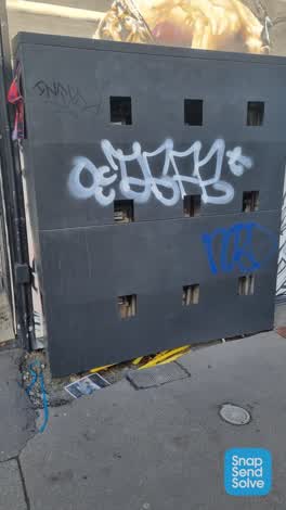 Graffiti,
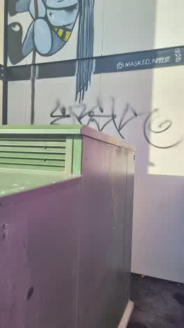 Graffiti,
Corner st Asaph & Madras
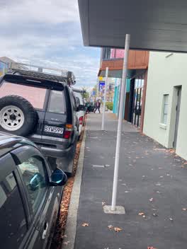 Roading/Streets,
Please replace missing P$60 sign on existing white post. Restriction Mon-Fri 9am-5pm left arrow. North side St Asaph outside The Hokitika sa
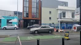 Roading/Streets,
Parked illegally at 270 St Asaph parked over entrance to BOXed Quarter
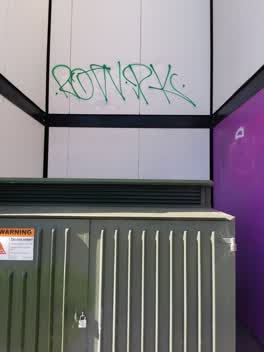 Graffiti,
Graffiti above power box St Asaph street
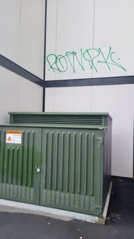 Graffiti,
270 st Asaph street
Roading/Streets,
Not sure if CCC can send warnings to people or simply let them know that they've been reported, but this driver blatantly parked right in th
Also reported on Saint Asaph Street
- 207 Saint Asaph Street, 79 reports
- 56 Saint Asaph Street, 55 reports
- 303 Saint Asaph Street, 55 reports
- 295 Saint Asaph Street, 54 reports
- 215 Saint Asaph Street, 46 reports
- 255 Saint Asaph Street, 44 reports
- 251 Saint Asaph Street, 41 reports
- 265 Saint Asaph Street, 40 reports
From the air, then
Sourced from Canterbury Maps and partners. LINZ, CC BY 3.0 NZ. Each frame is cut from Environment Canterbury’s historic imagery MapServer for that decade, only where the Footprints layer names a CC BY survey (NZAM-covered spots stay out). RetroLens holds more Crown aerials →
The green nearby
- Wilson Park, 55 m to the edge
- Excelsior Hotel Reserve, 263 m to the edge · Botanic
- Gasson Reserve, 404 m to the edge
- Washington Way Reserve, 458 m to the edge · Sports ground
- Science Alive Reserve, 461 m to the edge
Parks within half a kilometre, measured to the boundary, the council’s open data.
The civic shelf nearby
- St Asaph, 130 m away · Car park
Libraries, halls and the rest within half a kilometre, the council’s open data.
On the doorstep
- Boxed Inn, 4 m away · Bars & pubs
- Thai Box, 6 m away · Restaurants
- Wild Wings N' Things, 10 m away · Fast food
- Brazilian Kitchen, 13 m away · Fast food
Businesses within four hundred metres, measured at the pin: OpenStreetMap and the council directories.
The bus nearby
- Madras St near Southwark St, 69 m away · route 8, route 84, route 85, route 95
- Ara Institute, 173 m away · route 1, route 3, route 5, route 80, route 81
The closest Metro stops, within four hundred and fifty metres.
The tracks through here
- Walk and bike track through Christchurch Central City, 39 m to the line · walk · bike
- Walk and bike track through Christchurch Central City, 48 m to the line · walk · bike
- Walk and bike track through Christchurch Central City, 131 m to the line · walk · bike
- Walk and bike track through Christchurch Central City, 198 m to the line · walk · bike
- Walk and bike track through Christchurch Central City, 385 m to the line · walk · bike
Tracks whose line passes within half a kilometre, measured to the line itself, the council’s open data.
The named ground
Named places within 1.5 km of this address; the council’s own structure register, bridges, boardwalks and steps standing nearby, the open map’s record.
The remembered names nearby
- ‘corgis on High’ — Christchurch City Public Artwork, 179 m away ·
‘Corgis on High’ — Christchurch City public artwork, 6 December 2003
· 2009 - The First Public Water Supply Well Was Drilled Near This, 185 m away ·
THE FIRST PUBLIC WATER SUPPLY WELL was drilled near this site on 10 February 1864 by the C
· 2009
Inscribed plaques within two hundred and fifty metres, the register’s pins, not surveyed spots. The whole roll is at /plaques.
Renting nearby
new bonds in Christchurch Central City ran about $508 a week, $42 below the city median of $550, the suburb page keeps the rent record →.
What was here, 129 High Street
28 m away · 1/129 High Street · located to ±17 m · the place’s own record →
On the register. Nothing researched here yet.
What was here, Commercial Building and Setting. Duncan's Buildings
57 m away · 147 High Street · located to ±45 m · the place’s own record →
On the register. Nothing researched here yet.
What was here, Commercial Building Façade and Setting, Former A J Whites
141 m away · 181 High Street · located to ±20 m · the place’s own record →
On the register. Nothing researched here yet.
What was here, Triangle Reserve and Setting
191 m away · 189F High Street · located to ±17 m · the place’s own record →
On the register. Nothing researched here yet.
What was here, Former High Street Post Office and Setting
206 m away · 209 Tuam Street · located to ±21 m · the place’s own record →
On the register. Nothing researched here yet.
The civic layer
This ground votes in Central ward, the Papanui-Innes-Central community board. Ward lines don’t always follow suburb lines; this one is measured at the pin, not the suburb’s centre.
What stood on this ground → · On the map → · From the air, the Crown’s aerials back to 1936; search the address on RetroLens →
Questions, answered briefly
44 council reports on record since March 2017, most often graffiti on a fence, building or structure (15), graffiti (10), roading/streets (4).
Christchurch Central City, Christchurch, on Saint Asaph Street.
The heritage register names 5 places at or beside it, 129 High Street, Commercial Building and Setting. Duncan's Buildings.
Wilson Park, 55 m to its edge.