273A 273A
3 council reports since October 2020, 3 carrying a photograph.
On the register here
- Dwelling/Commercial Building and Setting, 147 Fitzgerald Avenue (149m)
- Dwelling and Setting, 229 Worcester Street (222m)
From the air, then
Sourced from Canterbury Maps and partners. LINZ, CC BY 3.0 NZ. Each frame is cut from Environment Canterbury’s historic imagery MapServer for that decade, only where the Footprints layer names a CC BY survey (NZAM-covered spots stay out). RetroLens holds more Crown aerials →
The green nearby
- Worcester Pump Station Park, 291 m to the edge · playground, 2 pieces
- Chester Street East Reserve, 313 m to the edge
- Raglan Reserve, 443 m to the edge
- Latimer Square, 468 m to the edge · Botanic · 2 ha
- William Brittan, 471 m to the edge
Parks within half a kilometre, measured to the boundary, the council’s open data. The whole roll is at /parks.
On the doorstep
- Vagabond Backpackers, 104 m away · Hostels
- Avenue Dairy, 107 m away · Dairies & convenience
- e-motors, 116 m away · Car repair
- Figlo Laundromat, 128 m away · Laundromats
Businesses within four hundred metres, measured at the pin, OpenStreetMap and the council directories.
The bus nearby
- Gloucester St near Fitzgerald Ave, 108 m away · route 5, route 7
- Gloucester St near Fitzgerald Ave, 123 m away · route 5, route 7
The closest Metro stops, within four hundred and fifty metres.
The tracks through here
- Walk and bike track through Christchurch Central City, 128 m to the line · walk · bike
- Walk and bike track through Christchurch Central City, 128 m to the line · walk · bike
- Walk and bike track through Christchurch Central City, 234 m to the line · walk · bike
- Walk and bike track through Christchurch Central City, 266 m to the line · walk · bike
- Walk and bike track through Christchurch Central City, 478 m to the line · walk · bike
Tracks whose line passes within half a kilometre, the council’s open data.
The named ground
Named places within 1.5 km of this address, the open map’s record.
The remembered names nearby
- Thanks to / Käinga ORA, 112 m away ·
Thanks to / KÄinga Ora / for their contribution to this seat / and the local community
Inscribed plaques within two hundred and fifty metres, the register’s pins, not surveyed spots. The whole roll is at /plaques.
Renting nearby
new bonds in Christchurch Central City ran about $508 a week, $42 below the city median of $550, the suburb page keeps the rent record →.
What gets reported here
Photographed here 3 on record
What’s on record
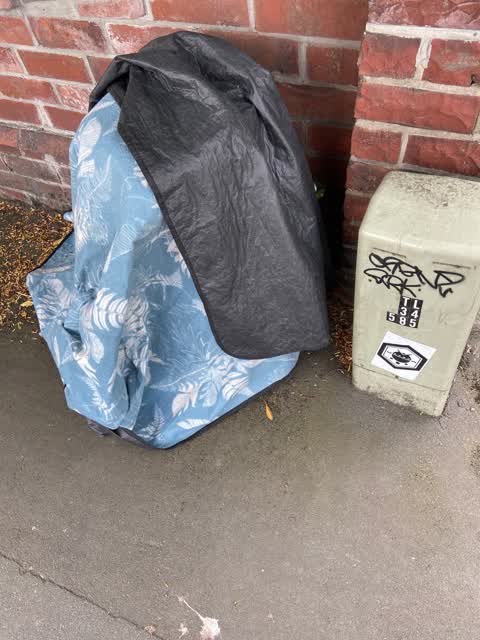
 Rubbish/Recycling, 13 Dec 2021
Old blanket and groundsheet dumped on the footpath outside 279 Worcester Street need removal.
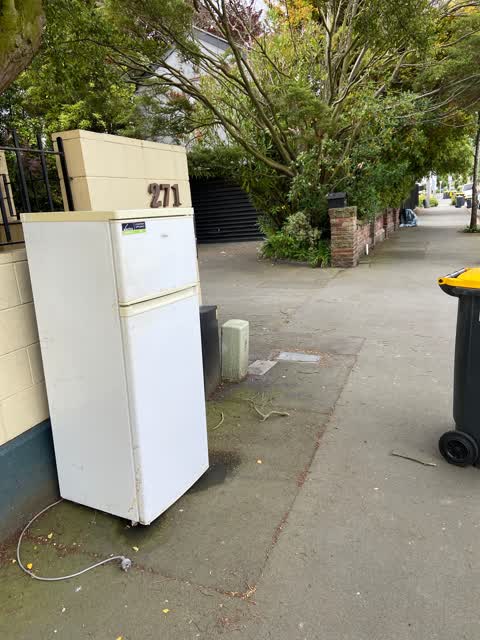
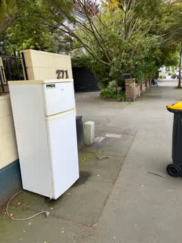 Rubbish/Recycling, 13 Dec 2021
Old fridge dumped on the footpath outside 271 Worcester Street needs removal.
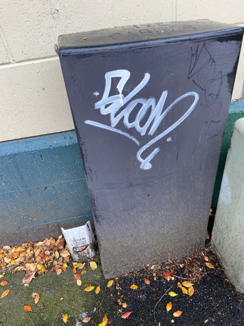
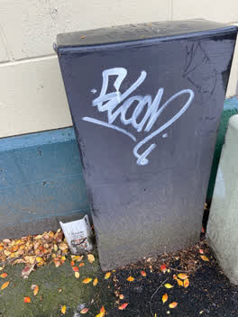 Graffiti, 29 Oct 2020
White paint tag on black live cables utility box by 271 Worcester Street
The civic layer
This ground votes in Central ward, the Papanui-Innes-Central community board is its local layer. Ward lines don’t always follow suburb lines; this one is measured at the pin, not the suburb’s centre. The whole roll is at /wards.
Everything about Christchurch Central City → · What stood on this ground → · On the map → · From the air, RetroLens holds the Crown’s aerials back to 1936; search the address there →
Questions, answered briefly
3 council reports on record since October 2020, most often rubbish/recycling (2), graffiti (1).
Christchurch Central City, Christchurch, on A.
The heritage register names 2 places at or beside it, Dwelling/Commercial Building and Setting, Dwelling and Setting.
Worcester Pump Station Park, 291 m to its edge.