30 Bangor Street, Christchurch Central City
14 reports on record since April 2018 · 14 with photographs. The street’s heaviest record is 2 Bangor Street — 75 reports on file. Indicative rating valuation and school zones, hazards, bin day and what stood here before.
What gets reported here
Photographed here 14 on record


Reported here
 Park - General Request —
  Dumped Rubbish —
  Rubbish and Bins - General —
 thank you
 Road Signage —
 dumped signs. been there 3 weeks. thank you!
 Dumped Rubbish —
 thank you!
 Dumped Rubbish —
 thank you!
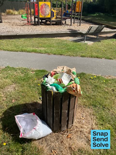
 Park - General Request —
 Full bin. Thanks
 Dumped Rubbish —
 Carpet. Thank you.
 Pavement - General —
 Snapped to countdown last week , apparently ignored it
 Park - General Request —
 This was a significant hole near posts. It was obscured by fallen leaves and my foot and leg went into it causing me to fall. I consider it
 Rubbish and Bins - General —
 Rubbish bin near play ground overflowing. Bangor Street.
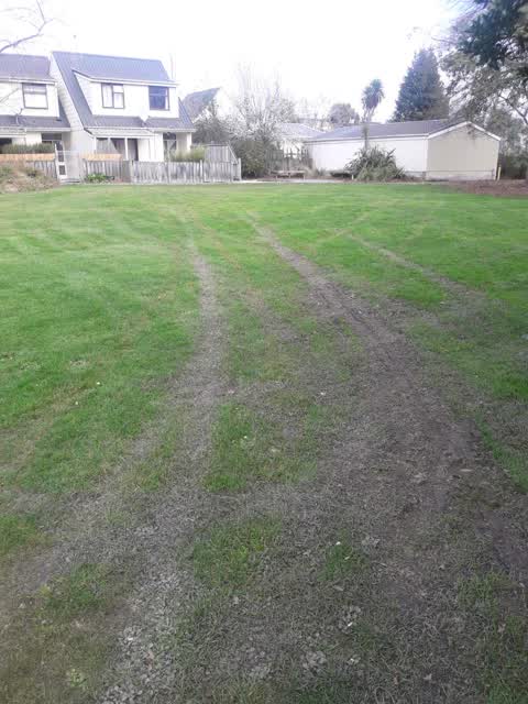
Parks —
tire marks on park
Rubbish/Recycling —
Bags of rubbish dumped by the park. Name on books, letters etc says Vanessa Moyst
Rubbish/Recycling —
Dumped wheels
Also reported on Bangor Street
- 2 Bangor Street — 75 reports
- 31 Bangor Street — 21 reports
- 44 Bangor Street — 19 reports
- 28 Bangor Street — 16 reports
- 2A Bangor Street — 12 reports
- 55 Bangor Street — 11 reports
- 36 Bangor Street — 10 reports
- 50 Bangor Street — 9 reports
The street’s crash record
NZTA’s record names Bangor Street in 3 crashes that hurt somebody since 2006 — 0 seriously hurt, nobody killed.
The green nearby
- Walnut Tree Park — 3 m to the edge
- Avon Riverbank Central City — 66 m to the edge · 6 ha
- Cambridge Green — 214 m to the edge
- Barbadoes Cemetery — 239 m to the edge · Botanic · 3 ha
- William Brittan — 247 m to the edge
Parks within half a kilometre, measured to the boundary — the council’s open data.
On the doorstep
- Christchurch Bridge Club — 165 m away · Clubs
- Gourmet Grub Food Truck — 189 m away · Fast food
- Scott Base Motors — 198 m away · Car dealers
- Beer Baroness Brewing Company — 201 m away · Bottle stores
Businesses within four hundred metres, measured at the pin — OpenStreetMap and the council directories.
The bus nearby
- Fitzgerald Ave near River Rd — 164 m away · route 7
- Fitzgerald Ave near Harvey Tce — 196 m away · route 7
The closest Metro stops, within four hundred and fifty metres.
The tracks through here
- Walk and bike track through Christchurch Central City — 177 m to the line · walk · bike
- Walk and bike track through Christchurch Central City — 217 m to the line · walk · bike
- Walk and bike track through Christchurch Central City — 221 m to the line · walk · bike
- Walk and bike track through Christchurch Central City — 221 m to the line · walk · bike
- Walk and bike track through Christchurch Central City — 221 m to the line · walk · bike
Tracks whose line passes within half a kilometre, measured to the line itself — the council’s open data.
The named ground
Named water within 500 m of this address, measured to the line or the edge; Named places within 1.5 km of this address; the council’s own structure register — bridges, boardwalks and steps standing nearby — the open map’s record.
The remembered names nearby
- William Guise Brittan Historical Garden on 26 November 1994 — 250 m away ·
WILLIAM GUISE BRITTAN HISTORICAL GARDEN On 26 November 1994 the first shrubs were planted
· 2009
Inscribed plaques within two hundred and fifty metres — the register’s pins, not surveyed spots. The whole roll is at /plaques.
Renting nearby
new bonds in Christchurch Central City ran about $508 a week — $42 below the city median of $550 — the suburb page keeps the rent record →.
What was here — Bangor Street No. 3 Pumphouse and Setting
200 m away · located to ±4 m · the place’s own record →
On the register. Nothing researched here yet.
What was here — Former Maturing Cellars and Administration Offices and Setting
211 m away · 294 Kilmore Street · located to ±24 m · the place’s own record →
On the register. Nothing researched here yet.
What was here — Dwelling and Setting
234 m away · 250 Kilmore Street · located to ±8 m · the place’s own record →
On the register. Nothing researched here yet.
The civic layer
This ground votes in Central ward — the Papanui-Innes-Central community board. Ward lines don’t always follow suburb lines; this one is measured at the pin, not the suburb’s centre.
What stood on this ground → · On the map → · From the air — the Crown’s aerials back to 1936; search the address on RetroLens →
Questions, answered briefly
14 council reports on record since April 2018 — most often dumped rubbish (4), park - general request (3), rubbish/recycling (2).
Christchurch Central City, Christchurch — on Bangor Street.
The heritage register names 3 places at or beside it — Bangor Street No. 3 Pumphouse and Setting, Former Maturing Cellars and Administration Offices and Setting.
Walnut Tree Park — 3 m to its edge.