304 Fitzgerald Avenue
6 council reports since June 2022, 4 carrying a photograph. The street’s heaviest record is 162 Fitzgerald Avenue, 79 reports on file.
On the register here
- Dwelling and Setting, 361 Cambridge Terrace (239m)
From the air, then
Sourced from Canterbury Maps and partners. LINZ, CC BY 3.0 NZ. Each frame is cut from Environment Canterbury’s historic imagery MapServer for that decade, only where the Footprints layer names a CC BY survey (NZAM-covered spots stay out). RetroLens holds more Crown aerials →
The green nearby
- Barbadoes Cemetery, 177 m to the edge · Botanic · 3 ha
- Avon Riverbank Central City, 268 m to the edge · 6 ha
- Richmond Playground, 378 m to the edge · playground, 14 pieces
- Alexandra Park, 388 m to the edge
- Walnut Tree Park, 404 m to the edge · playground, 25 pieces
Parks within half a kilometre, measured to the boundary, the council’s open data. The whole roll is at /parks.
On the doorstep
- John Rhind Funeral Directors, 104 m away · Funeral directors
- Youth Health Centre, 212 m away · Business
- Aotea Motel, 238 m away · Motels
- Avalon Court Motel, 270 m away · Motels
Businesses within four hundred metres, measured at the pin, OpenStreetMap and the council directories.
The bus nearby
- Whitmore St near Bealey Ave, 76 m away · route 7
- Fitzgerald Ave near Alexandra St, 172 m away · route 7
The closest Metro stops, within four hundred and fifty metres.
The tracks through here
- Walk and bike track through Christchurch Central City, 7 m to the line · walk · bike
- Walk and bike track through Christchurch Central City, 230 m to the line · walk · bike
- Walk and bike track through Christchurch Central City, 312 m to the line · walk · bike
- Walk and bike track through Christchurch Central City, 467 m to the line · walk · bike
- Walk and bike track through Christchurch Central City, 488 m to the line · walk · bike
Tracks whose line passes within half a kilometre, the council’s open data.
The named ground
Named water within 500 m of this address, measured to the line or the edge, the open map’s record.
Renting nearby
new bonds in Christchurch Central City ran about $508 a week, $42 below the city median of $550, the suburb page keeps the rent record →.
What gets reported here
Photographed here 4 on record


What’s on record
 Street Cleaning, 3 Sept 2026
Broken glass bottle in bike/bus lane, corner Fitzgerald and Bealey. Left hand size going towards hills rd from Fitzgerald. Just in front of
 Dumped Rubbish, 12 Dec 2025
 Roads - General, 11 Feb 2025
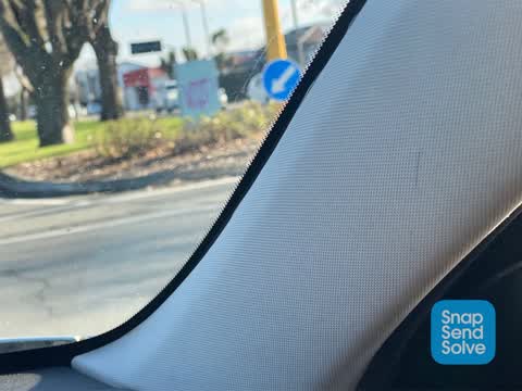
Keep left sign need to be mounted on the traffic signal pole
- Pavement - Damaged, 16 May 2023
- Pavement - Damaged, 9 Feb 2023
 Graffiti, 29 Jun 2022
Hello councilperson Could consideration be given to removing the graffiti which says VOID from the signal box which controls the lights? ??
Elsewhere on Fitzgerald Avenue
- 162 Fitzgerald Avenue, 79 reports
- 67 Fitzgerald Avenue, 43 reports
- 112 Fitzgerald Avenue, 41 reports
- 100 Fitzgerald Avenue, 41 reports
- 187 Fitzgerald Avenue, 34 reports
- 64 Fitzgerald Avenue, 31 reports
- 234 Fitzgerald Avenue, 31 reports
- 107 Fitzgerald Avenue, 28 reports
The street’s crash record
NZTA’s record names Fitzgerald Avenue in 283 crashes that hurt somebody since 2006, 5 people killed, 41 seriously hurt.
The civic layer
This ground votes in Central ward, the Papanui-Innes-Central community board is its local layer. Ward lines don’t always follow suburb lines; this one is measured at the pin, not the suburb’s centre. The whole roll is at /wards.
Fitzgerald Avenue, the whole record → · Everything about Christchurch Central City → · What stood on this ground → · On the map → · From the air, RetroLens holds the Crown’s aerials back to 1936; search the address there →
Questions, answered briefly
6 council reports on record since June 2022, most often pavement - damaged (2), street cleaning (1), roads - general (1).
Christchurch Central City, Christchurch, on Fitzgerald Avenue.
The heritage register names a place at or beside it, Dwelling and Setting.
Barbadoes Cemetery, 177 m to its edge, 3 ha.