304 Tuam Street, Christchurch Central City
24 reports on record since November 2018 · 18 with photographs. The street’s heaviest record is 278 Tuam Street, 89 reports on file. Indicative rating valuation and school zones, hazards, bin day and what stood here before.
What gets reported here
Photographed here 18 on record


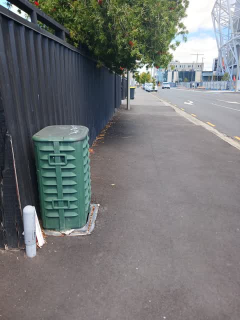


Reported here
 Graffiti on a fence, building or structure,
graffiti on black wooden fence
 Graffiti on a traffic light pole or cabinet, or wa,
graffiti on traffic control cabinet nearby
 Accessibility,
pole with no contrast in footpath issue for low vision and distracted pedestrians walking to and from new stadium
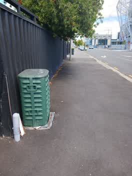 Overgrown Vegetation,
overhanging foliage
 Graffiti on a fence, building or structure,
 Graffiti on a fence, building or structure,
Have reported this multiple times, please get sorted, We are working hard to make our area grafity free
 Graffiti on a fence, building or structure,
 Graffiti on a fence, building or structure,
 Graffiti on a fence, building or structure,
 Graffiti on a cabinet, pole or railway asset,
 Graffiti on a fence, building or structure,
 Graffiti on a fence, building or structure,
 Graffiti on a fence, building or structure,
 Graffiti on a fence, building or structure,
 Graffiti on a fence, building or structure,
 Graffiti on a fence, building or structure,
offensive
- Graffiti,
- Graffiti,
- Pit and Equipment - General,
- Graffiti,
- Graffiti,
- Graffiti,
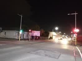 Street Light Outage,
4 lights
Water Supply,
Commercial size water meter pictured in footpath has a leak. Box is in footpath currently being replaced as part of CCC roading maintenance
Also reported on Tuam Street
- 278 Tuam Street, 89 reports
- 286 Tuam Street, 52 reports
- 16 Tuam Street, 52 reports
- 94 Tuam Street, 50 reports
- 189 Tuam Street, 38 reports
- 322 Tuam Street, 31 reports
- 284 Tuam Street, 29 reports
- 290 Tuam Street, 28 reports
From the air, then
Sourced from Canterbury Maps and partners. LINZ, CC BY 3.0 NZ. Each frame is cut from Environment Canterbury’s historic imagery MapServer for that decade, only where the Footprints layer names a CC BY survey (NZAM-covered spots stay out). RetroLens holds more Crown aerials →
The street’s crash record
NZTA’s record names Tuam Street in 144 crashes that hurt somebody since 2006, 18 seriously hurt, nobody killed.
The green nearby
- Wilson Park, 189 m to the edge
- Latimer Square, 421 m to the edge · Botanic · 2 ha
- Excelsior Hotel Reserve, 442 m to the edge · Botanic
Parks within half a kilometre, measured to the boundary, the council’s open data.
The civic shelf nearby
- St Asaph, 171 m away · Car park
Libraries, halls and the rest within half a kilometre, the council’s open data.
On the doorstep
- Magnitude Cafe & Roastery, 21 m away · Cafés
- Galaxy Arcade, 46 m away · Bars & pubs
- Arcadia Retro Arcade & Pinball Emporia, 52 m away · Arcades
- Galaxy Arcade & Bar, 55 m away · Business
Businesses within four hundred metres, measured at the pin: OpenStreetMap and the council directories.
The bus nearby
- St Asaph St near Barbadoes St, 127 m away · route 80
- Tuam St near Madras St, 157 m away · route 1, route 3, route 5, route 80
The closest Metro stops, within four hundred and fifty metres.
The tracks through here
- Walk and bike track through Christchurch Central City, 4 m to the line · walk · bike
- Walk and bike track through Christchurch Central City, 164 m to the line · walk · bike
- Walk and bike track through Christchurch Central City, 254 m to the line · walk · bike
- Walk and bike track through Christchurch Central City, 412 m to the line · walk · bike
- Walk and bike track through Christchurch Central City, 412 m to the line · walk · bike
Tracks whose line passes within half a kilometre, measured to the line itself, the council’s open data.
The named ground
Named places within 1.5 km of this address; the council’s own structure register, bridges, boardwalks and steps standing nearby, the open map’s record.
Renting nearby
new bonds in Christchurch Central City ran about $508 a week, $42 below the city median of $550, the suburb page keeps the rent record →.
What was here, 319 St Asaph Street
92 m away · 319 St Asaph Street · located to ±21 m · the place’s own record →
On the register. Nothing researched here yet.
The civic layer
This ground votes in Central ward, the Papanui-Innes-Central community board. Ward lines don’t always follow suburb lines; this one is measured at the pin, not the suburb’s centre.
What stood on this ground → · On the map → · From the air, the Crown’s aerials back to 1936; search the address on RetroLens →
Questions, answered briefly
24 council reports on record since November 2018, most often graffiti on a fence, building or structure (12), graffiti (5), water supply (1).
Christchurch Central City, Christchurch, on Tuam Street.
The heritage register names a place at or beside it, 319 St Asaph Street.
Wilson Park, 189 m to its edge.