31 Dundas Street, Christchurch Central City
76 reports on record since October 2015 · 63 with photographs. The most-reported address on Dundas Street. Indicative rating valuation and school zones, hazards, bin day and what stood here before.
What gets reported here
Photographed here 63 on record


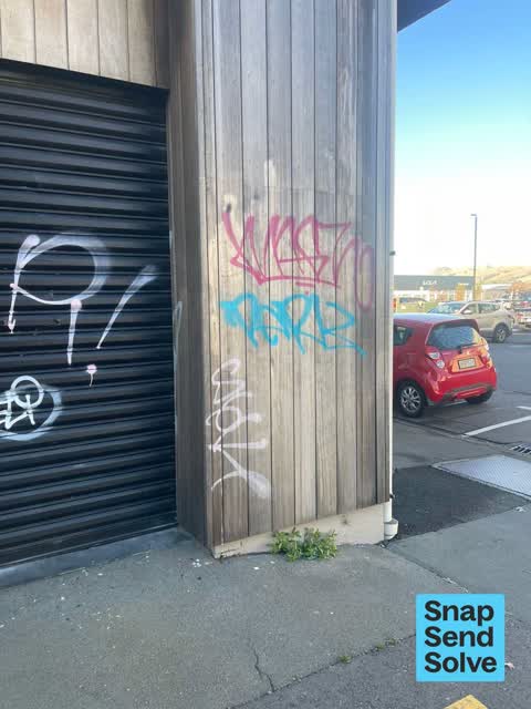


Reported here
 Graffiti on a fence, building or structure —
 graffiti on light lamp post pole nearby
 Graffiti on a fence, building or structure —
 Tagged street light (fence, building or structure)
 Graffiti on a fence, building or structure —
 Graffiti
 Litter —
 Shattered glass in the gutter and on the footpath by 31 Dundas Street needs removal ASAP.
 Graffiti on a fence, building or structure —
 Graffiti Across the side of the building
 Graffiti on a fence, building or structure —
 Nearby on fence see pics
 Graffiti on a traffic light pole or cabinet, or wa —
 See pic
 Graffiti on a fence, building or structure —
 Graffiti on lamp post
 Graffiti on a fence, building or structure —
  Graffiti on a fence, building or structure —
  Graffiti on a traffic light pole or cabinet, or wa —
 West side of 31 dundas street
 Graffiti on a fence, building or structure —
 West side of 31 dundas street
 Graffiti on a fence, building or structure —
 See pic
 Graffiti on a fence, building or structure —
 Graffiti on ccc managed pole
 Graffiti on a fence, building or structure —
 See pic
 Graffiti on a fence, building or structure —
 Graffiti across the side of the building.
 Graffiti on a fence, building or structure —
 Multiple paint tags on anonymous asset near 31 Dundas Street facing the footpath.
 Graffiti on a fence, building or structure —
 See pic
 Graffiti on a fence, building or structure —
 See pic
 Graffiti on a fence, building or structure —
 Graffiti on til fence
 Graffiti on a traffic light pole or cabinet, or wa —
 Graffiti on water backflow system
 Graffiti on a fence, building or structure —
 Graffiti across the side of the building.
 Graffiti on a fence, building or structure —
  Water Leak —
 Water leak from the water meter
 Graffiti somewhere else —
  Graffiti somewhere else —
 31 dundas
 Graffiti on a cabinet, pole or railway asset —
 Graffiti on 2 cabinets, Dundas Street, ChCh, near Pak n SAve entrance. ( only repainted several days ago !!)
 Graffiti somewhere else —
  Graffiti on a fence, building or structure —
 On street light right in front on TVNZ building
 Graffiti on a fence, building or structure —
 On fence next to Smith City Carpark
 Graffiti on a fence, building or structure —
 On carpark edge.
 Graffiti on a fence, building or structure —
 On box.
 Graffiti on a fence, building or structure —
 Graffiti across the fence.
 Graffiti somewhere else —
  Graffiti somewhere else —
  Graffiti somewhere else —
  Graffiti on a cabinet, pole or railway asset —
  Graffiti somewhere else —
  Graffiti on a fence, building or structure —
 Graffiti on fence.
 Graffiti on a fence, building or structure —
 Graffiti across fence on dundas street.
 Graffiti —
 Next to TBNZ building and Smiths City car park black fence
 Pavement - Damaged —
 Water valve black cover has been openly exposed since February ive had to keep covering it with the metal sheet you see in pics. Ive seen 3
- Graffiti —
- Graffiti —
- Graffiti —
- Graffiti —
- Graffiti —
- Graffiti —
- Road Signage —
- Graffiti —
- Graffiti —
- Graffiti —
- Graffiti —
- Graffiti —
- Graffiti —
 Graffiti —
 Blue and pink paint tag (male genitalia?!) on FFP Backflow Prevention Device facing the footpath at east end of Smith’s City carpark on Dund
 Graffiti —
 Purple paint tag on metal plate on concrete lamp pole opposite east end of Smith’s City carpark on Dundas Street.
 Graffiti —
 In front of Pak'n save at the city areas, just next to Smith city.
 Graffiti —
 In front of Pak'n save at the city areas, just next to Smith city.
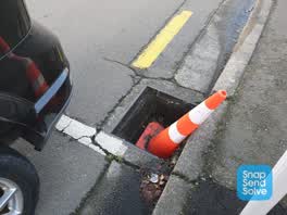 Wastewater/Stormwater —
 Missing a storm water cover.
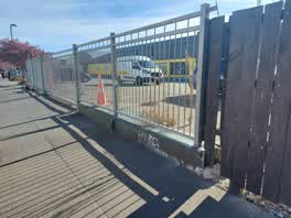 Graffiti —
 Tag on low concrete wall at the very corner of Smiths secured parking, next to TVNZ building. Next to footpath
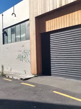 Graffiti —
 Green and black tags
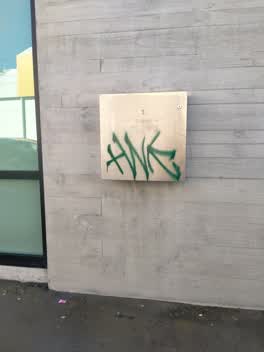 Graffiti —
 Tag on power box
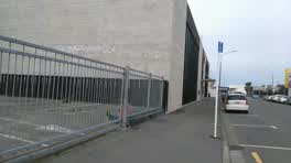 Graffiti —
 West wall
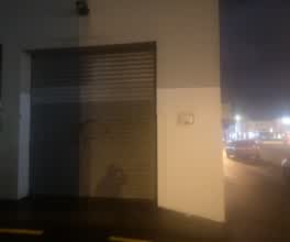 Graffiti —
 On side of WMART on roller doors
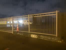 Graffiti —
 Far corner of Smith City car park - tvnz side
Graffiti —
Roading/Streets —
Hydrant not marked for FENZ ID
Graffiti —
Graffiti —
Graffiti —
Graffiti —
Graffiti —
Roading/Streets —
P120 sign on floor os the address needs to be put back up
Graffiti —
Graffiti on lamppost
Roading/Streets —
P120/Disabled sign has blown over and snapped at base. Please replace. Thanks.
Also reported on Dundas Street
- 12 Dundas Street — 60 reports
- 39 Dundas Street — 35 reports
- 40 Dundas Street — 18 reports
- 14 Dundas Street — 9 reports
- 13-19 Dundas Street — 4 reports
- 12-14 Dundas Street — 2 reports
- 38-36 Dundas Street — 1 report
- 38 Dundas Street — 1 report
The street’s crash record
NZTA’s record names Dundas Street in 11 crashes that hurt somebody since 2006 — 2 seriously hurt, nobody killed.
The green nearby
- Carlyle Reserve — 302 m to the edge
- Science Alive Reserve — 354 m to the edge
- Gasson Reserve — 367 m to the edge
- Wilson Park — 407 m to the edge
- Excelsior Hotel Reserve — 451 m to the edge · Botanic
Parks within half a kilometre, measured to the boundary — the council’s open data.
The civic shelf nearby
- Re:start - Lichfield St — 448 m away · Car park
Libraries, halls and the rest within half a kilometre — the council’s open data.
On the doorstep
- TVNZ — 12 m away · Company
- PAK'nSave — 52 m away · Supermarkets
- Pak'n Save Moorhouse — 93 m away · Supermarkets
- Liquorland Moorhouse — 94 m away · Bottle stores
Businesses within four hundred metres, measured at the pin — OpenStreetMap and the council directories.
The bus nearby
- Manchester St near Allen St — 121 m away · route 27, route 84, route 85, route 95
- Smiths City (Southbound) — 130 m away · route 1, route 8, route 44
The closest Metro stops, within four hundred and fifty metres.
The tracks through here
- Walk and bike track through Christchurch Central City — 97 m to the line · walk · bike
- Walk and bike track through Christchurch Central City — 153 m to the line · walk · bike
- Walk and bike track through Christchurch Central City — 154 m to the line · walk · bike
- Walk and bike track through Christchurch Central City — 205 m to the line · walk · bike
- Walk and bike track through Christchurch Central City — 205 m to the line · walk · bike
Tracks whose line passes within half a kilometre, measured to the line itself — the council’s open data.
The named ground
Named places within 1.5 km of this address — the open map’s record.
Renting nearby
new bonds in Christchurch Central City ran about $508 a week — $42 below the city median of $550 — the suburb page keeps the rent record →.
What was here — New City Hotel and Setting
174 m away · located to ±20 m · the place’s own record →
On the register. Nothing researched here yet.
What was here — Former P & D Duncan Ltd Building and Setting
220 m away · 7/204 St Asaph Street · located to ±18 m · the place’s own record →
On the register. Nothing researched here yet.
What was here — Former R. Buchanan & Sons' City Foundry and Setting
221 m away · 2/210 St Asaph Street · located to ±14 m · the place’s own record →
On the register. Nothing researched here yet.
The civic layer
This ground votes in Central ward — the Papanui-Innes-Central community board. Ward lines don’t always follow suburb lines; this one is measured at the pin, not the suburb’s centre.
What stood on this ground → · On the map → · From the air — the Crown’s aerials back to 1936; search the address on RetroLens →
Questions, answered briefly
76 council reports on record since October 2015 — most often graffiti (30), graffiti on a fence, building or structure (26), graffiti somewhere else (7).
Christchurch Central City, Christchurch — on Dundas Street.
The heritage register names 3 places at or beside it — New City Hotel and Setting, Former P & D Duncan Ltd Building and Setting.
Carlyle Reserve — 302 m to its edge.