55 Chester Street West, Christchurch Central City
148 reports on record since July 2020 · 117 with photographs. The most-reported address on Chester Street West. Indicative rating valuation and school zones, hazards, bin day and what stood here before.
What gets reported here
- Graffiti — 40
- Graffiti on a fence, building or structure — 36
- Graffiti somewhere else — 32
- General Request — 7
- Water Leak — 5
- Hazard — vehicle — 5
Photographed here 117 on record


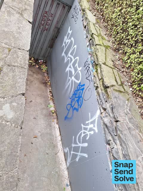


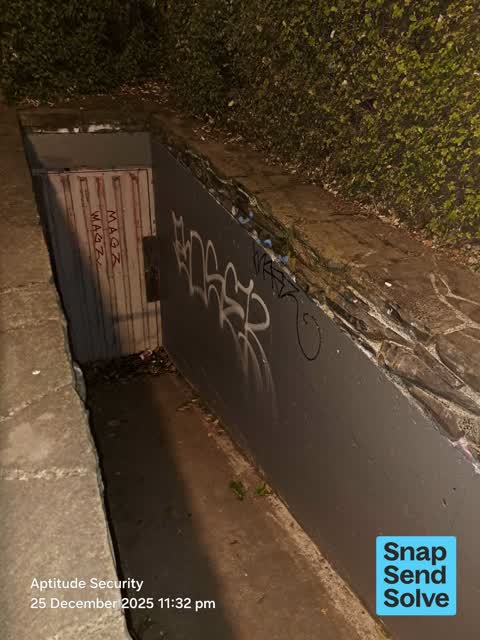

Reported here the newest 80 of 148
 Graffiti on a fence, building or structure —
Graffiti Across the side of the building
 Graffiti on a fence, building or structure —
 Graffiti on a fence, building or structure —
 Road Signage —
a road sign from road works last month has been left in the garden of Wilson's carpark and forgotten
 Graffiti on a fence, building or structure —
Graffiti Across the side of the building
 General Request —
Can the bridge in Victoria square please get painted
 Graffiti on a fence, building or structure —
 Graffiti on a fence, building or structure —
 Graffiti on a fence, building or structure —
 Graffiti on a fence, building or structure —
 Graffiti on a fence, building or structure —
Graffiti Across the side of the building.
 Graffiti on a fence, building or structure —
Graffiti Across the side of the building.
 Graffiti on a fence, building or structure —
 Graffiti on a fence, building or structure —
 Graffiti on a fence, building or structure —
See pic
 Graffiti on a fence, building or structure —
Near bridge
 Graffiti on a fence, building or structure —
 Graffiti on a fence, building or structure —
 Graffiti on a fence, building or structure —
 Graffiti on a fence, building or structure —
 Street Light Outage —
Some of the footpath lights are out from Victoria Square past the Town Hall
 Graffiti on a traffic light pole or cabinet, or wa —
Stuck on posters on parking info sign controller at Durham, North of Chester
 Graffiti on a fence, building or structure —
 Graffiti on a fence, building or structure —
 General Request —
 Graffiti on a fence, building or structure —
 Graffiti on a fence, building or structure —
 Graffiti on a fence, building or structure —
 Park - General Request —
See Photo
 Park - General Request —
Abandoned pavers after Saturday events. Stall holder has not removed 8pm Sunday night
 Graffiti somewhere else —
 Damaged Street Light —
Light not working right
 Graffiti on a cabinet, pole or railway asset —
Multiple paint tabs on 3 sides of anonymous (Orion?) asset at the corner of Chester Street West and Durham Street North.
 Pavement - Damaged —
Old pole needs taking down to footpath level on Durham Street North near Chester Street West. OHS issue for pedestrians safety at present.
 Graffiti somewhere else —
Graffiti on railing
 Graffiti somewhere else —
 Damaged Street Sign —
 Graffiti somewhere else —
 Facility - General Request —
These lights on the Victoria Square bridge need repainting and the stonework needs water blasting - this is now outstanding since the earthq
 Graffiti somewhere else —
 Graffiti somewhere else —
 Graffiti somewhere else —
 Graffiti somewhere else —
 Graffiti on a fence, building or structure —
City team has tried, can't remove.
 Graffiti somewhere else —
 Graffiti somewhere else —
 Graffiti somewhere else —
Floral clock ramp again...
 Graffiti somewhere else —
 Graffiti somewhere else —
See pics near steps with gates around it
 Graffiti somewhere else —
Carpark on corner
 Graffiti somewhere else —
 Graffiti somewhere else —
Flower clock ramp
 Graffiti somewhere else —
Flower clock again bugger.
 Graffiti somewhere else —
 Graffiti on a fence, building or structure —
 Graffiti somewhere else —
 Graffiti somewhere else —
 Graffiti somewhere else —
 Graffiti on a fence, building or structure —
 Graffiti on a fence, building or structure —
City team can't remove
 Graffiti on a playground or in a park —
 Graffiti on a fence, building or structure —
 Graffiti somewhere else —
Flower clock
 Graffiti on a fence, building or structure —
Hamish hay bridge. More from a fortnight ago
 Graffiti somewhere else —
Floral clock again
 Graffiti on a fence, building or structure —
 Graffiti somewhere else —
Flower clock ramp....again
 Facility - General Request —
Floral clock is showing wrong tone.
 Graffiti on a fence, building or structure —
 Graffiti somewhere else —
Lots of graffiti around the back of the floral clock. Thanks
 Graffiti on a fence, building or structure —
Central city can't remove
 Graffiti somewhere else —
Parks team couldn’t remove
 Graffiti somewhere else —
Parks team couldn’t remove
 Facility - General Request —
Multiple street lamps at least 9 in Victoria park town hall floral clock and James cook statue not working. Most led type + one lamp on the
 Graffiti on a road, footpath or bridge —
 Graffiti on a fence, building or structure —
 Graffiti on a fence, building or structure —
 Graffiti somewhere else —
 Graffiti somewhere else —
Victoria Sq flower clock maintenance ramp...more graphiti.
 Hazard — vehicle —
Parked on path and garden
68 more on record — the live page pages them.
Also reported on Chester Street West
- 66 Chester Street West — 55 reports
- 59 Chester Street West — 53 reports
- 54 Chester Street West — 24 reports
- 24 Chester Street West — 14 reports
- 48 Chester Street West — 6 reports
- 42 Chester Street West — 6 reports
- 51 Chester Street West — 5 reports
- 2 Chester Street West — 5 reports
The street’s crash record
NZTA’s record names Chester Street West in 2 crashes that hurt somebody since 2006 — 0 seriously hurt, nobody killed.
The green nearby
- Victoria Square — 49 m to the edge · Botanic · 2 ha
- Canterbury Provincial Council Reserve — 129 m to the edge · Botanic
- Victoria Triangles — 263 m to the edge
- Edmonds Band Rotunda — 275 m to the edge · Botanic
- Cranmer Square — 290 m to the edge · Botanic · 2 ha
Parks within half a kilometre, measured to the boundary — the council’s open data.
The civic shelf nearby
- Aldersgate — 125 m away · Car park
- Armagh St — 174 m away · Car park
- Turanga Library — 339 m away · Library · Cathedral Square, Christchurch
Libraries, halls and the rest within half a kilometre — the council’s open data.
On the doorstep
- Christchurch Town Hall — 78 m away · Venues & events
- Bakertilly - Staples Rodway — 108 m away · Business
- Millie's House — 109 m away · Childcare
- Mobile Osaka-ya — 113 m away · Fast food
Businesses within four hundred metres, measured at the pin — OpenStreetMap and the council directories.
The bus nearby
- Kilmore Street Town Hall — 119 m away · route 1, route 29, route 95
- Kilmore St near Manchester St — 295 m away · route 1, route 27, route 29, route 95
The closest Metro stops, within four hundred and fifty metres.
The tracks through here
- Walk and bike track through Christchurch Central City — 123 m to the line · walk · bike
- Walk and bike track through Christchurch Central City — 126 m to the line · walk · bike
- Walk and bike track through Christchurch Central City — 149 m to the line · walk · bike
- Walk and bike track through Christchurch Central City — 266 m to the line · walk · bike
- Walk and bike track through Christchurch Central City — 364 m to the line · walk · bike
Tracks whose line passes within half a kilometre, measured to the line itself — the council’s open data.
The named ground
Named water within 500 m of this address, measured to the line or the edge; Named places within 1.5 km of this address; the council’s own structure register — bridges, boardwalks and steps standing nearby — the open map’s record.
The remembered names nearby
- In Conjunction With the Christchurch Beautifying — 7 m away ·
IN CONJUNCTION WITH THE CHRISTCHURCH BEAUTIFYING ASSOCIATION INC. THIS FLORAL CLOCK WAS PR
· 2009 - This Floral Clock Was Presented to the Citizens — 7 m away ·
THIS FLORAL CLOCK WAS PRESENTED TO THE CITIZENS OF CHRISTCHURCH BY CALDER MACKAY CO. LTD 1
· 2009 - Victoria Bridge — Historical Description 1851–1989 — 51 m away ·
VICTORIA BRIDGE — HISTORICAL DESCRIPTION 1851–1989
· 2009
Inscribed plaques within two hundred and fifty metres — the register’s pins, not surveyed spots. The whole roll is at /plaques.
Renting nearby
new bonds in Christchurch Central City ran about $508 a week — $42 below the city median of $550 — the suburb page keeps the rent record →.
What was here — Floral Clock and Setting
right here · 66 Chester Street West · located to ±5 m · the place’s own record →
On the register. Nothing researched here yet.
What was here — Former Market Place Bridge/Hamish Hay Bridge and Setting
46 m away · located to ±31 m · the place’s own record →
On the register. Nothing researched here yet.
What was here — Captain James Cook Statue and Setting
80 m away · 89 Armagh Street · located to ±2 m · the place’s own record →
On the register. Nothing researched here yet.
What was here — Horse Watering Ramp and Setting
88 m away · located to ±7 m · the place’s own record →
On the register. Nothing researched here yet.
What was here — The Christchurch Town Hall and Setting
95 m away · located to ±79 m · the place’s own record →
On the register. Nothing researched here yet.
The civic layer
This ground votes in Central ward — the Papanui-Innes-Central community board. Ward lines don’t always follow suburb lines; this one is measured at the pin, not the suburb’s centre.
What stood on this ground → · On the map → · From the air — the Crown’s aerials back to 1936; search the address on RetroLens →
Questions, answered briefly
148 council reports on record since July 2020 — most often graffiti (40), graffiti on a fence, building or structure (36), graffiti somewhere else (32).
Christchurch Central City, Christchurch — on Chester Street West.
The heritage register names 5 places at or beside it — Floral Clock and Setting, Former Market Place Bridge/Hamish Hay Bridge and Setting.
Victoria Square — 49 m to its edge, 2 ha.