626 Colombo Street, Christchurch Central City
12 reports on record since September 2019 · 11 with photographs. The street’s heaviest record is 794 Colombo Street — 159 reports on file. Indicative rating valuation and school zones, hazards, bin day and what stood here before.
What gets reported here
Photographed here 11 on record


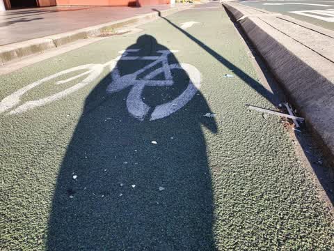
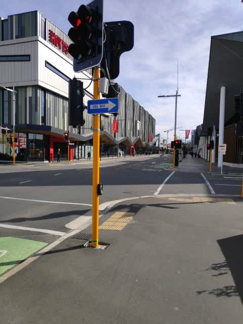
Reported here
 Pavement - Damaged —
This access hatch is damaged - possible trip hazard.
 Damaged Street Sign —
 Graffiti on a fence, building or structure —
White and blue paint tags on 2 litter bins by 626 Colombo Street corner of Tuam Street
 Damaged Street Light —
Ped crossing took a long time to activate after pushing the button on pole 3. Red man appeared approx. 10 secs after button pushed. All li
 Graffiti on a fence, building or structure —
 Graffiti on a fence, building or structure —
Black and white paint tags on 2 bins at the corner of Tuam and Colombo Streets.
 Pavement - Damaged —
Broken glass on pavement
- Graffiti —
 Pavement - General —
Vomit on footpath requires cleaning please
 Public Toilet —
Cracked tiles on toilet floor at the bus exchange & empty small toilet roll holder for wheelchair Users
 Roading/Streets —
Kia ora Maintenance legends, Could we please get the big patch of broken mirror on the cycleway and the bus lane swept up please? Thanks he
Roading/Streets —
I was hit by a car while cycling in the bike lane, due to the worst intersection design I think I've ever seen. please add additional signag
Also reported on Colombo Street
- 794 Colombo Street — 159 reports
- 673 Colombo Street — 102 reports
- 781 Colombo Street — 55 reports
- 521 Colombo Street — 46 reports
- 722 Colombo Street — 45 reports
- 569 Colombo Street — 45 reports
- 527 Colombo Street — 41 reports
- 711 Colombo Street — 38 reports
The street’s crash record
NZTA’s record names Colombo Street in 177 crashes that hurt somebody since 2006 — 1 person killed, 32 seriously hurt.
The green nearby
- City Mall — 243 m to the edge
- Excelsior Hotel Reserve — 257 m to the edge · Botanic
- High Street Triangles — 271 m to the edge
- Friendship Corner — 310 m to the edge · Botanic
- The Stewart Plaza — 327 m to the edge
Parks within half a kilometre, measured to the boundary — the council’s open data.
The civic shelf nearby
- Re:start - Lichfield St — 78 m away · Car park
- Triangle — 292 m away · Car park
Libraries, halls and the rest within half a kilometre — the council’s open data.
On the doorstep
- The Food Den — 20 m away · Fast food
- Isushi — 31 m away · Restaurants
- Archie Brothers Cirque Electriq — 38 m away · Arcades
- Miyabi Sushi Sushi — 66 m away · Restaurants
Businesses within four hundred metres, measured at the pin — OpenStreetMap and the council directories.
The bus nearby
- Bus Interchange (Platform A) — 64 m away · route 3, route 5, route 60, route 80, route 81, route 84, route 85, route 86
- Bus Interchange (Platform B) — 101 m away · route 1, route 7, route 8, route 27, route 44, route 91, route 92, route 95
The closest Metro stops, within four hundred and fifty metres.
The tracks through here
- Walk and bike track through Christchurch Central City — 10 m to the line · walk · bike
- Walk and bike track through Christchurch Central City — 234 m to the line · walk · bike
- Walk and bike track through Christchurch Central City — 297 m to the line · walk · bike
- Walk and bike track through Christchurch Central City — 310 m to the line · walk · bike
- Walk and bike track through Christchurch Central City — 316 m to the line · walk · bike
Tracks whose line passes within half a kilometre, measured to the line itself — the council’s open data.
The named ground
Named water within 500 m of this address, measured to the line or the edge; Named places within 1.5 km of this address; the council’s own structure register — bridges, boardwalks and steps standing nearby — the open map’s record.
Renting nearby
new bonds in Christchurch Central City ran about $508 a week — $42 below the city median of $550 — the suburb page keeps the rent record →.
What was here — Colonial Motor Company Garage and Setting
103 m away · 201 St Asaph Street · located to ±40 m · the place’s own record →
On the register. Nothing researched here yet.
What was here — Former P & D Duncan Ltd Building and Setting
173 m away · 7/204 St Asaph Street · located to ±18 m · the place’s own record →
On the register. Nothing researched here yet.
What was here — Commercial Building and Setting, Lawrie and Wilson Auctioneers
177 m away · 210 Tuam Street · located to ±14 m · the place’s own record →
On the register. Nothing researched here yet.
What was here — Commercial Building and Setting, Former Sargood Son and Ewen
182 m away · 92 Lichfield Street · located to ±28 m · the place’s own record →
On the register. Nothing researched here yet.
What was here — Former R. Buchanan & Sons' City Foundry and Setting
187 m away · 2/210 St Asaph Street · located to ±14 m · the place’s own record →
On the register. Nothing researched here yet.
The civic layer
This ground votes in Central ward — the Papanui-Innes-Central community board. Ward lines don’t always follow suburb lines; this one is measured at the pin, not the suburb’s centre.
What stood on this ground → · On the map → · From the air — the Crown’s aerials back to 1936; search the address on RetroLens →
Questions, answered briefly
12 council reports on record since September 2019 — most often graffiti on a fence, building or structure (3), roading/streets (2), pavement - damaged (2).
Christchurch Central City, Christchurch — on Colombo Street.
The heritage register names 5 places at or beside it — Colonial Motor Company Garage and Setting, Former P & D Duncan Ltd Building and Setting.
City Mall — 243 m to its edge.