658 Colombo Street, Christchurch Central City
26 reports on record since June 2016 · 23 with photographs. The street’s heaviest record is 794 Colombo Street — 159 reports on file. Indicative rating valuation and school zones, hazards, bin day and what stood here before.
What gets reported here
Photographed here 23 on record


Reported here
 Graffiti on a fence, building or structure —
 graffiti stickers on bus interchange stickers
- Graffiti on a bus stop or public toilet —
rubbish and recycle bin has been bent over by dumb people.
 Graffiti on a traffic light pole or cabinet, or wa —
 Sticker placed on a pedestrian crossing button outside the EntX/Hoyts complex. Please remove ASAP due to the wording.
 Graffiti on a fence, building or structure —
 graffiti in multiple areas
 Traffic Signals —
 Pedestrian button not working outside bus exchange.
 Graffiti on a bus stop or public toilet —
 Most of the sitting area has a gravity on the seat please refer attached photo and there are some more inside the Bus interchange
 Damaged Street Sign —
 someone pulled that strip down from the side, please come have a look
 Graffiti on a cabinet, pole or railway asset —
 Tag on traffic lights cabinet
 Graffiti on a cabinet, pole or railway asset —
  Graffiti somewhere else —
  Graffiti on a cabinet, pole or railway asset —
 Another cabinet tagged.
 Graffiti on a cabinet, pole or railway asset —
 Graffiti on control box (for traffic lights?) Has been there for some time.
 Graffiti somewhere else —
 Blue traffic control cabinet
 Graffiti on a cabinet, pole or railway asset —
  Graffiti somewhere else —
  Graffiti somewhere else —
  Graffiti somewhere else —
  Graffiti somewhere else —
 Graffiti.
- Graffiti —
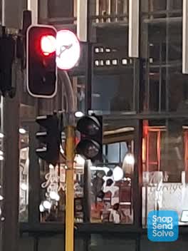 Street Light Outage —
 The pedestrian lights outside Hoyts flicker on and off every morning. This could be distracting for motorists.
- Street Light Outage —
Crossing aspect not working on bus xchange side
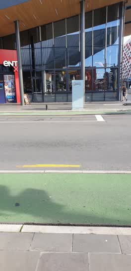 Graffiti —
 White utility box traffic signals? Outside Joe's garage Colombo St Lichfield
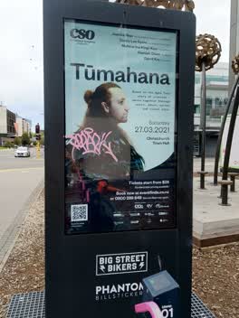 Graffiti —
 Roading/Streets —
blocked footpath on both sides
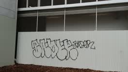 Graffiti —
 public area
Graffiti —
Also reported on Colombo Street
- 794 Colombo Street — 159 reports
- 673 Colombo Street — 102 reports
- 781 Colombo Street — 55 reports
- 521 Colombo Street — 46 reports
- 722 Colombo Street — 45 reports
- 569 Colombo Street — 45 reports
- 527 Colombo Street — 41 reports
- 711 Colombo Street — 38 reports
The street’s crash record
NZTA’s record names Colombo Street in 177 crashes that hurt somebody since 2006 — 1 person killed, 32 seriously hurt.
The green nearby
- City Mall — 122 m to the edge
- High Street Triangles — 158 m to the edge
- The Stewart Plaza — 205 m to the edge
- Excelsior Hotel Reserve — 250 m to the edge · Botanic
- Friendship Corner — 260 m to the edge · Botanic
Parks within half a kilometre, measured to the boundary — the council’s open data.
The civic shelf nearby
- Re:start - Lichfield St — 74 m away · Car park
- Triangle — 173 m away · Car park
- Turanga Library — 467 m away · Library · Cathedral Square, Christchurch
- Scales — 474 m away · Car park
- Civic Offices — 490 m away · Council office
Libraries, halls and the rest within half a kilometre — the council’s open data.
On the doorstep
- Shanghai Street Dumplings - Central City — 12 m away · Restaurants
- One Shot Esports Bar — 16 m away · Bars & pubs
- Joe's Garage — 20 m away · Restaurants
- Auntie Dai's Dumplings - Bus Interchange — 24 m away · Restaurants
Businesses within four hundred metres, measured at the pin — OpenStreetMap and the council directories.
The bus nearby
- Bus Interchange (Intercity stop) — 33 m away · route 3, route 8, route 80
- Bus Interchange (Platform B) — 53 m away · route 1, route 7, route 8, route 27, route 44, route 91, route 92, route 95
The closest Metro stops, within four hundred and fifty metres.
The tracks through here
- Walk and bike track through Christchurch Central City — 111 m to the line · walk · bike
- Walk and bike track through Christchurch Central City — 240 m to the line · walk · bike
- Walk and bike track through Christchurch Central City — 250 m to the line · walk · bike
- Walk and bike track through Christchurch Central City — 255 m to the line · walk · bike
- Walk and bike track through Christchurch Central City — 267 m to the line · walk · bike
Tracks whose line passes within half a kilometre, measured to the line itself — the council’s open data.
The named ground
Named water within 500 m of this address, measured to the line or the edge; Named places within 1.5 km of this address; the council’s own structure register — bridges, boardwalks and steps standing nearby — the open map’s record.
The remembered names nearby
- Te Kiheru Wai o Tahu / the Canoe Bailer of Tahu / 2015 — 190 m away ·
Te Kiheru Wai o Tahu / The Canoe Bailer of Tahu / 2015 / (MÄori text and English translat
· 2015
Inscribed plaques within two hundred and fifty metres — the register’s pins, not surveyed spots. The whole roll is at /plaques.
Renting nearby
new bonds in Christchurch Central City ran about $508 a week — $42 below the city median of $550 — the suburb page keeps the rent record →.
What was here — Former Beaths Department Store (components)
108 m away · 201/690 Colombo Street · located to ±21 m · the place’s own record →
On the register. Nothing researched here yet.
What was here — Commercial Building and Setting, Former Sargood Son and Ewen
162 m away · 92 Lichfield Street · located to ±28 m · the place’s own record →
On the register. Nothing researched here yet.
What was here — Triangle Reserve and Setting
175 m away · 261F High Street · located to ±18 m · the place’s own record →
On the register. Nothing researched here yet.
What was here — Commercial Building and Setting, Former Wellington Woollen Mills Manufacturing Company
182 m away · 96 Lichfield Street · located to ±28 m · the place’s own record →
On the register. Nothing researched here yet.
What was here — Commercial Building and Setting
184 m away · 225 High Street · located to ±19 m · the place’s own record →
On the register. Nothing researched here yet.
The civic layer
This ground votes in Central ward — the Papanui-Innes-Central community board. Ward lines don’t always follow suburb lines; this one is measured at the pin, not the suburb’s centre.
What stood on this ground → · On the map → · From the air — the Crown’s aerials back to 1936; search the address on RetroLens →
Questions, answered briefly
26 council reports on record since June 2016 — most often graffiti somewhere else (6), graffiti on a cabinet, pole or railway asset (5), graffiti (5).
Christchurch Central City, Christchurch — on Colombo Street.
The heritage register names 5 places at or beside it — Former Beaths Department Store (components), Commercial Building and Setting, Former Sargood Son and Ewen.
City Mall — 122 m to its edge.